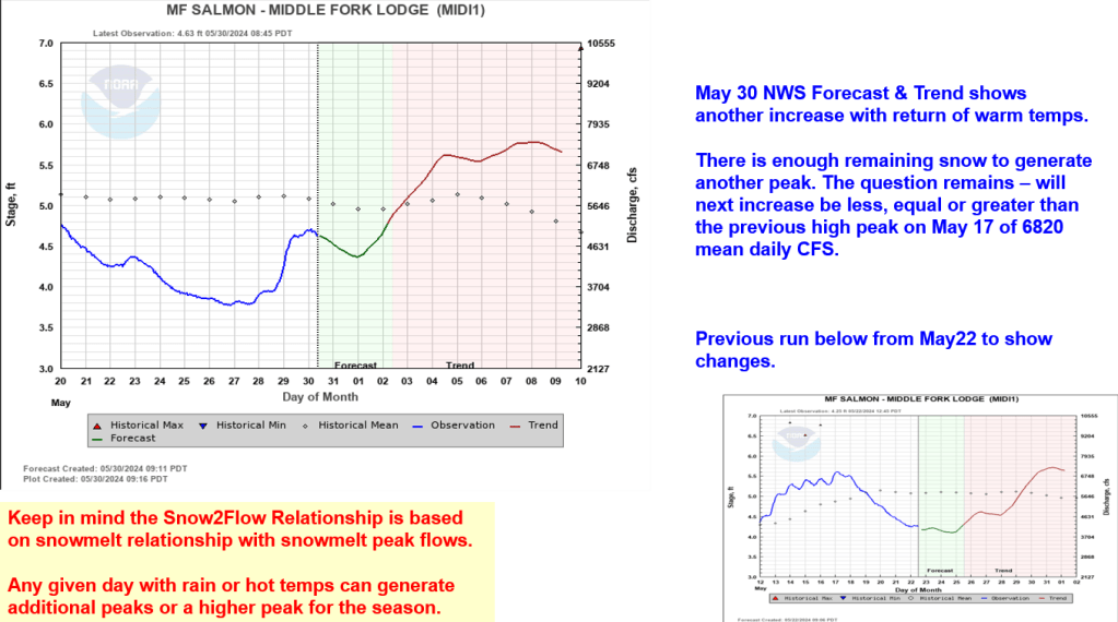
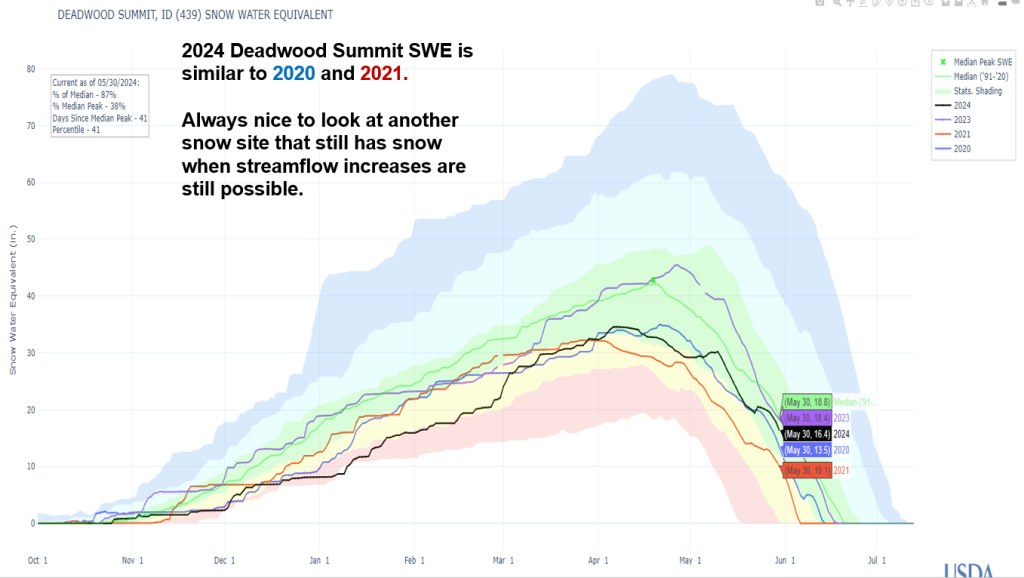
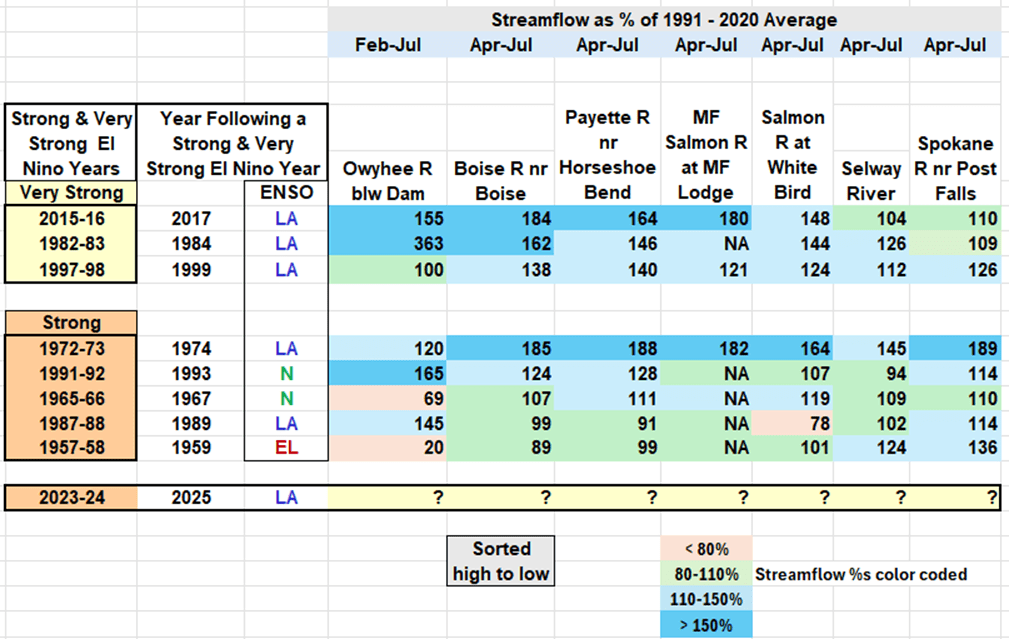
With more snow accumulating in our mountains, let’s look at how this year compares with other years that follow Strong El Nino Years. In the past, we’ve had some good snow and flow years following Strong El Nino Years. The easiest way to explain this is – it seems the oceans and atmosphere has a lot of energy to get rid of the following year. Let’s see if we can still use the past to predict the future and how the snow is tracking.
Here’s our new table of Strong and Very Strong El Nino Years and the years that follow. You can quickly see by the color shading that only a few are below 80% of average, and rest are near average, above average or outstanding with greater than 150% of average runoff.
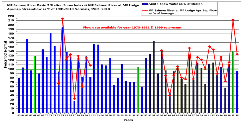
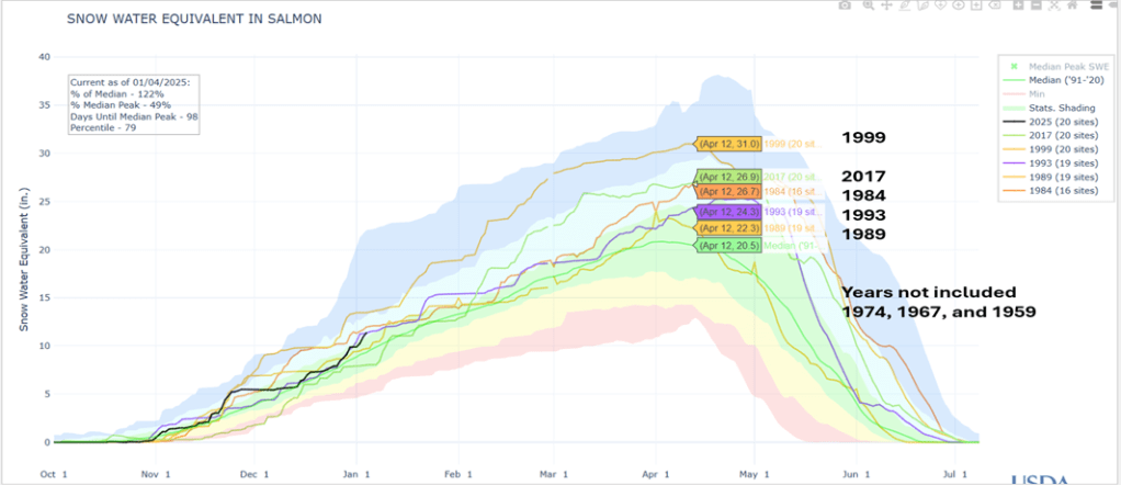
Here’s the big picture for the Salmon River. This snow index is based on about 20 SNOTEL sites. It also shows that this year, 2025, is tracking these years that follow a Strong El Nino Year.
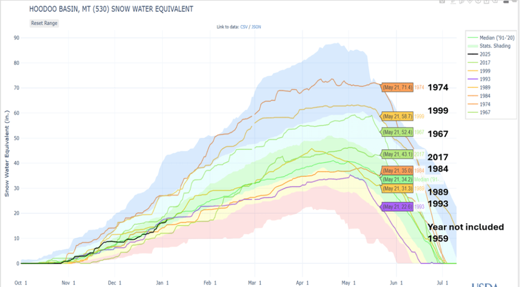
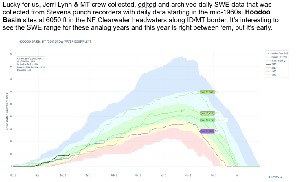
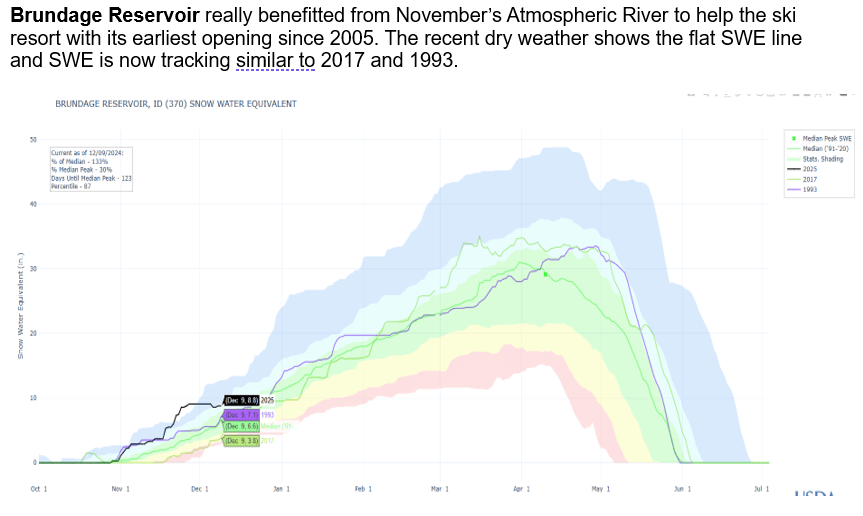
Looking at Hoodoo Basin which has daily SWE starting in 1967 also shows it was a good snow year. Interesting to note that Pete’s analog years were also 1967, 1993 and 2017 which all followed Strong El Nino Years.