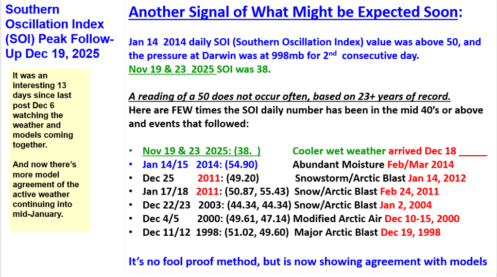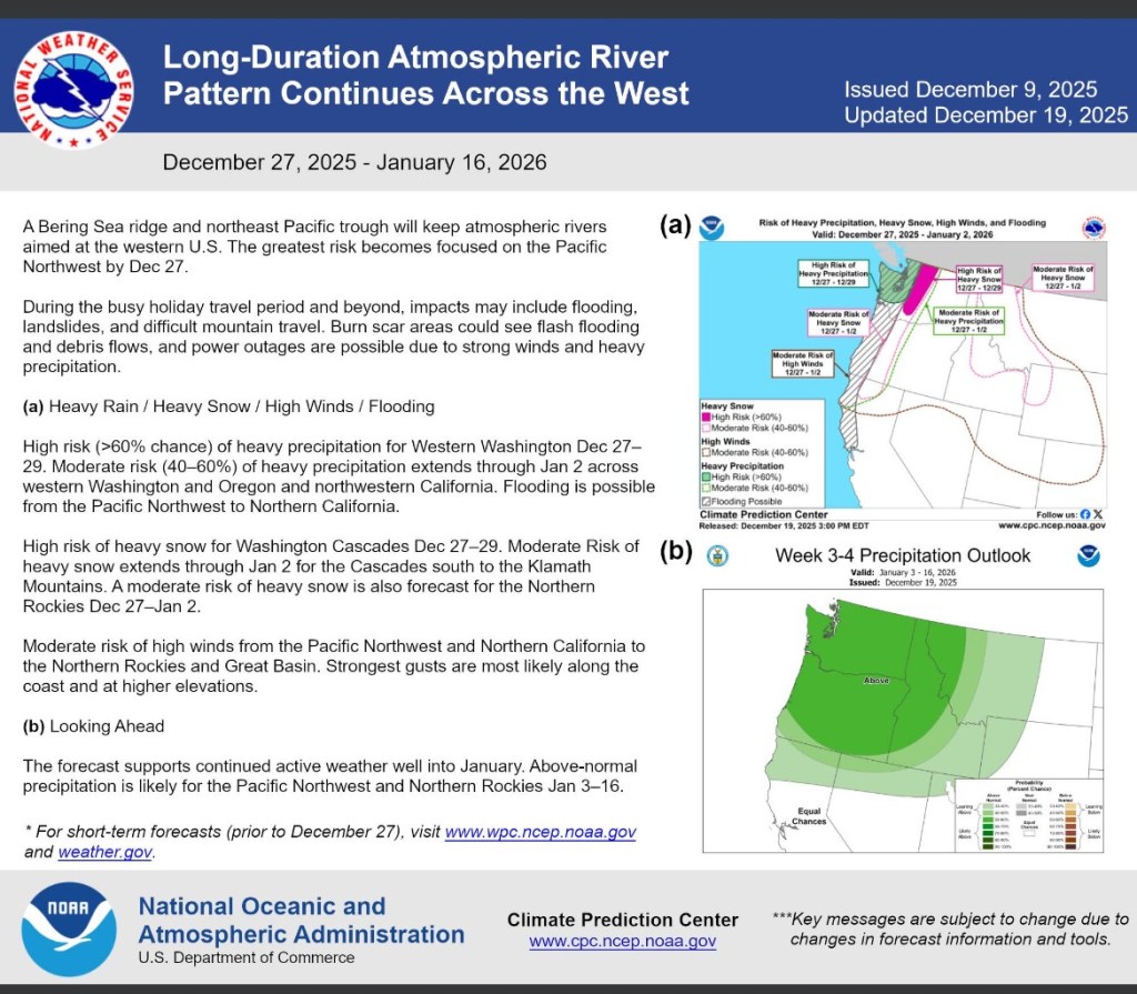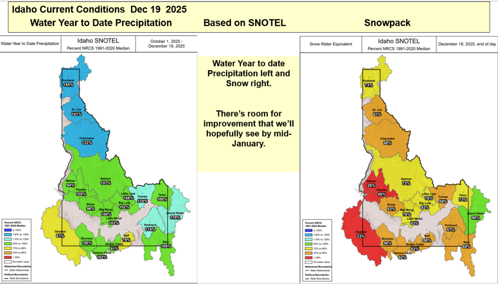
It was an interesting 13 days since last post Dec 6 watching the weather and models coming together and now there’s model agreement of the active weather continuing into mid-January.


It was an interesting 13 days since last post Dec 6 watching the weather and models coming together and now there’s model agreement of the active weather continuing into mid-January.


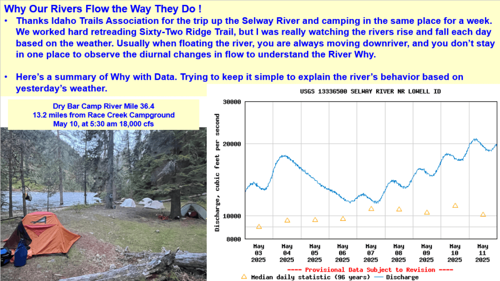
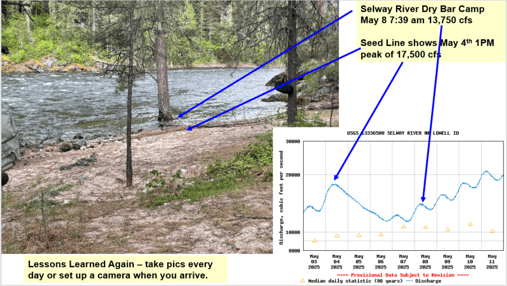
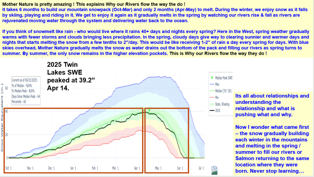
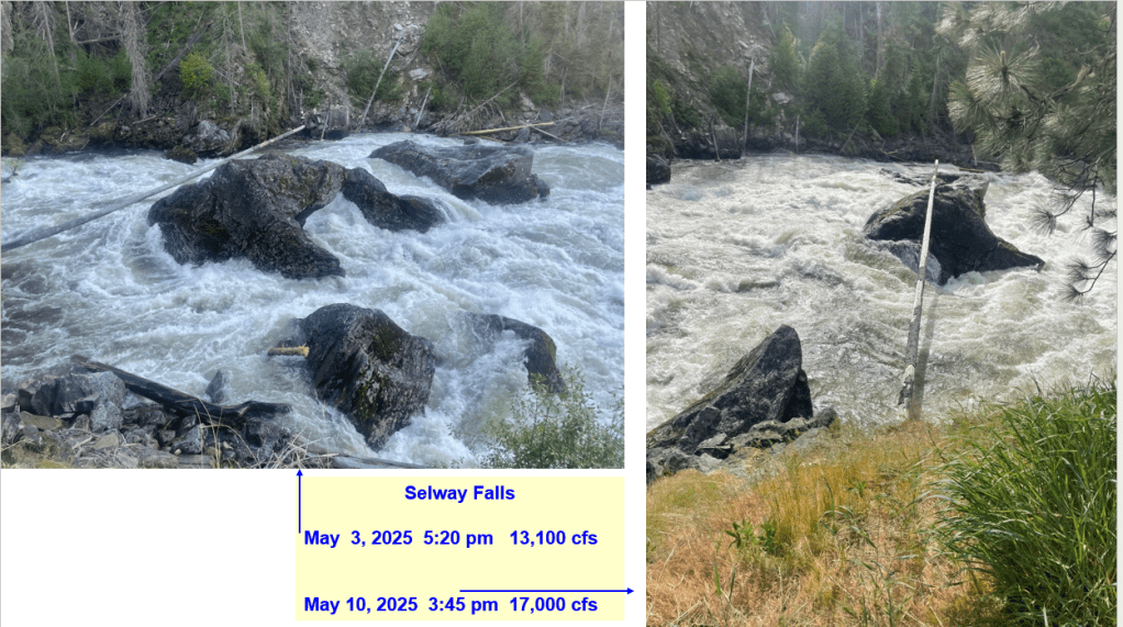
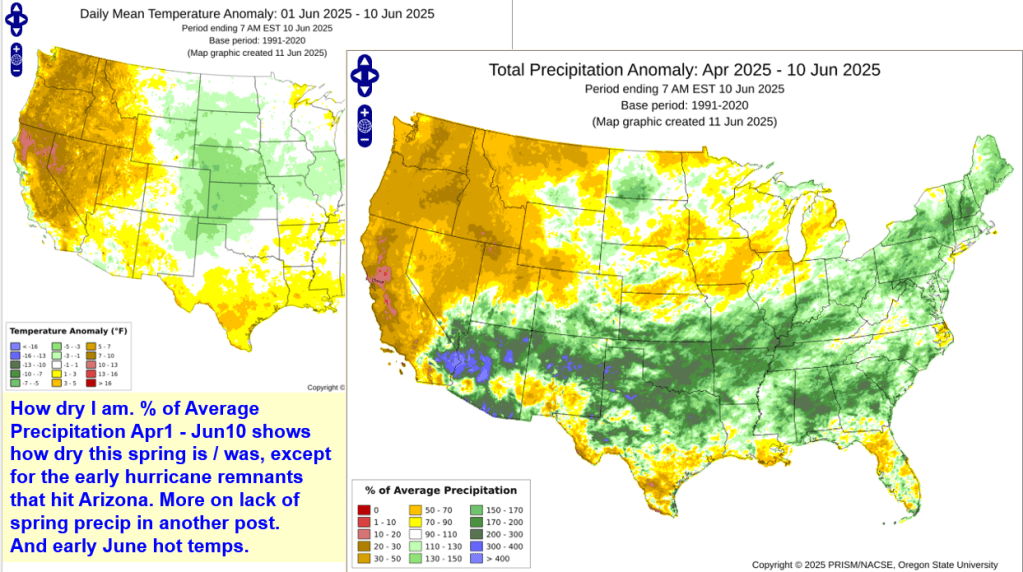
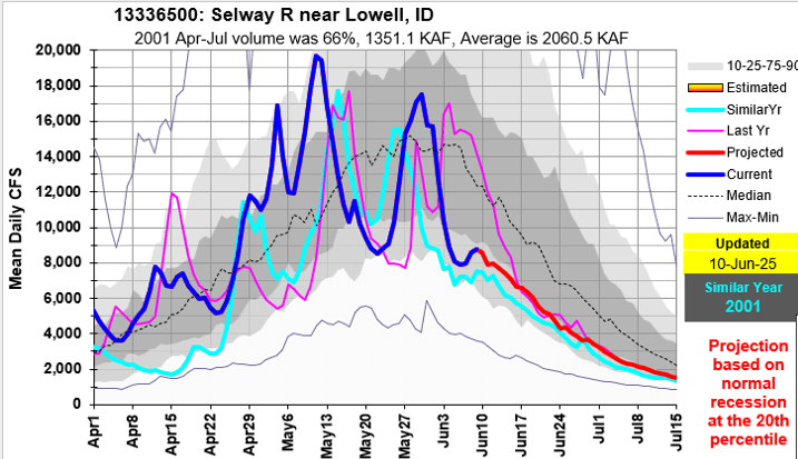
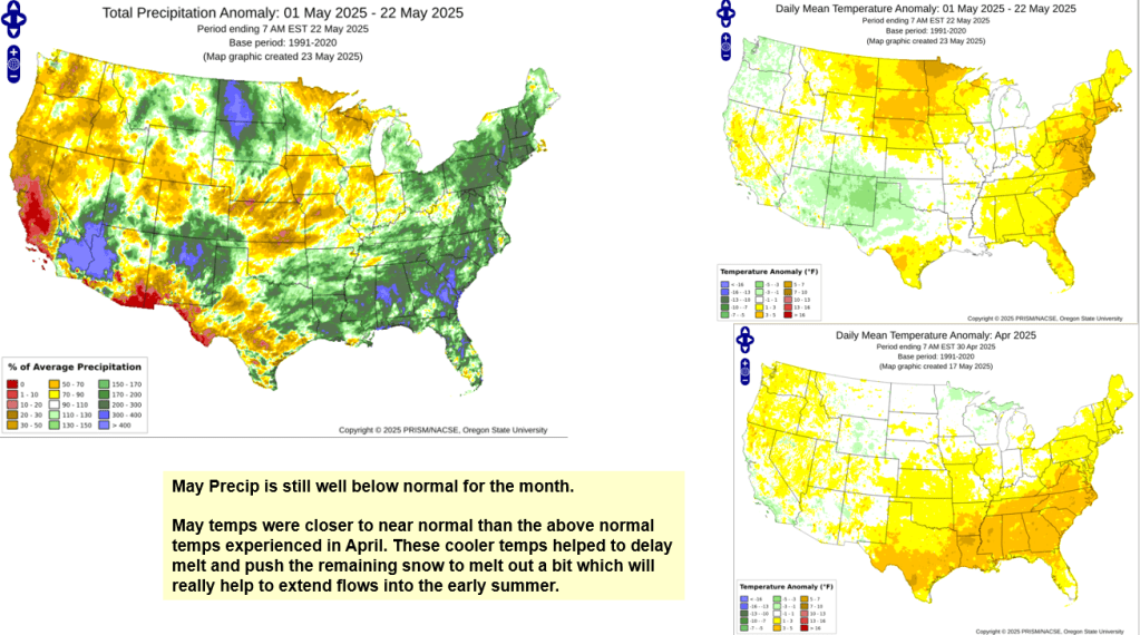
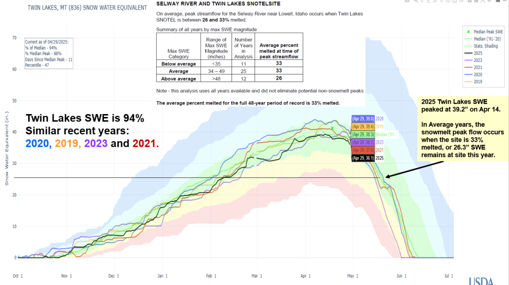
Thanks Idaho Trails Association and letting me camp, work and watch the Selway River rise and fall this May. Here’s a summary about the climatic conditions (daily/weekly weather, cold & warm fronts, record high day & non-freezing night temps, snowmelt rates, lack of spring precipitation) that produced this spring’s Selway River hydrograph shape. It’s a complex world out there. Hopefully this helps explain the diurnal river changes and why our rivers flow the way they do as our winter snowpack melts in the spring.


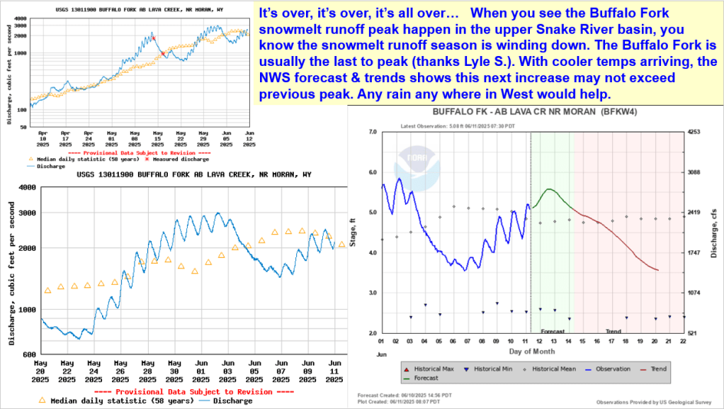
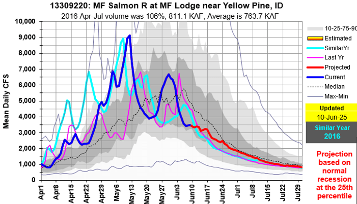
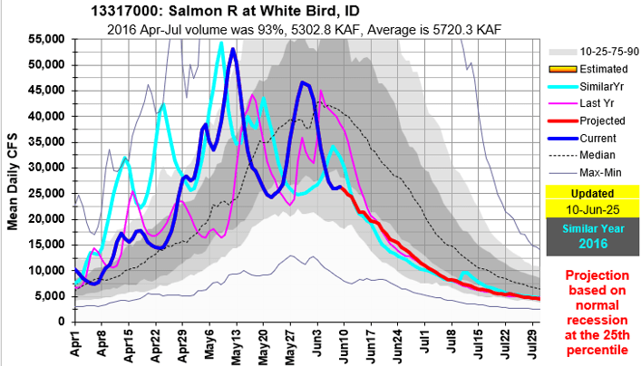
When you see the Buffalo Fork snowmelt runoff peak happen in the upper Snake River basin, you know the snowmelt runoff season is winding down. Here’s an update with similar recession years to help in monitoring this year’s flow. Projections are made for some rivers if a peak wasn’t happening.


Alphabetical flow graph summary – includes most Idaho rivers across the state and similar runoff years. Short on time to do full analysis but wanted to share.


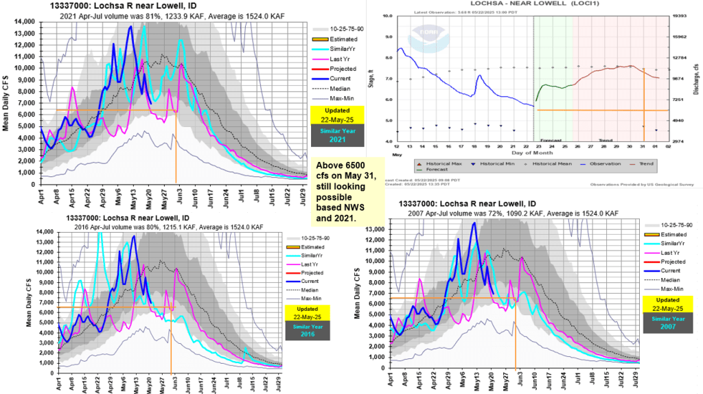
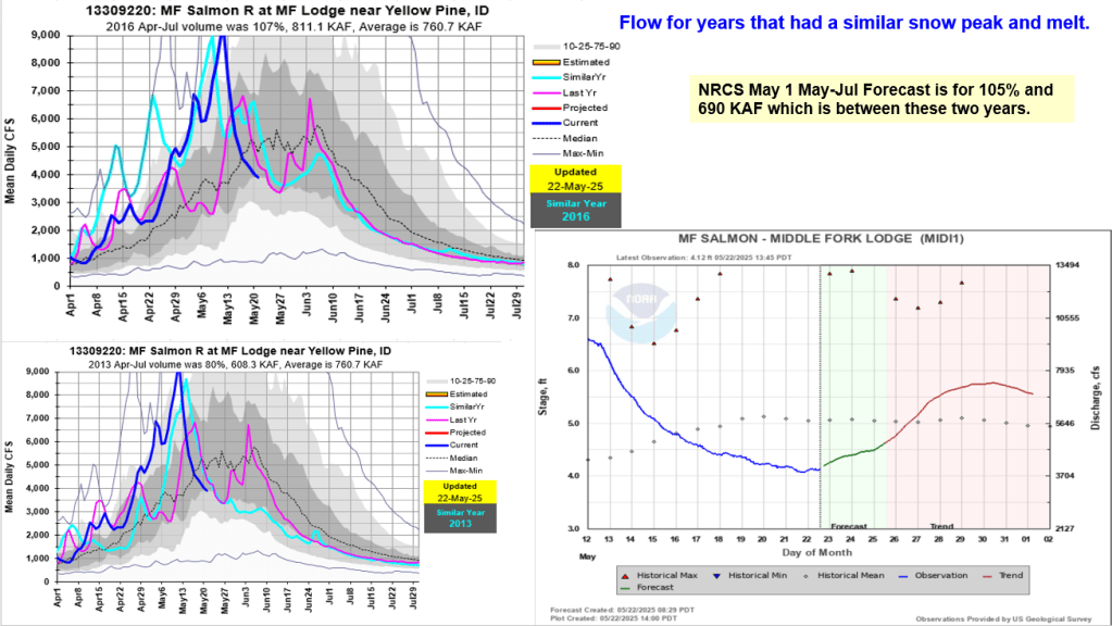
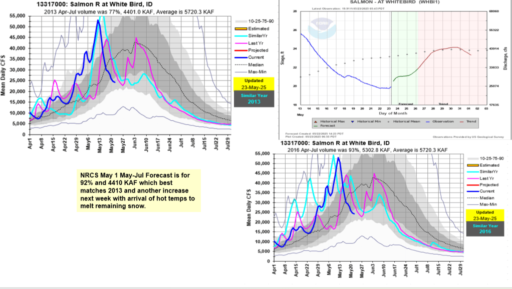
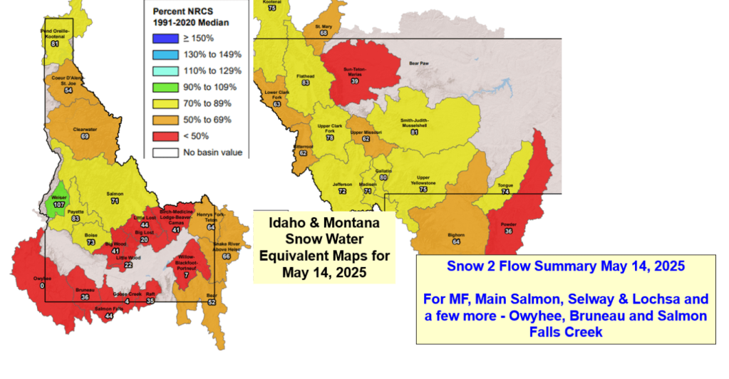
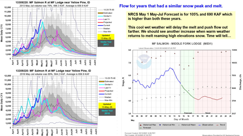
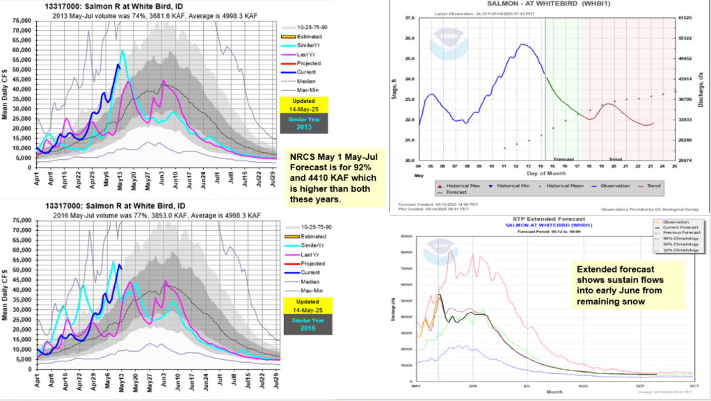
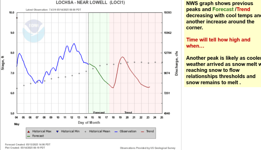
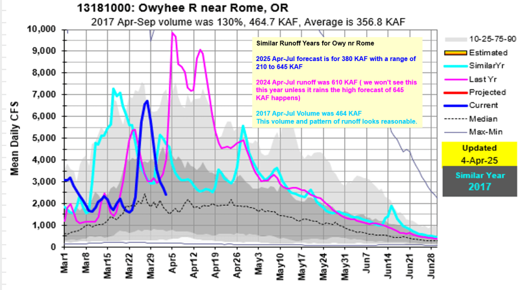
For MF, Main Salmon, Selway & Lochsa and a few more – Owyhee, Bruneau and Salmon Falls Creek. Enjoy, be safe and keep and eye on the weather and flow levels for changing conditions.


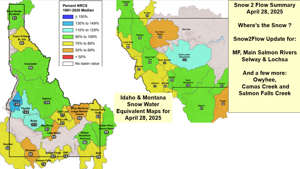
Snow2Flow Update for: MF & Main Salmon Rivers – Selway & Lochsa Rivers and a few more: Owyhee, Camas Creek and Salmon Falls Creek
Snow is melting, rivers are rising, enjoy and be safe. Know your limits.


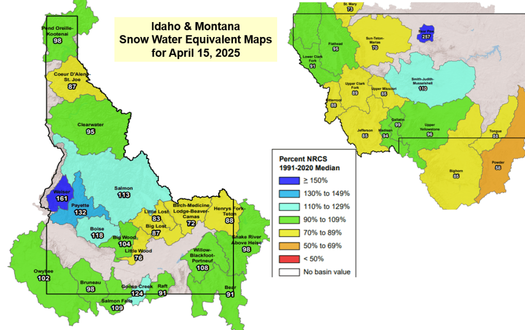
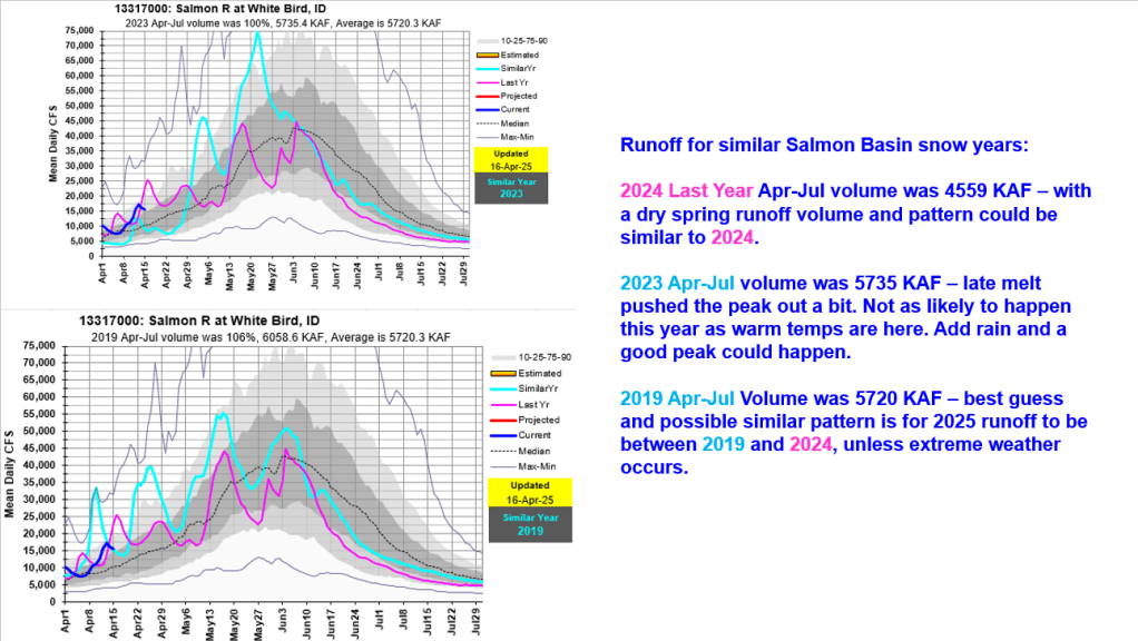
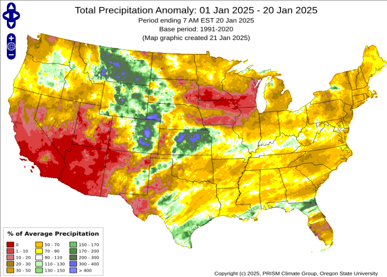
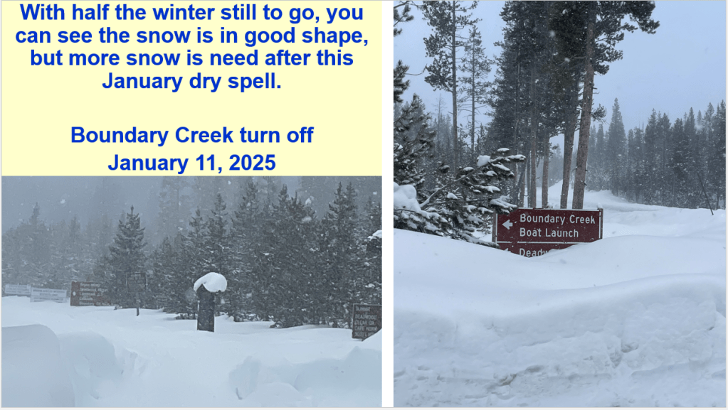
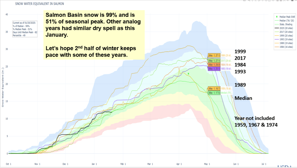
Here’s a snow & flow update for the Salmon, MF and Selway rivers and a Lochsa Bonus. Current snow conditions are displayed with analog years mentioned in previous posts. Streamflow forecast are from the NWS around Jan 20 and compared to observed runoff the analog years. January 15 is consider the half way point for winter. Overall the snow is in good shape because of the great start, but more snow is need after this dry January as show in image below.


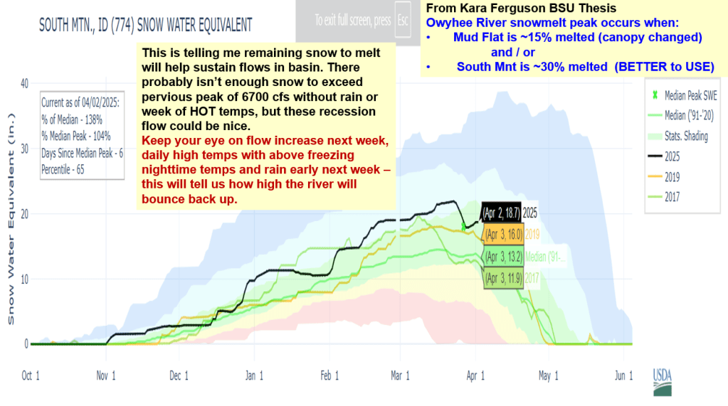
Here’s a talk given to Idaho Alfalfa & Clover Seed Growers about current conditions, analog years, acres burned, a few slides about 2024 extreme weather and disasters, and the snow & flow outlooks for the Weiser, Payette, Boise and Owyhee basins. With high, dry and cold weather here for a bit, we’re gonna loose about 1% a day, but the snow won’t be melting. Cold is good! We’ve seen winter dry spells in other years and lucky for us, SW Idaho got off to a great start this winter. Let the 2nd half of winter start – any day now…