Idaho Museum of Mining & Geology – Water Snowpack and Drought Update

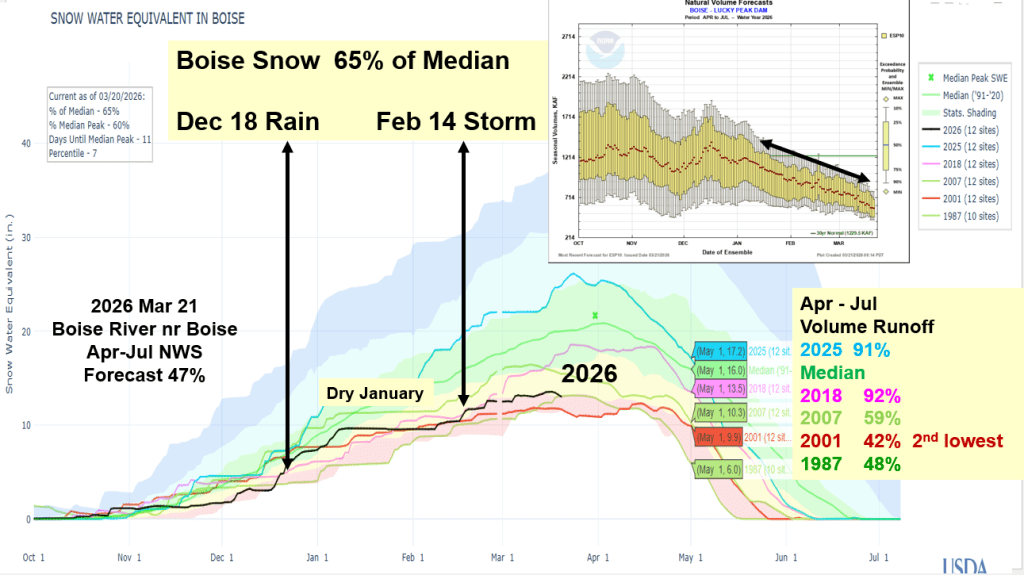
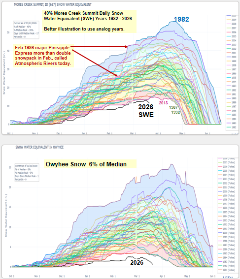
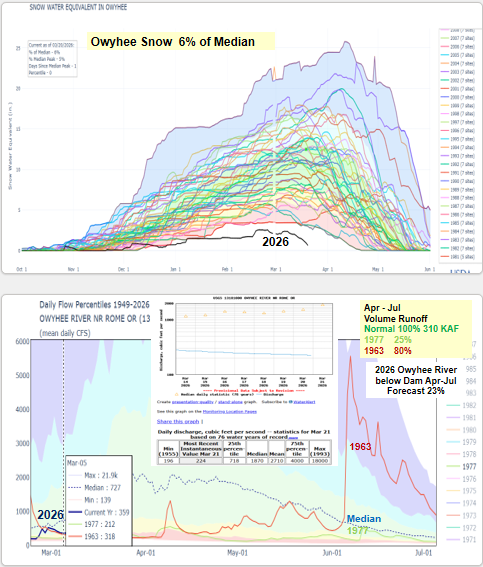
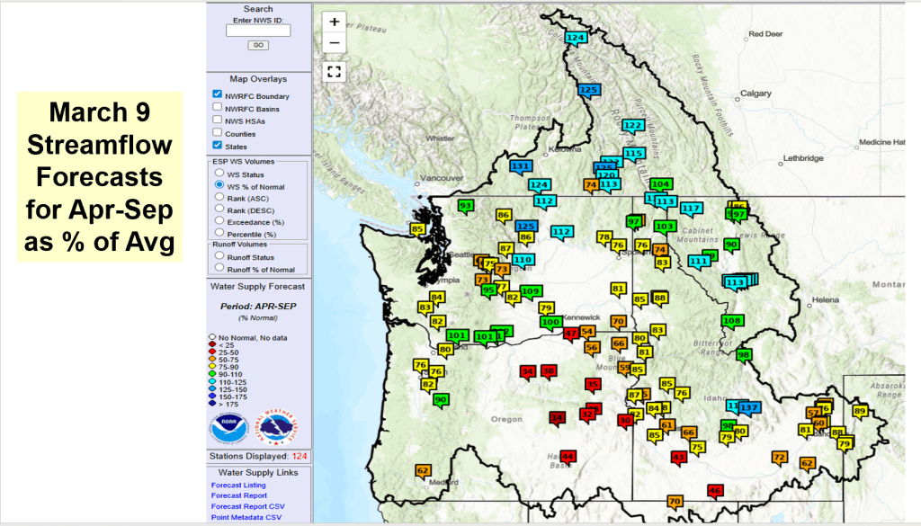
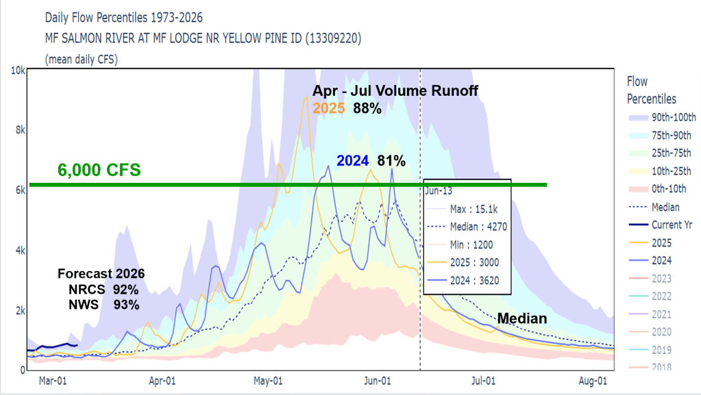
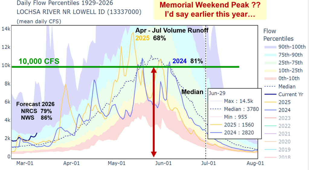
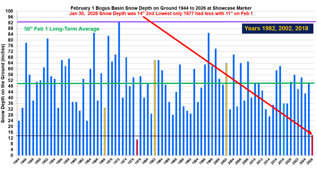
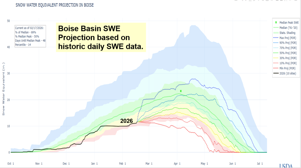
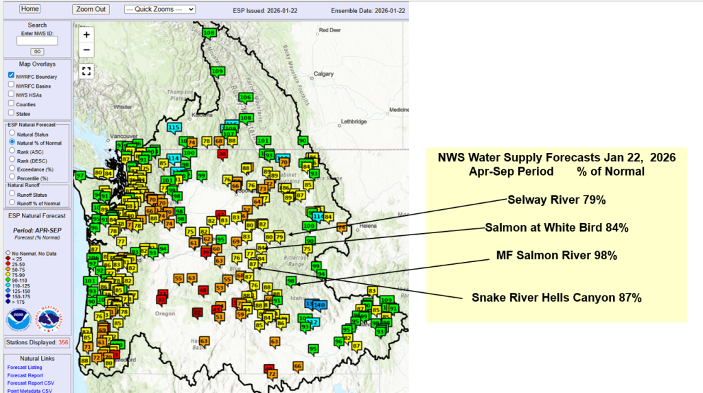
Mid-March heat dome is melting Idaho’s snow way too earlier. Even the higher elevations are starting to melt and rivers are rising. Here’s an update of how we got here and the 3-D Drought that put us in this unique position. Winter 2026 will be remembered as a winter with near normal water year to date precipitation, elevation distributed snowpacks, warm temps and now a spring heat dome that is melting the snow and pushing rivers up, except in the Owyhee because there is very little snow to melt. Let’s hope cooler weather returns by month’s end and a few cool wet storms in Aril arrive to save our remaining higher elevation snow to melt later this spring. A wet spring is needed this year. Another record dry Apr-May-Jun like last year, would not be good. Spring rain are needed now while the snow is melting to increase runoff. Even a late spring rain event like the one that occurred June 1, 1963 pushing the Owyhee River up to 5000 cfs, would be sweet. 1963 is an analog year for this year which also had very low snow runoff in the Owyhee. Lessoned learned from watching Owyhee River runoff – it often sets the stage for runoff trends seen elsewhere in southern Idaho.
Snow2Flow Verification for Years 2023, 24 & 25

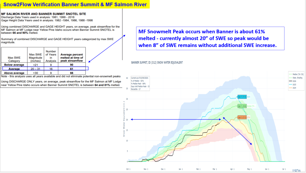
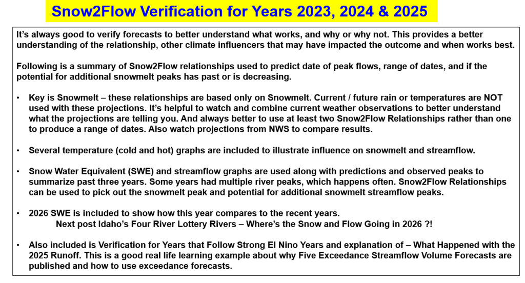
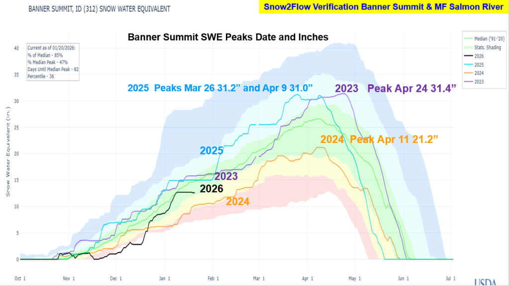
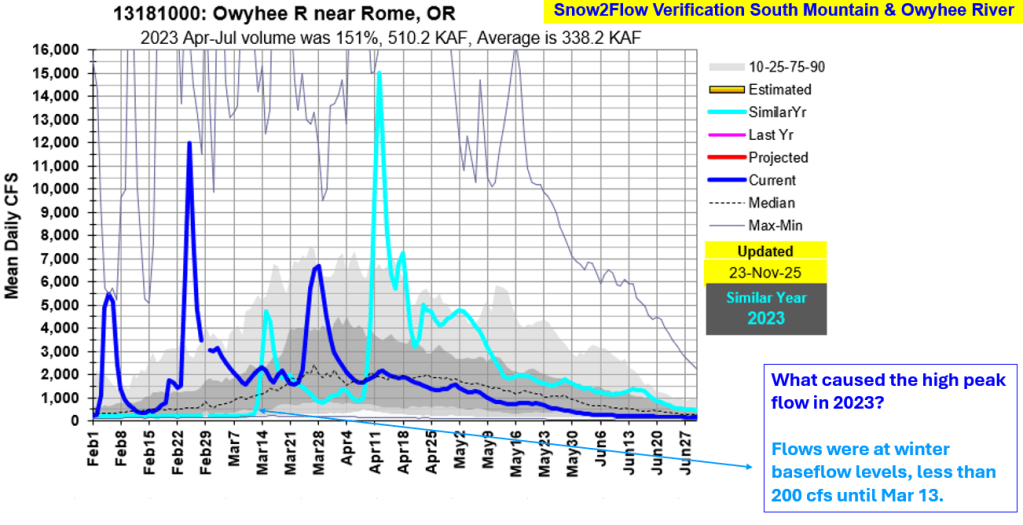
It’s always good to verify forecasts to better understand what works, and why or why not. This provides a better understanding of the relationship, other climate influencers that may have impacted the outcome and when works best. Following is a summary of Snow2Flow relationships used to predict date of peak flows, range of dates, and if the potential for additional snowmelt peaks has past or is decreasing

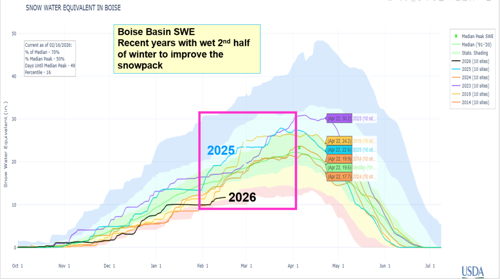
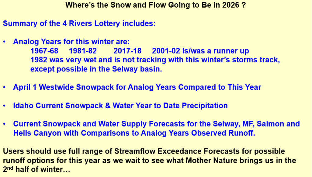
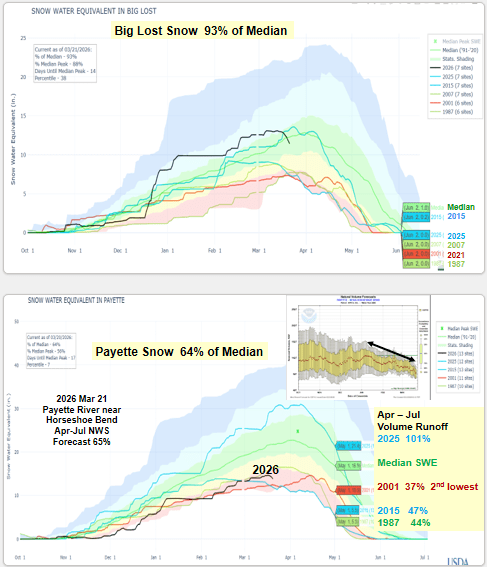
Snow & Flow graphs illustrate what happened and how the predictions preformed. 2026 SWE is also include to give you a hint how this winter is tracking these recent years. Next post Idaho’s Four River Lottery – Where’s the Snow and Flow Going in 2026 ?!

Temperature Driven Snow Drought

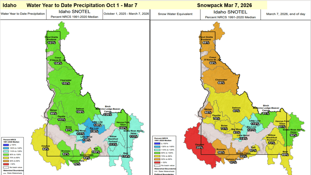
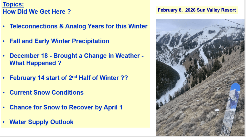
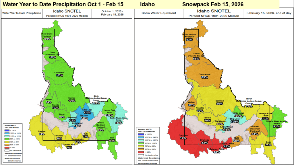
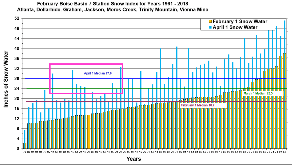
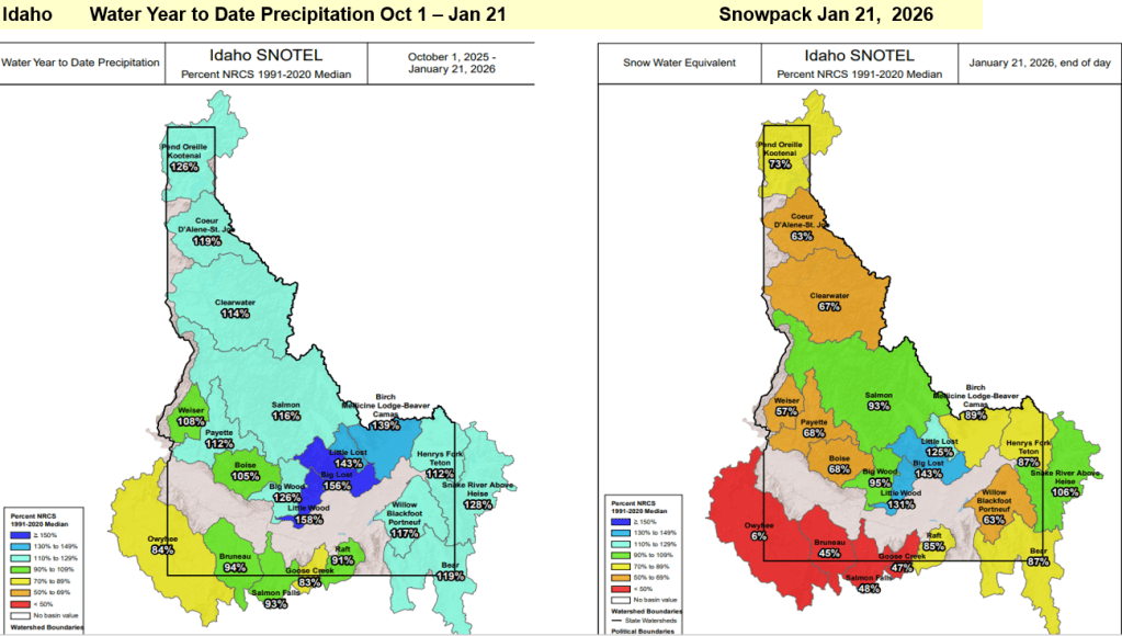
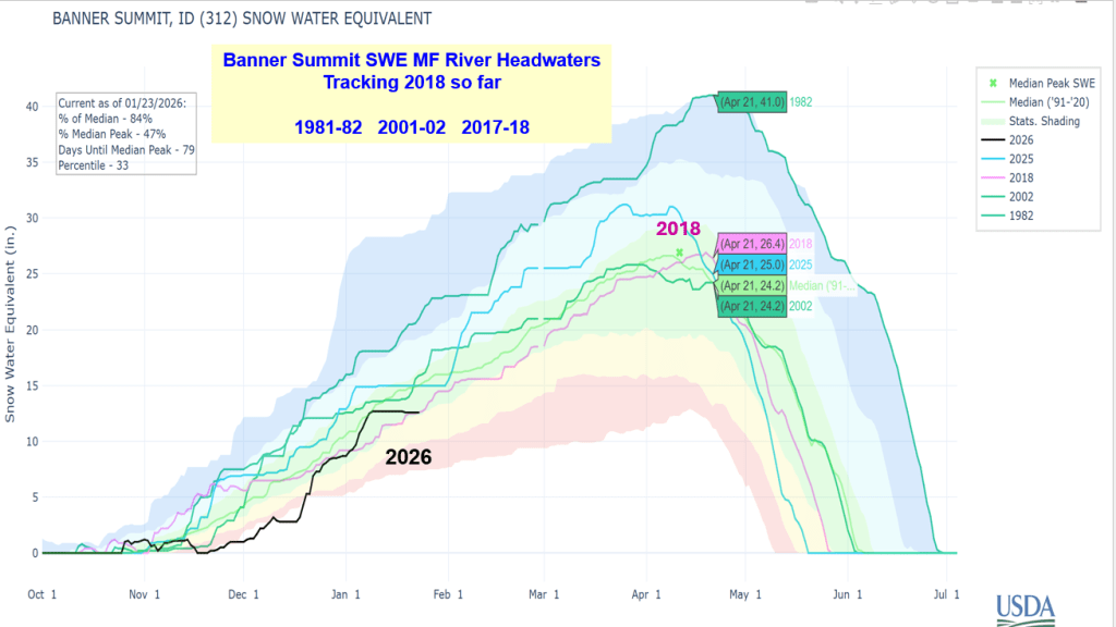
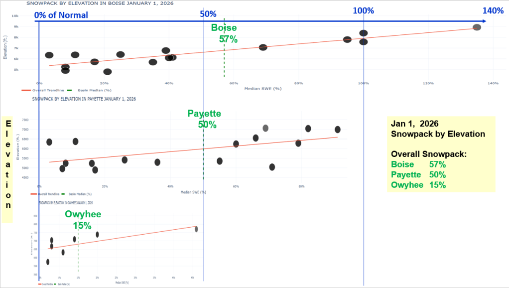
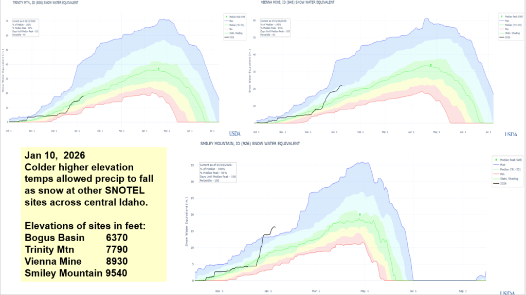
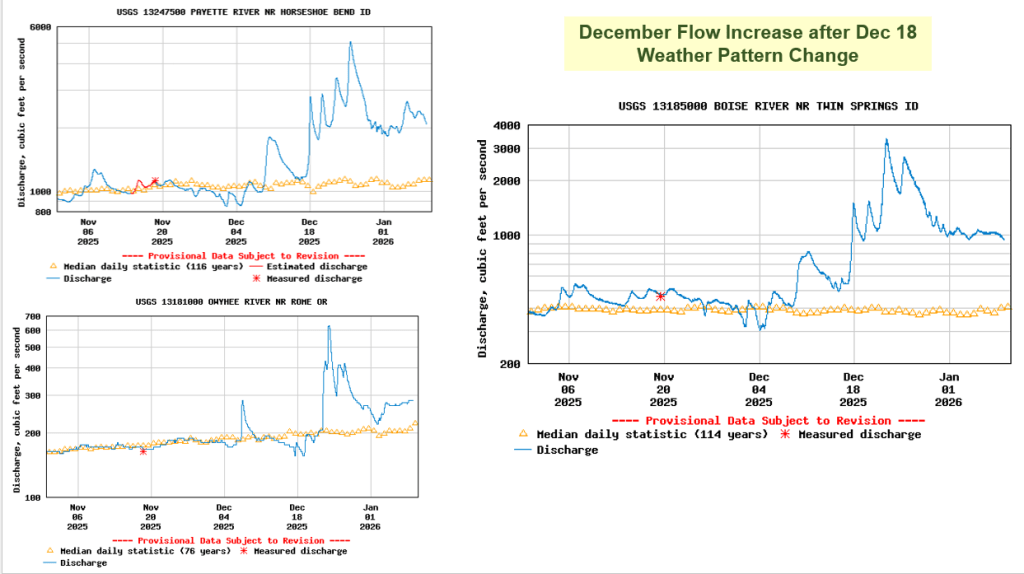
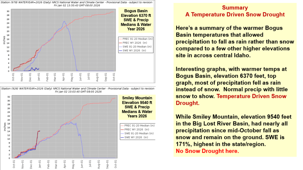
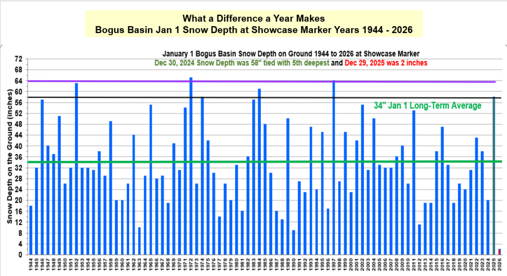
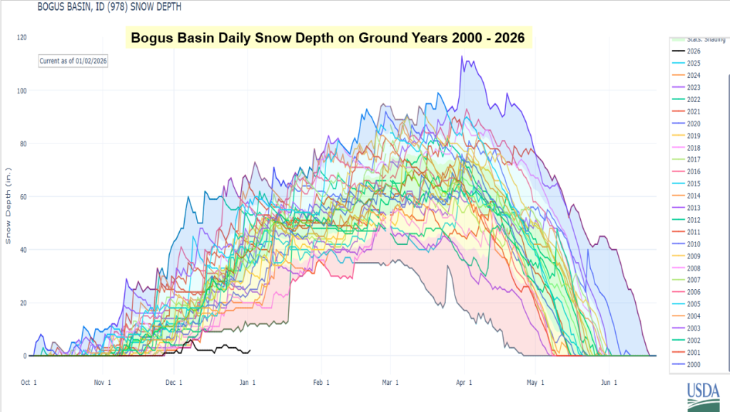
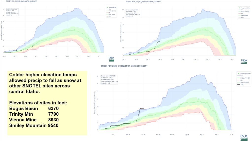
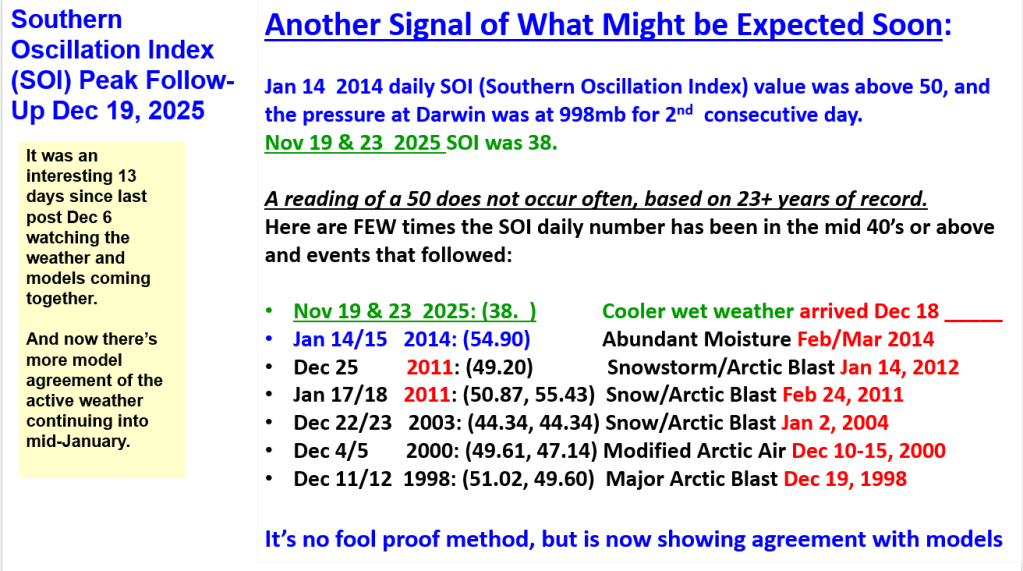
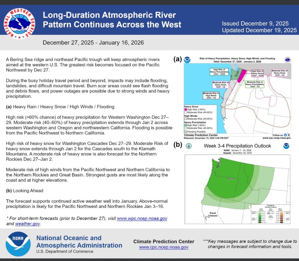
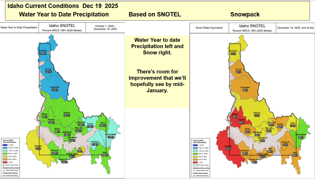
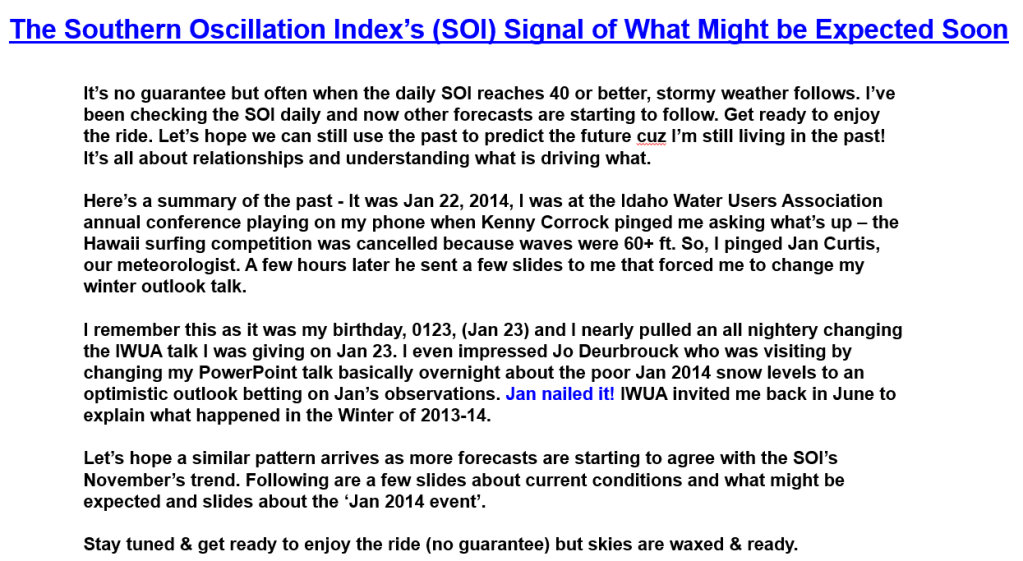
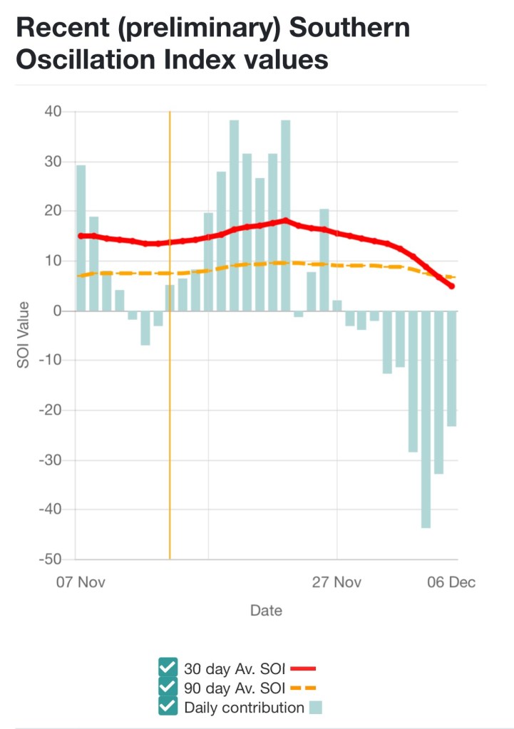
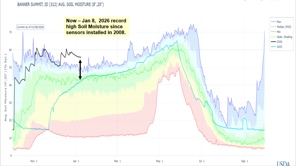
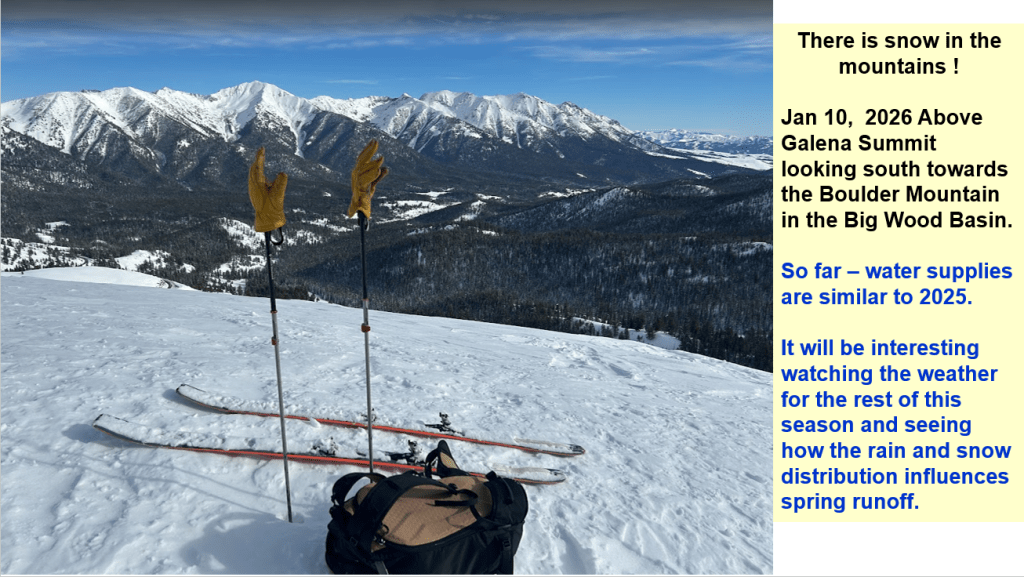
A change in weather pattern starting around Dec 18 as hinted by Nov SOI Spikes brought numerous Atmospheric Rivers events with abundant precipitation to parts of the West. Too much rain in some areas. Locally, warm temps allowed this moisture to fall as rain rather than snow except in higher elevations around Idaho. Water year to date precip is near normal across most of the state. Snowpacks are near record low in lower elevations and increase in higher elevations. Smiley Mountain snow, in the Big Lost Basin, is 171% of normal. Here’s a summary explaining the abundant moisture and influence of temps on snowfall across central Idaho.
2025 Summary & 2026 Outlook

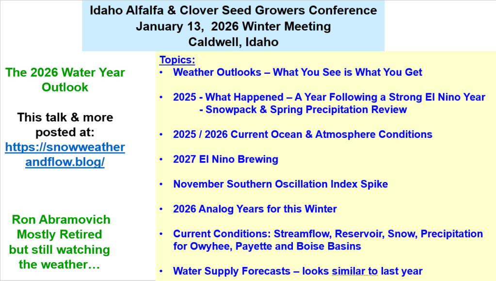
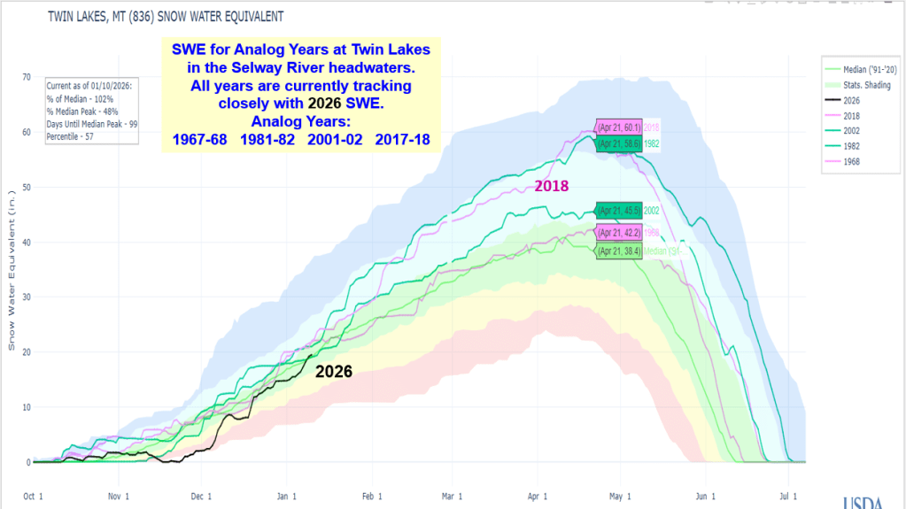
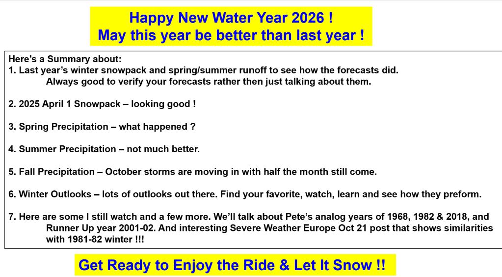
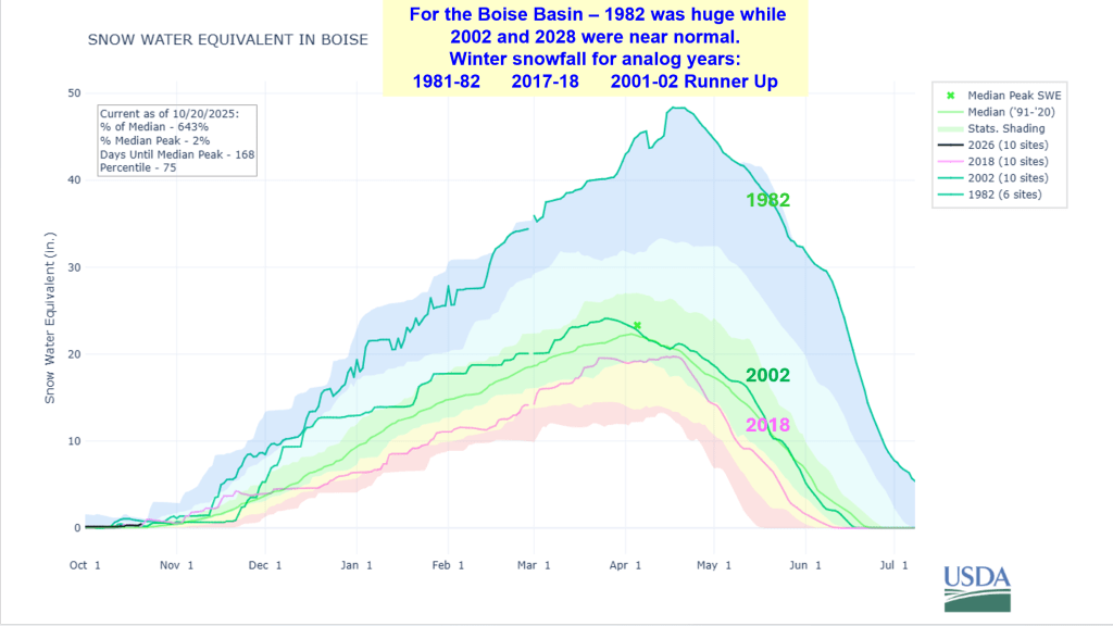
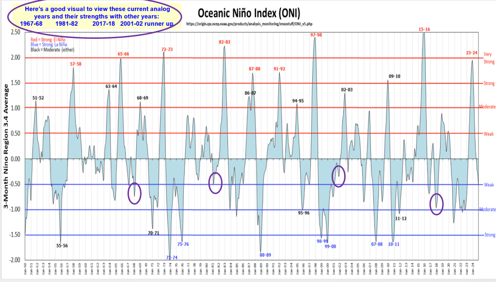
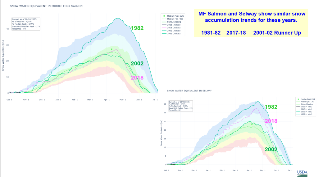
Here’s a summary of what happened to last year’s runoff because of near record dry spring. Summer is over and Fall precip is moving with a huge Atmospheric River tail that stretches over 1000 miles to SE Asia. Winter Outlooks for 2025-26 with analog years based on similar ocean conditions; we’ll watch and updated as we progress into winter. For now enjoy the wet weather as we start the new water by building our mountain snowpack.