Idaho Museum of Mining & Geology talk from March 9 about 1. Current Ocean and Atmosphere Teleconnections, 2. Conditions Leading to this Year, 3. 2024 Extreme Weather & Natural Disasters, 4. Current Stream, Snow and Water Supply Forecasts with Highlights for the Payette, Boise and Owyhee Basins, and Weather Outlooks.
Here’s a talk given to Idaho Alfalfa & Clover Seed Growers about current conditions, analog years, acres burned, a few slides about 2024 extreme weather and disasters, and the snow & flow outlooks for the Weiser, Payette, Boise and Owyhee basins. With high, dry and cold weather here for a bit, we’re gonna loose about 1% a day, but the snow won’t be melting. Cold is good! We’ve seen winter dry spells in other years and lucky for us, SW Idaho got off to a great start this winter. Let the 2nd half of winter start – any day now…
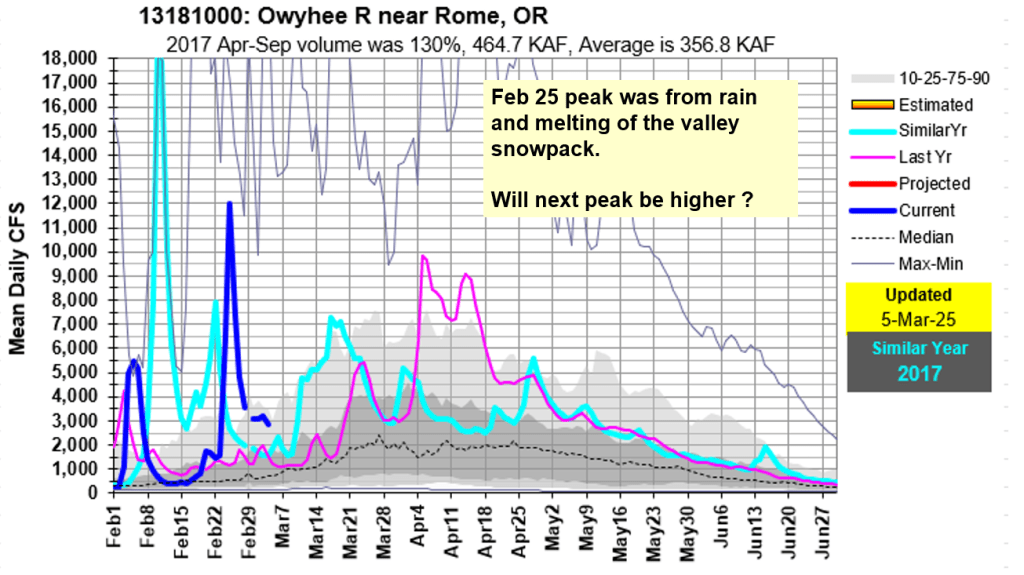
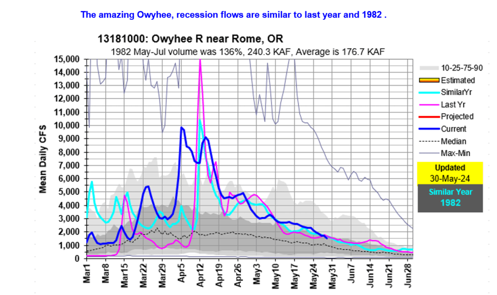
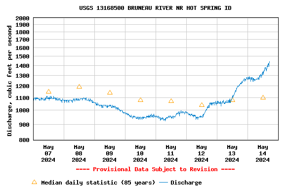
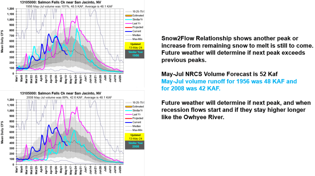
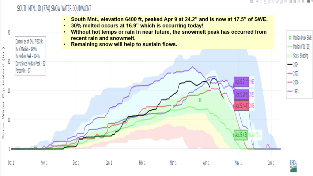
The Bruneau is rising again along with Salmon Falls Creek. The Owyhee had a long and amazing season and is holding steady from the remaining snow melting in the basin.
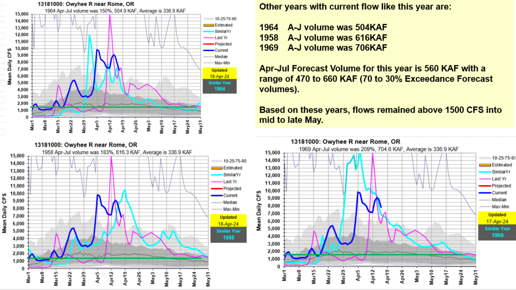
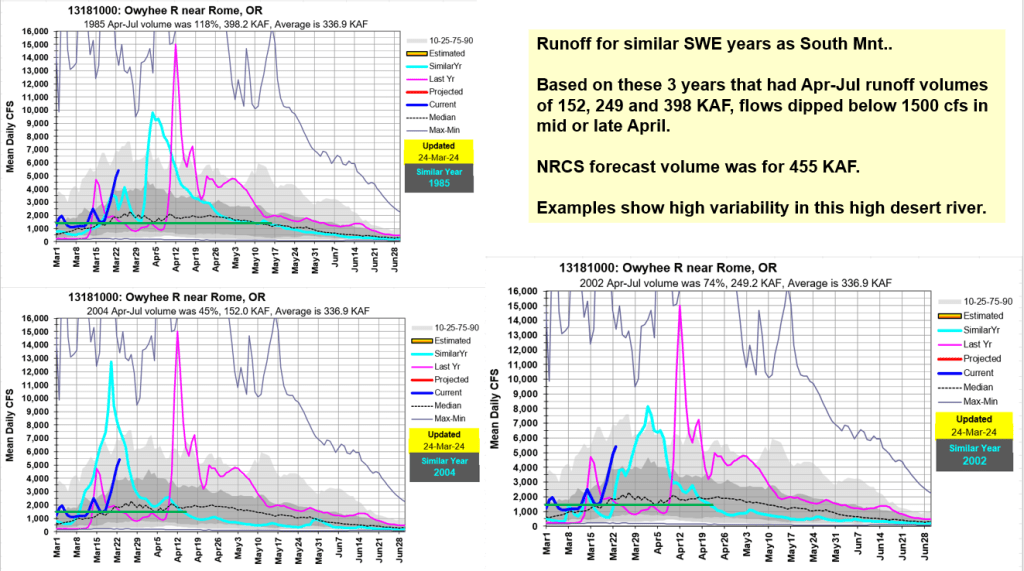
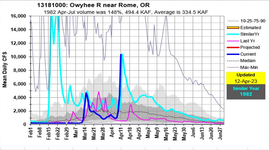
Remaining snow will help to sustain flows… how long – here are a few similar runoff volumes and recession years. With little weather on the horizon, current snow melt from warm days and freezing nights is ideal.
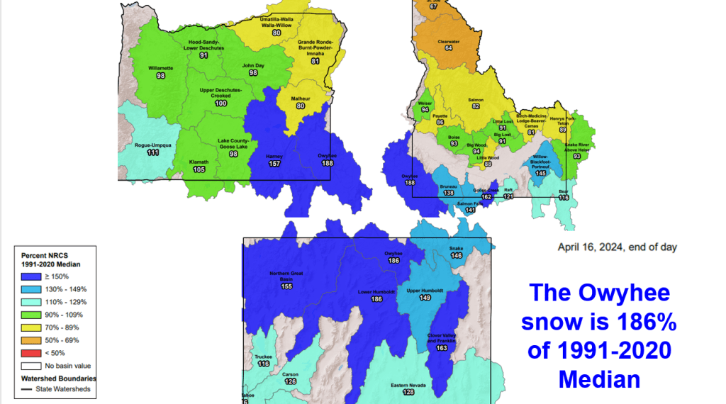
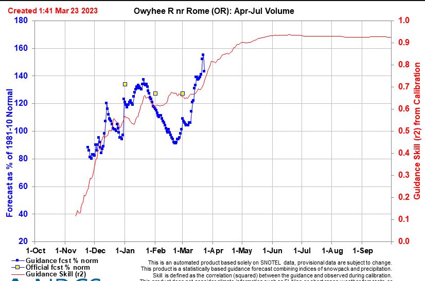
Here’s an update for the Owyhee based on current snow, flow projections and more weather moving in this week and next. It’s nice to look at big picture to see what’s happening around this tri-state basin.
Update for Owyhee, Weiser, Camas, Salmon Falls, Bruneau, Boise & Big Wood
For complete Snow to Flow Relationships see:
Snow Melt / Peak Streamflow Relationships (PDF; 146 KB) – Report by Kara Ferguson (2017) summarizing the relationship between snowmelt and peak streamflow timing on rivers throughout Idaho.
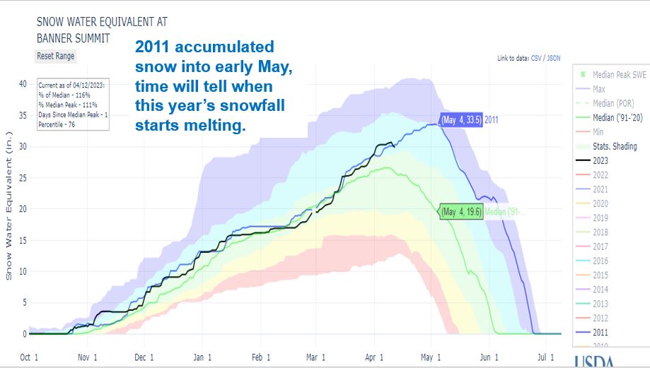
Following are several graphs illustrating current snow levels and similar years along with resulting runoff. The Owyhee – based on snow2flow relationship just had a snowmelt peak. More rain and warmer temps will produce more peaks. Weiser – always interesting watching the Weiser River react to current conditions as we wait and watch to try to figure out how the higher elevation basins in the state will flow. Camas Creek lots of snow to melt. Bruneau is looking good along with Salmon Falls Creek. Is Banner Summit reaching its peak? Time will tell and then we’ll see how headwaters snow melts and the mighty Salmon River responds. Be safe and know your boating limits.
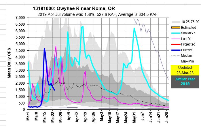
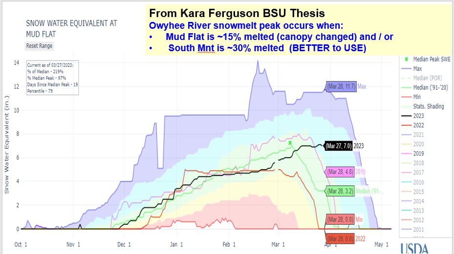
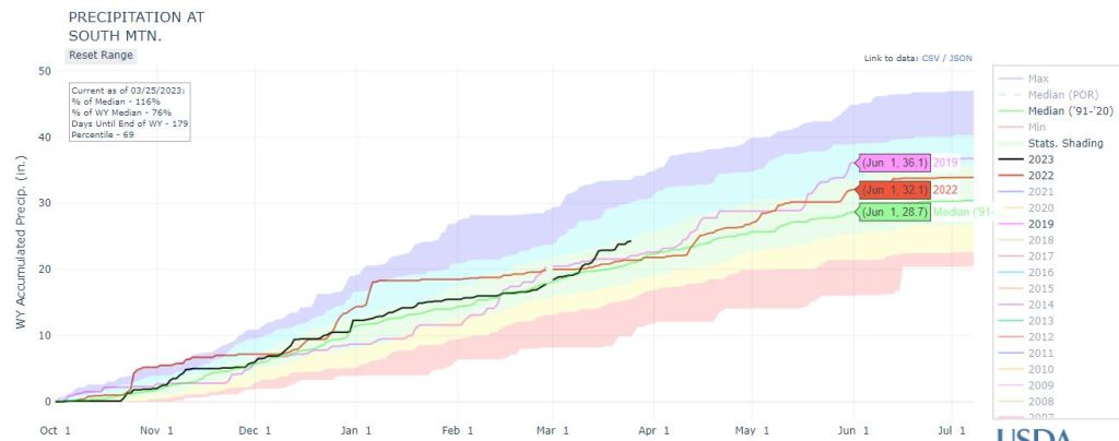
The Owyhee River at Rome increased to 4600 cfs (mean daily flow) on Mar 16 from melting of valley snow and rain for its first peak since last year. The higher elevation snow is still accumulating, even at Mud Flat SNOTEL site which is only 5730 feet in elevations. March precipitation thru March 27 was 144% of median with another storm to continue building the pack as cold will remain until at least early April. Then, get ready as the cold temps will not last for ever…
With an April-July runoff volume of 150% of median predicted, means we could see volumes similar to the first half of the 2019. The 2nd peak on May 31, 2019 depends if the wet /cool spring weather continues into late spring / early summer.