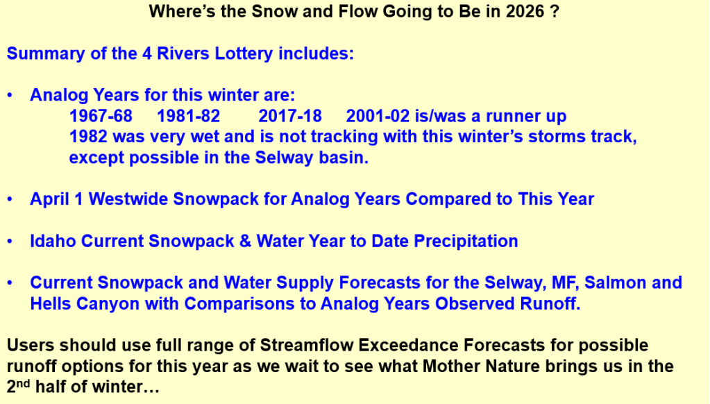
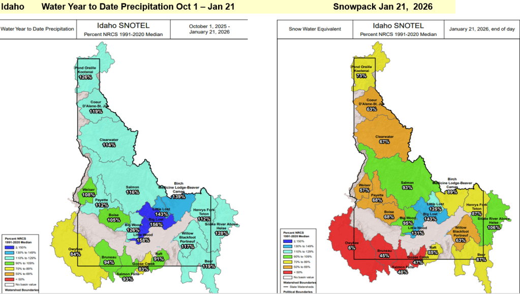
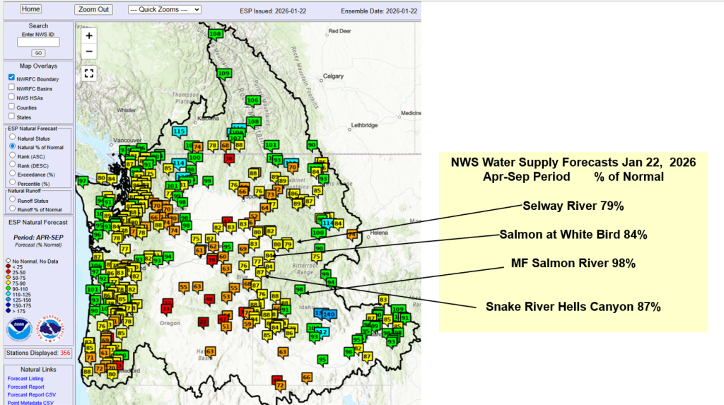
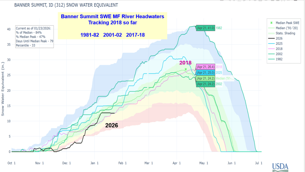
Here’s a summary of current snow water supply conditions for Idaho’s 4 River Lottery Rivers. Short on time for complete analysis but this should provide current info about the accumulation of this winter’s unique snowpack and where we are compared to other years.
It’s always good to verify forecasts to better understand what works, and why or why not. This provides a better understanding of the relationship, other climate influencers that may have impacted the outcome and when works best. Following is a summary of Snow2Flow relationships used to predict date of peak flows, range of dates, and if the potential for additional snowmelt peaks has past or is decreasing
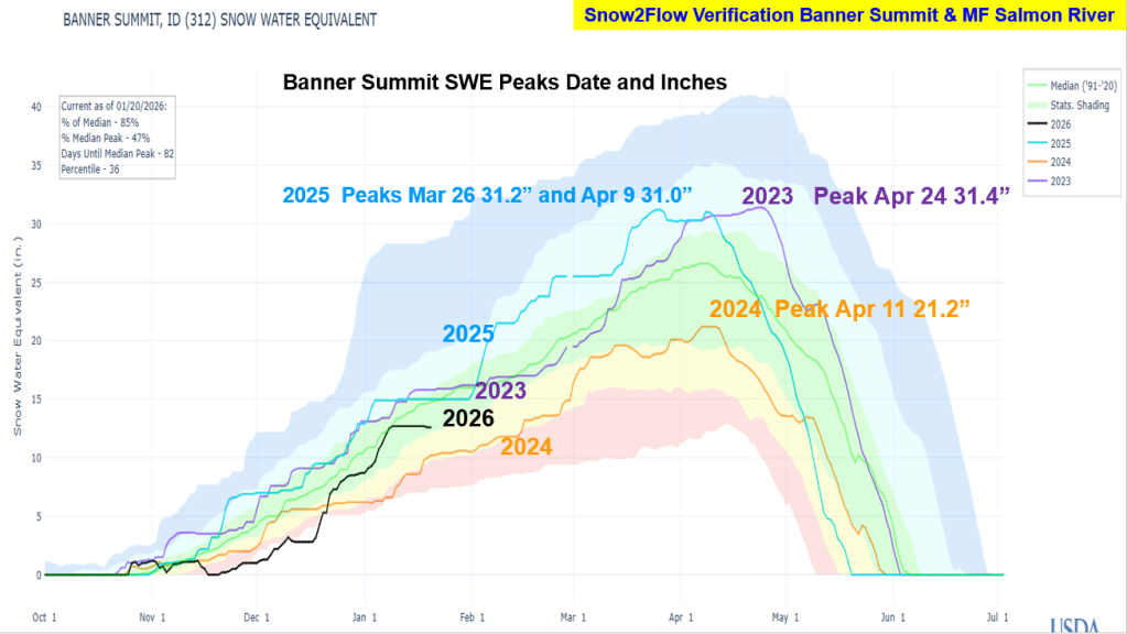
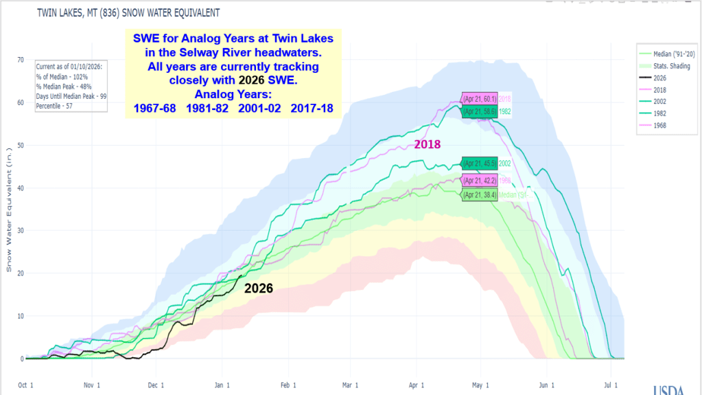
Snow & Flow graphs illustrate what happened and how the predictions preformed. 2026 SWE is also include to give you a hint how this winter is tracking these recent years. Next post Idaho’s Four River Lottery – Where’s the Snow and Flow Going in 2026 ?!
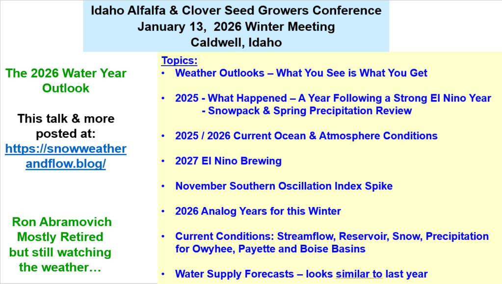
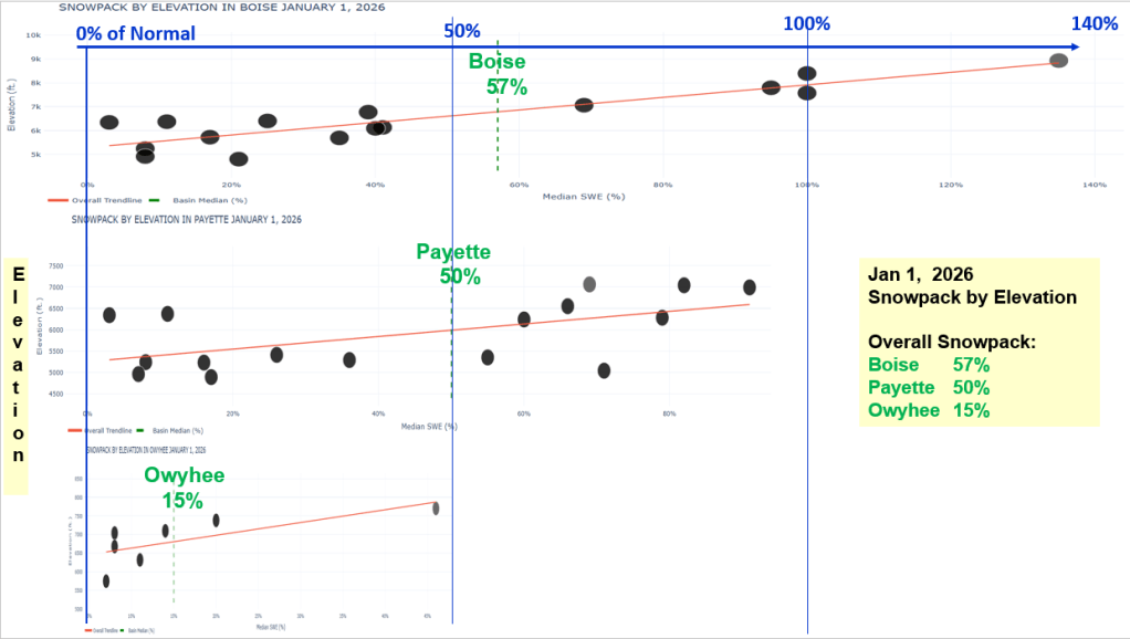
Here’s a summary of the 2025 runoff, the fall and early winter weather that created the unique elevational distribution of the snowpack and water supply outlook for the Payette, Boise & Owyhee basins. This talk was for the Idaho Alfalfa & Seed Growers Conference.
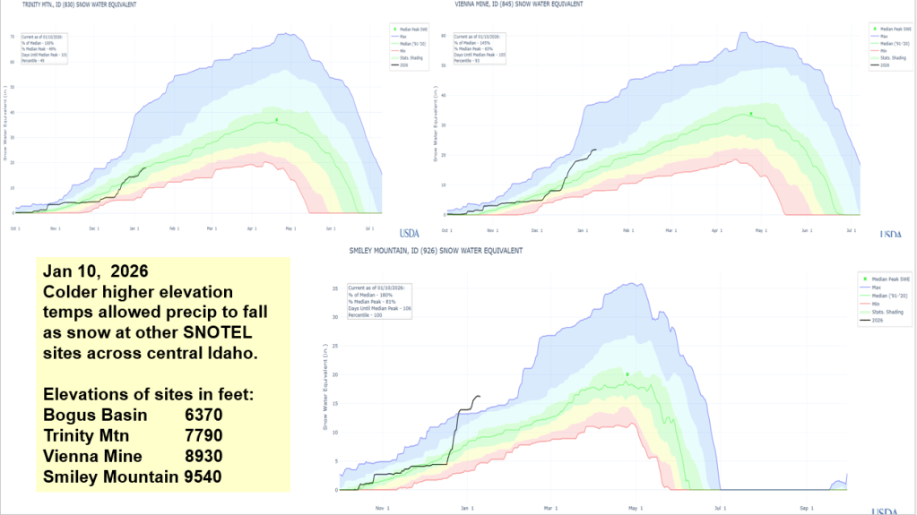
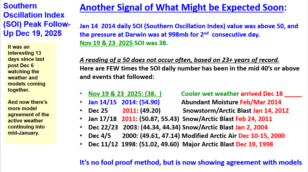
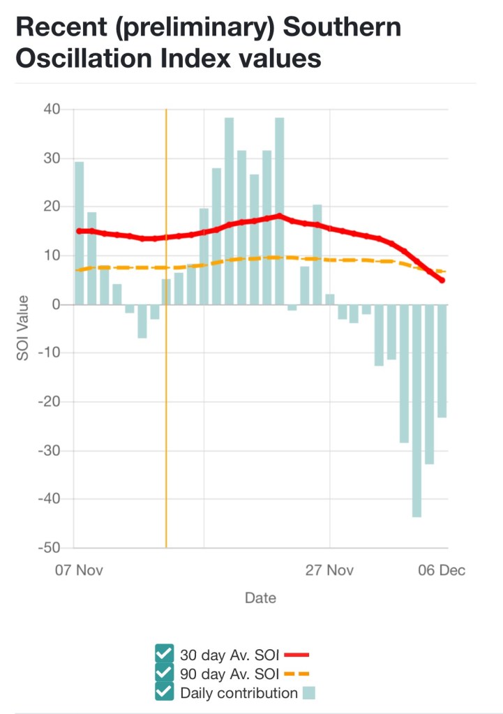
It was an interesting 13 days since last post Dec 6 watching the weather and models coming together and now there’s model agreement of the active weather continuing into mid-January.
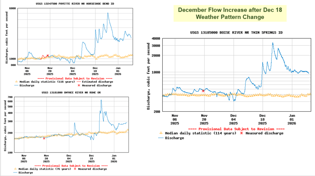
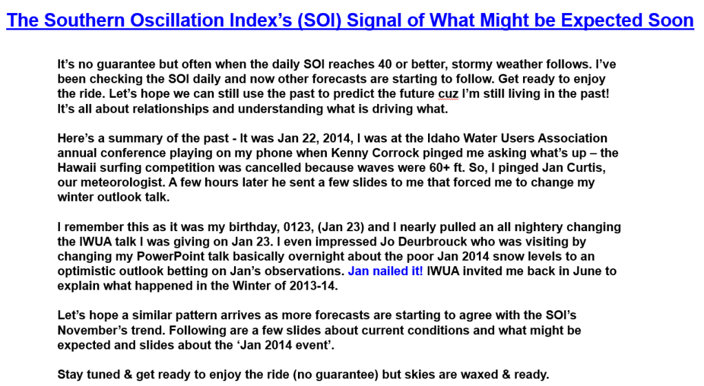
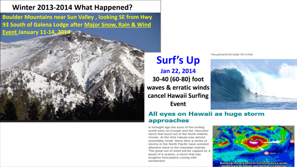
No guarantees, but if history repeats, we could see a weather pattern change around Dec 18. Here’s a summary for the November SOI Event and what I learned the winter of 2014 when it also happened ! Time will tell where the event might arrive or if the event tracks farther east.
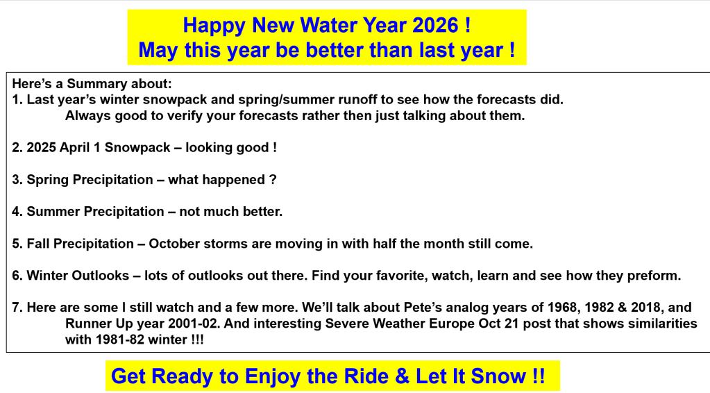
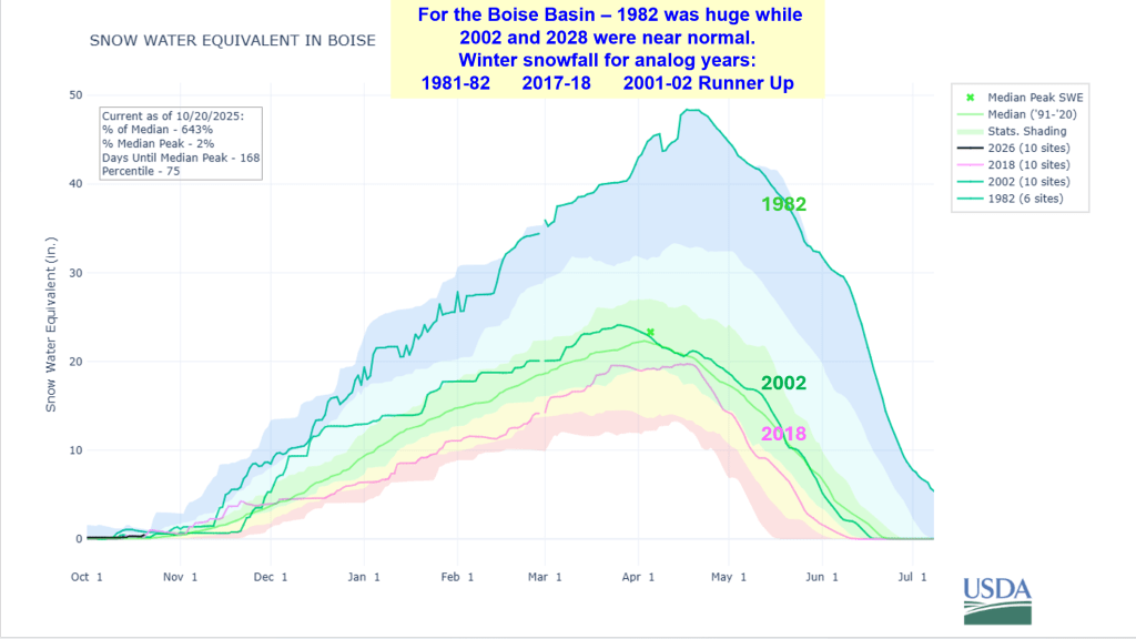
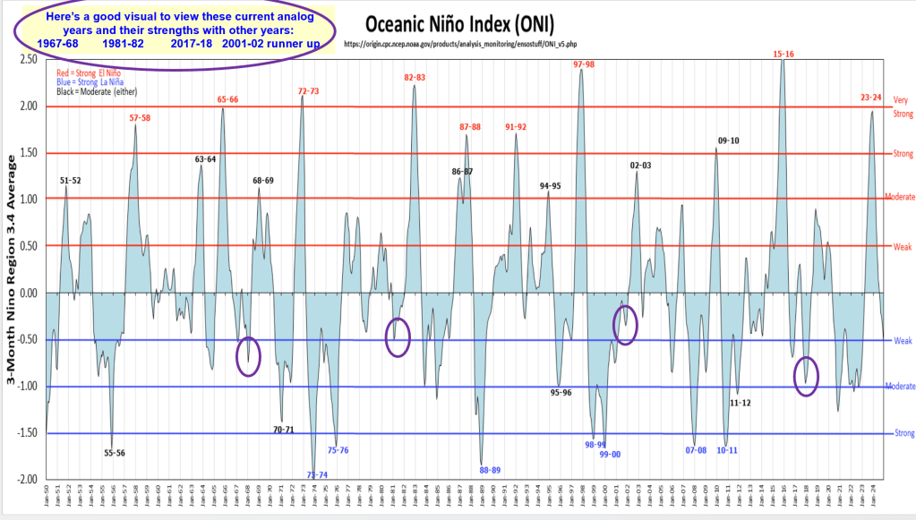
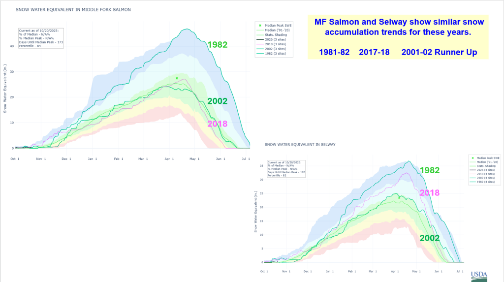
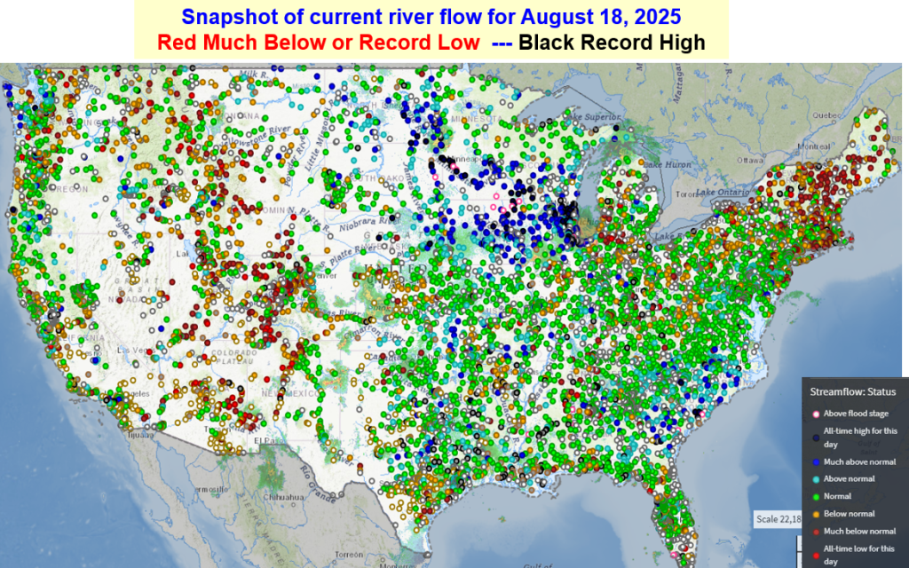
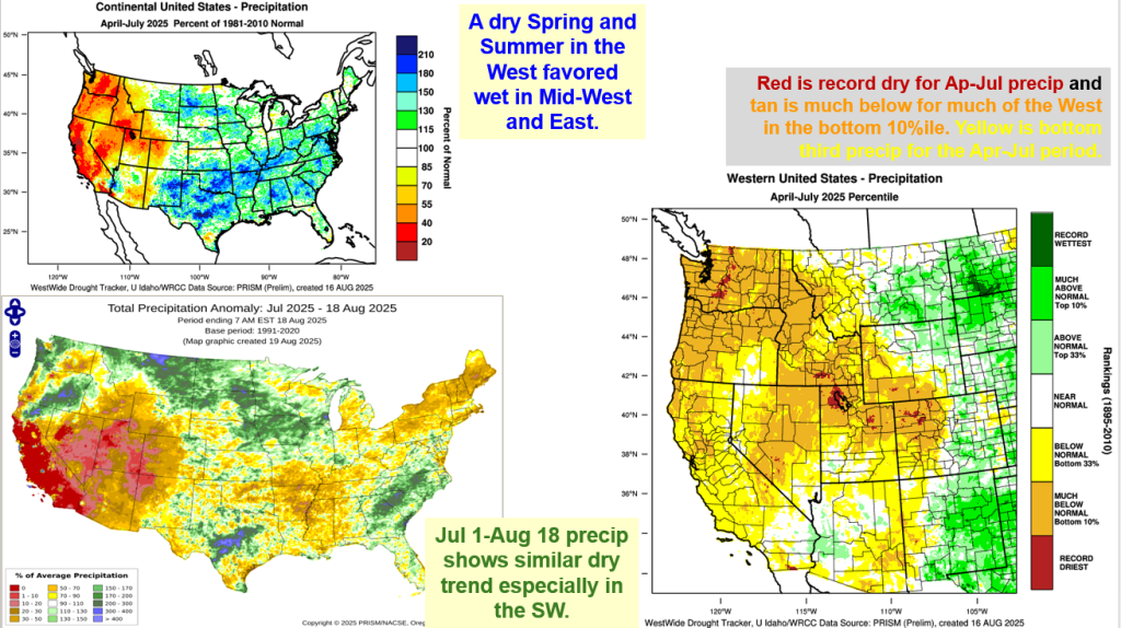
Here’s a summary of what happened to last year’s runoff because of near record dry spring. Summer is over and Fall precip is moving with a huge Atmospheric River tail that stretches over 1000 miles to SE Asia. Winter Outlooks for 2025-26 with analog years based on similar ocean conditions; we’ll watch and updated as we progress into winter. For now enjoy the wet weather as we start the new water by building our mountain snowpack.
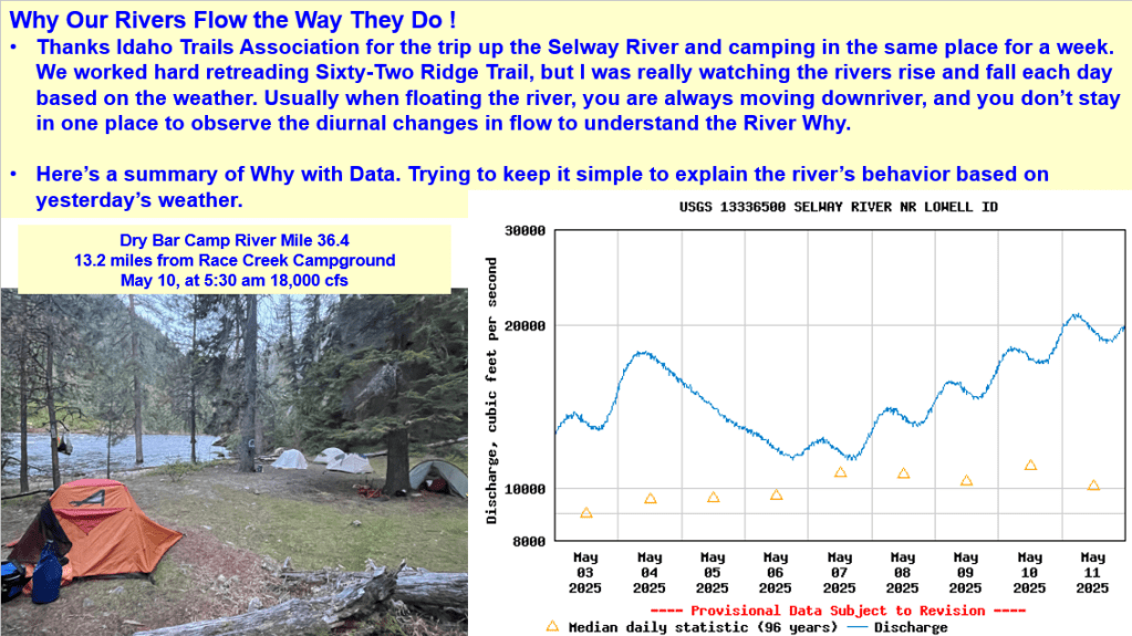
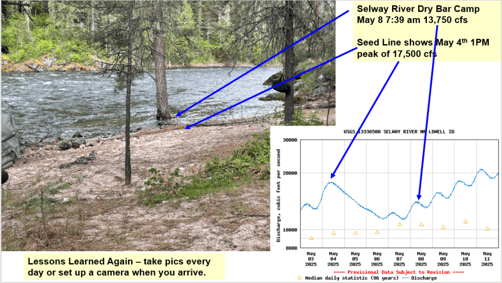
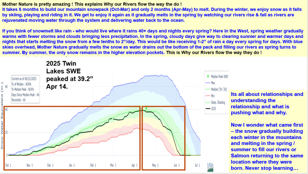
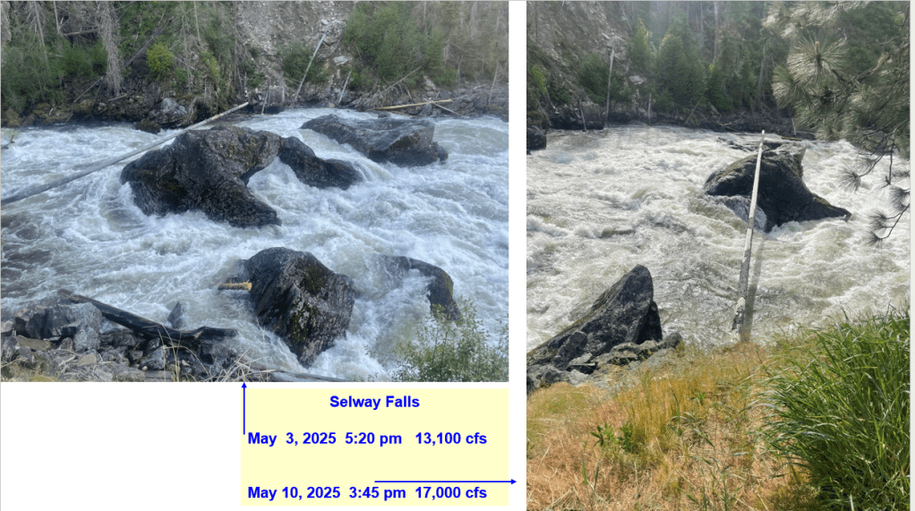
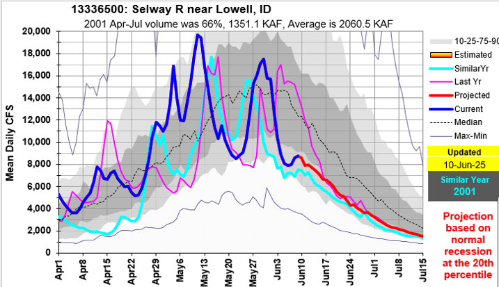
Thanks Idaho Trails Association and letting me camp, work and watch the Selway River rise and fall this May. Here’s a summary about the climatic conditions (daily/weekly weather, cold & warm fronts, record high day & non-freezing night temps, snowmelt rates, lack of spring precipitation) that produced this spring’s Selway River hydrograph shape. It’s a complex world out there. Hopefully this helps explain the diurnal river changes and why our rivers flow the way they do as our winter snowpack melts in the spring.
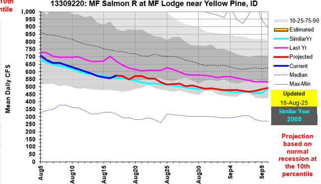
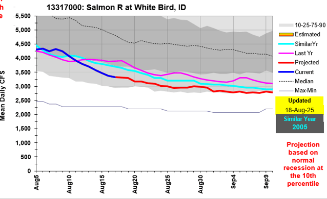
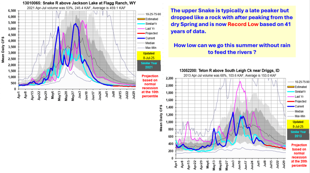
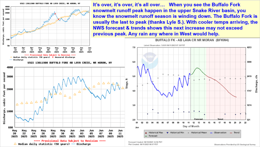
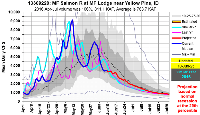
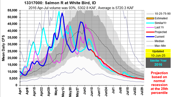
When you see the Buffalo Fork snowmelt runoff peak happen in the upper Snake River basin, you know the snowmelt runoff season is winding down. Here’s an update with similar recession years to help in monitoring this year’s flow. Projections are made for some rivers if a peak wasn’t happening.