Snowmelt peaks flows have passed but June rains can generate additional increases. Didn’t realize the Moyie River is flowing near record low and exactly the opposite of 2022.
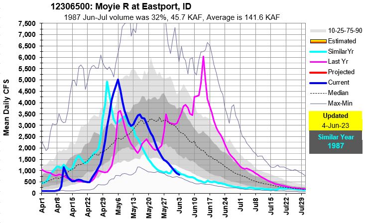
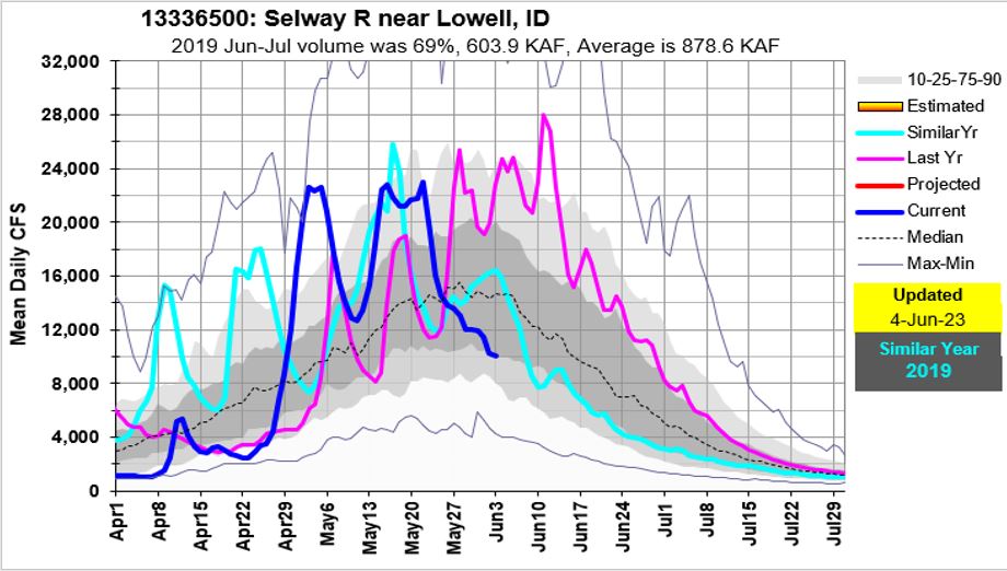
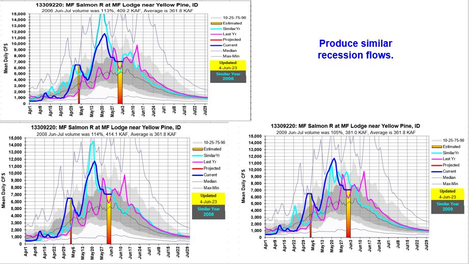
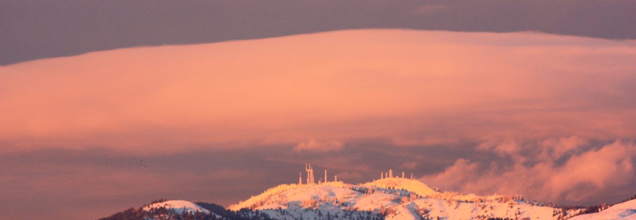
Snowmelt peaks flows have passed but June rains can generate additional increases. Didn’t realize the Moyie River is flowing near record low and exactly the opposite of 2022.
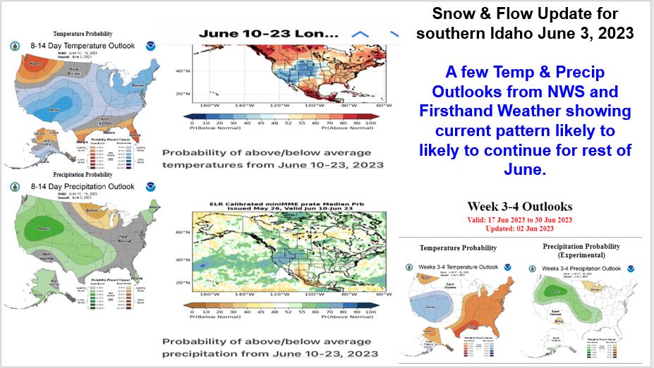
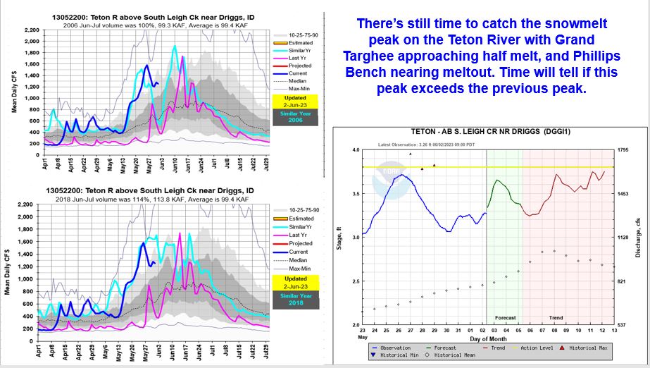
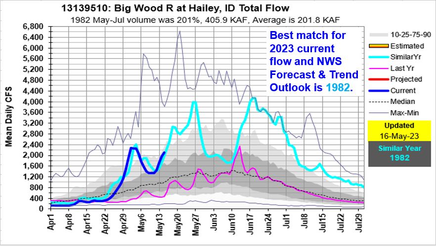
Snowmelt water is still feeding our rivers with enough from the higher elevation basins to generate another increase in the Big Lost River and Teton River. Weather outlooks are trending with more of the same weather for the rest of June – cool in southern Idaho / Nevada and warmer towards Seattle.
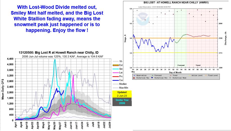
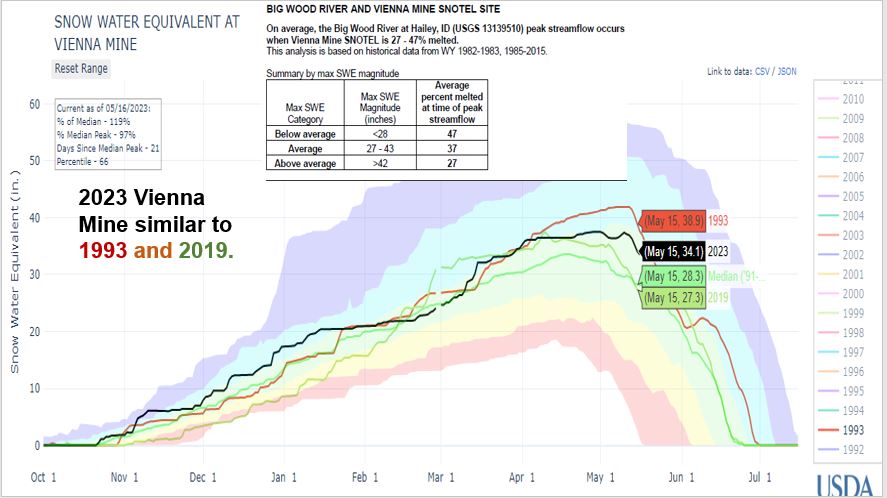
It’s almost time for a road trip to find the the Big Lost White Stallion ! Warming day time temps and above freezing nighttime temps will keep the snow melting 24 hours a day.

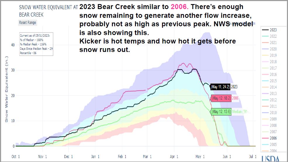
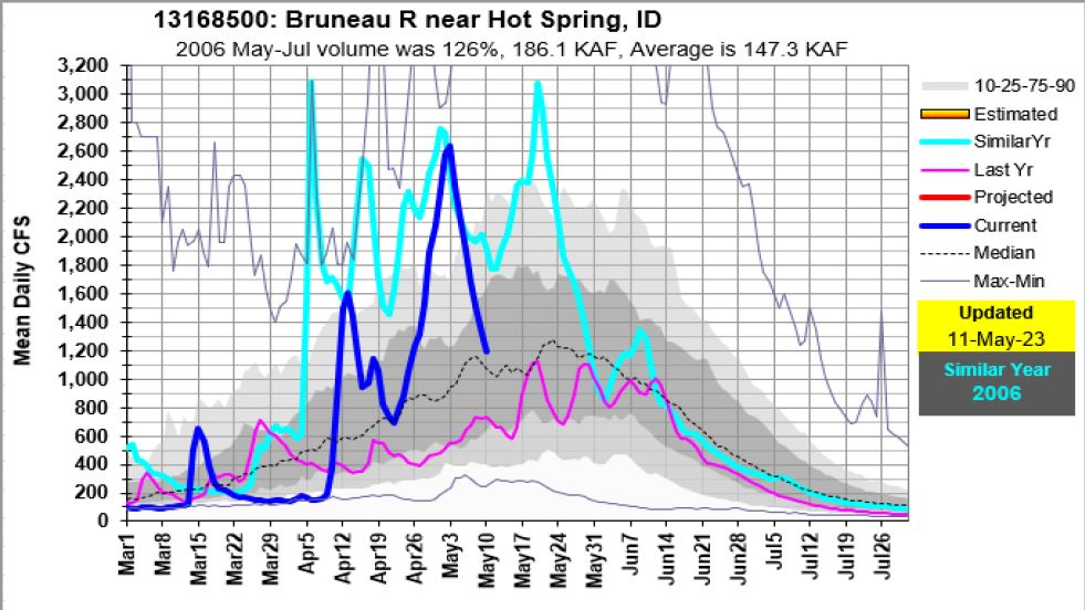
Here’s a short update, just dont tell Mike… The Bruneau is unique place, lets keep it that way. There’s enough snow to produce another increase, but the wild card are the extended period of hot temps. I didn’t look to see how much if any rain fell in May 2006 that added to flow increase.
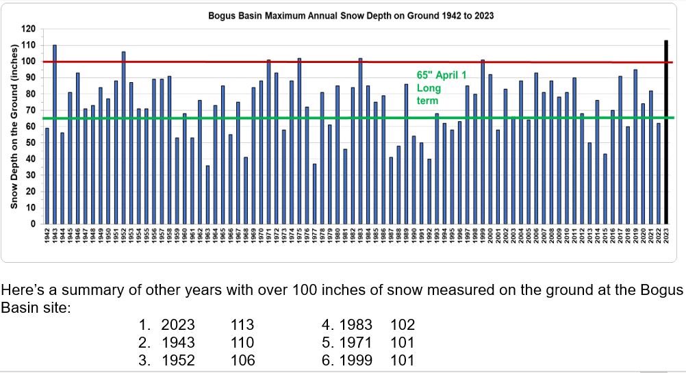
The winter of 2022 – 2023 will be a winter to remember. Here’s a summary of the history of the Bogus Basin snow sites that are used to compare this year’s snowfall to the historic data, and the 113 inches of record setting depth of snow measured on the ground March 30, 2023.
Update for Owyhee, Weiser, Camas, Salmon Falls, Bruneau, Boise & Big Wood
For complete Snow to Flow Relationships see:
Snow Melt / Peak Streamflow Relationships (PDF; 146 KB) – Report by Kara Ferguson (2017) summarizing the relationship between snowmelt and peak streamflow timing on rivers throughout Idaho.
From https://www.nrcs.usda.gov/wps/portal/wcc/home/quicklinks/states/idaho/watersupply/peak
And NWS peak flow products and forecasts:
Peak Flow and Stage Forecasts from NWS
Know your boating limits as rivers will be high for an extended period.


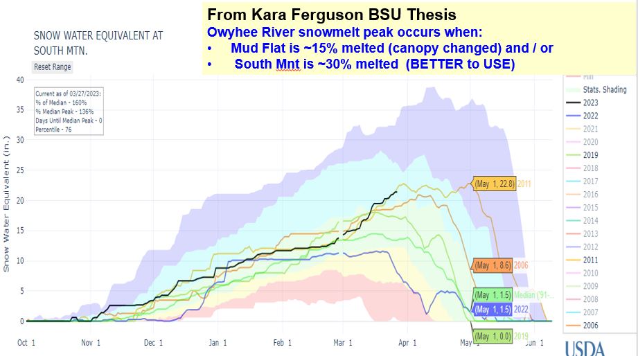
With plenty of snow to melt, we’ll see an extended period of higher water and the highest flows in a few years. The warmest days of the season will start melting more snow to feed the river. A projected weekend storm may limit how high the river rises or add to it with rain. When the peak occurs is still a function of how hot it gets and when, along with input from spring rains or not. We know there is a good snowpack, best in years, to sustain flows for a while based on past similar snow years. Be safe, know your limits and keep an eye that flow gage, the melting snow sites and future weather as the Owyhee flows in this high desert can change quickly.
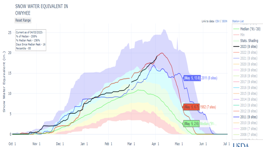
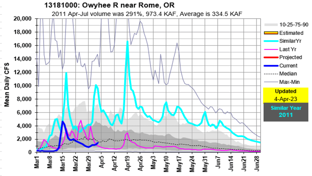
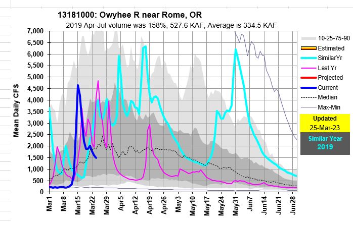
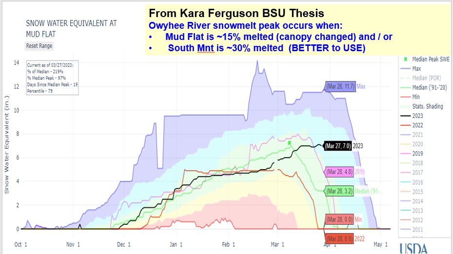
The Owyhee River at Rome increased to 4600 cfs (mean daily flow) on Mar 16 from melting of valley snow and rain for its first peak since last year. The higher elevation snow is still accumulating, even at Mud Flat SNOTEL site which is only 5730 feet in elevations. March precipitation thru March 27 was 144% of median with another storm to continue building the pack as cold will remain until at least early April. Then, get ready as the cold temps will not last for ever…
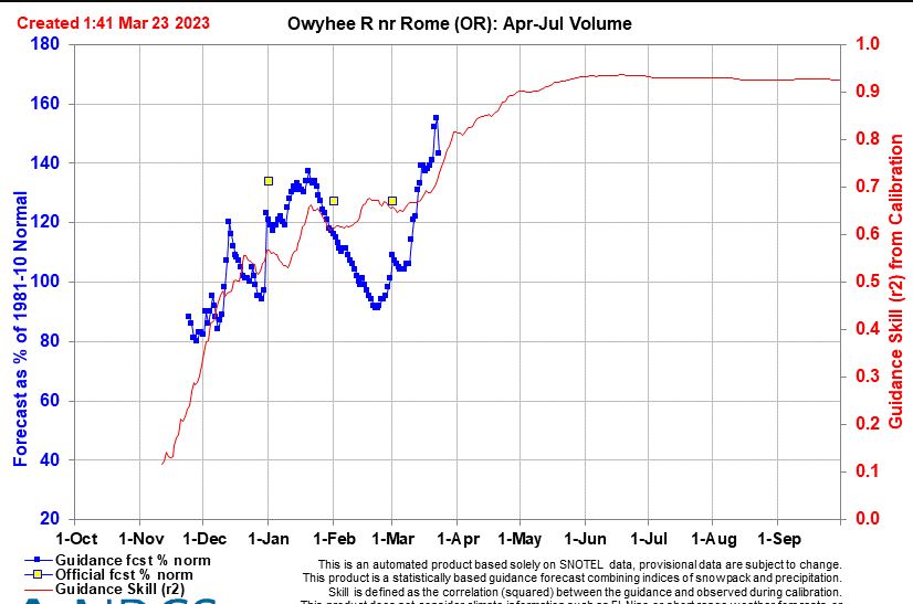
With an April-July runoff volume of 150% of median predicted, means we could see volumes similar to the first half of the 2019. The 2nd peak on May 31, 2019 depends if the wet /cool spring weather continues into late spring / early summer.
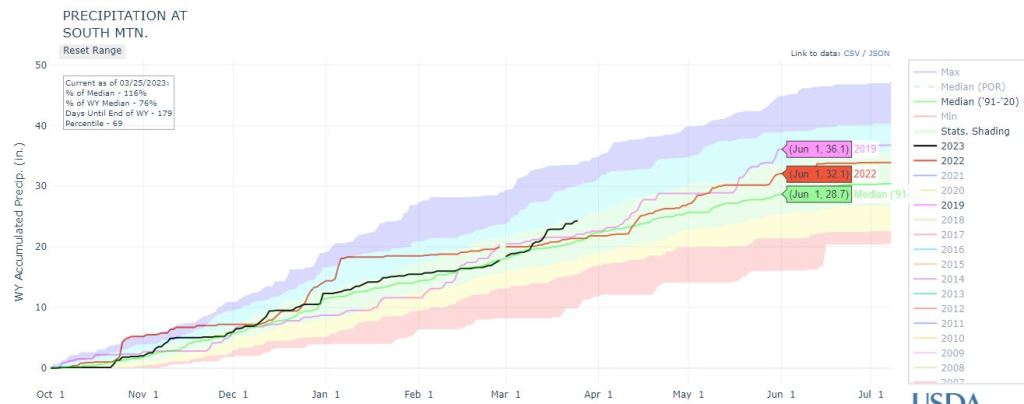
No signs of an early spring in sight yet… so don’t put those skis away.
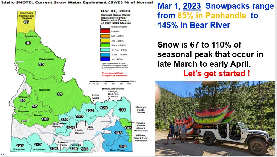
Here’s an update given at the Idaho Whitewater Association March 1 meeting. We start where we left off last March because 2022 set the stage for this 3rd consecutive La Nina winter. Included is current snowpack and similar (ocean condition analog) years for this winter. Most analog years had a delayed melt like 2022. Keep your eye on the sky as we watch to see what March brings and when warmer temperatures arrive. For now, cold is good to keep the snow in place and allow the mountainous snowpack to keep accumulating.

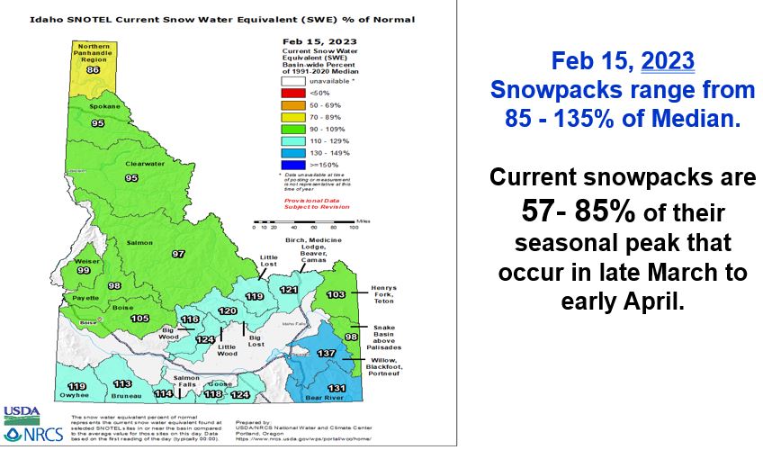
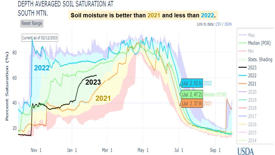
Here’s an update given Feb 16 at the Idaho Hay & Forage Conference. Includes a summary of last year and 2009 analog year followed by current snow, water supply, soil moisture and weather outlooks for these basins across southern Idaho – Owyhee, Weiser, Payette, Boise, Big Wood, Big Lost, Snake, Salmon Falls Creek & Goose Creek.