Low snow means low flows in these basins. Hopefully more weather moves in during the month of May


Low snow means low flows in these basins. Hopefully more weather moves in during the month of May
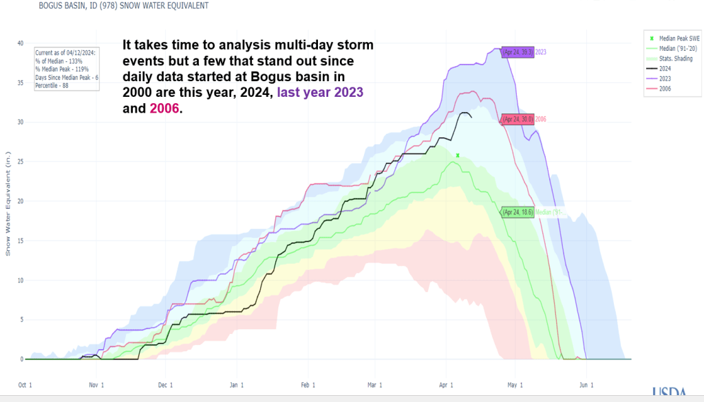
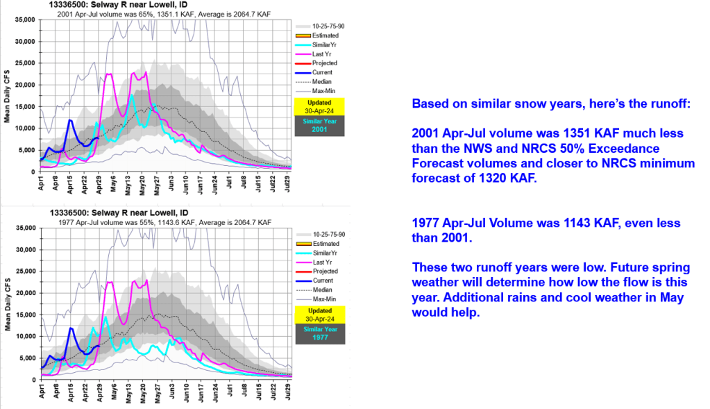
Here’s an update looking at remaining snow, snowmelt, volume forecasts and similar runoff years. We’ll see a decrease in melt and flows with cooler front moving in, but melt and flows are projected to rebound later this week with return to high pressure, that will hopefully move on sooner than later…

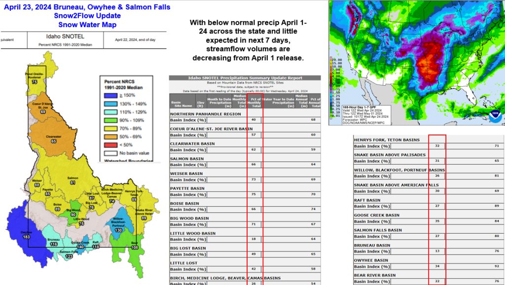
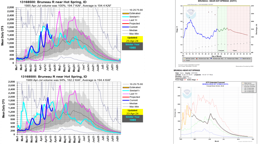
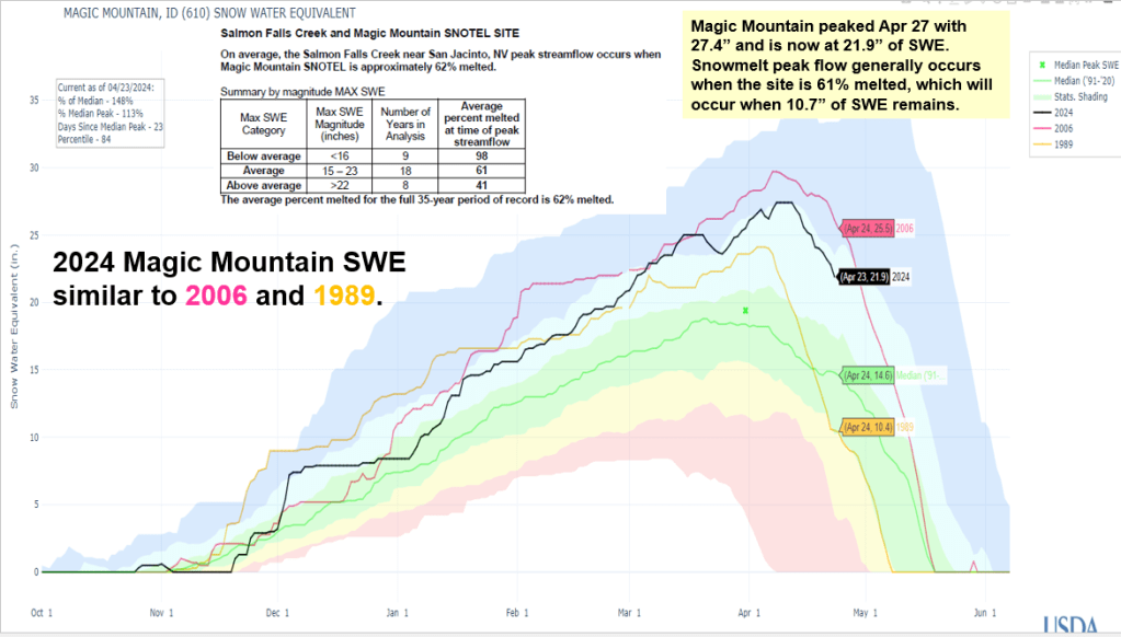
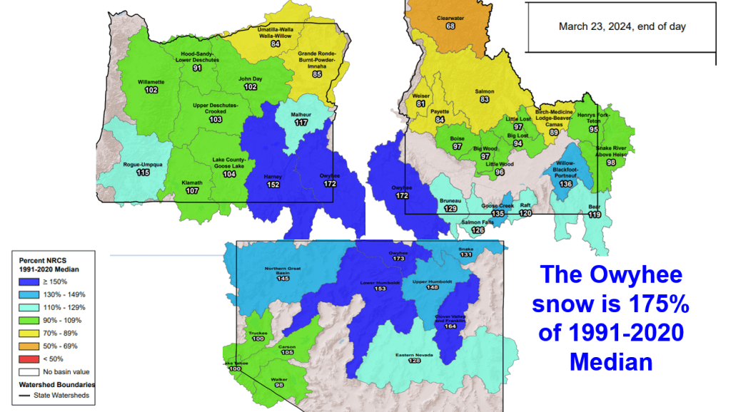
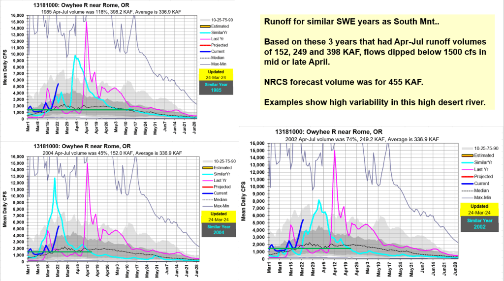
With below normal precipitation April 1-24 across the state and little expected in next 7 days, streamflow volumes are decreasing from April 1 release. The Owyhee River has peaked from snowmelt and remaining snow will help sustain flows. Remaining snow in Bruneau and Salmon Falls basins will produce another another flow increase. Future snowmelt rates and weather will determine if next flow increase exceeds the previous peaks already seen.

Here’s an update for the Owyhee based on current snow, flow projections and more weather moving in this week and next. It’s nice to look at big picture to see what’s happening around this tri-state basin.

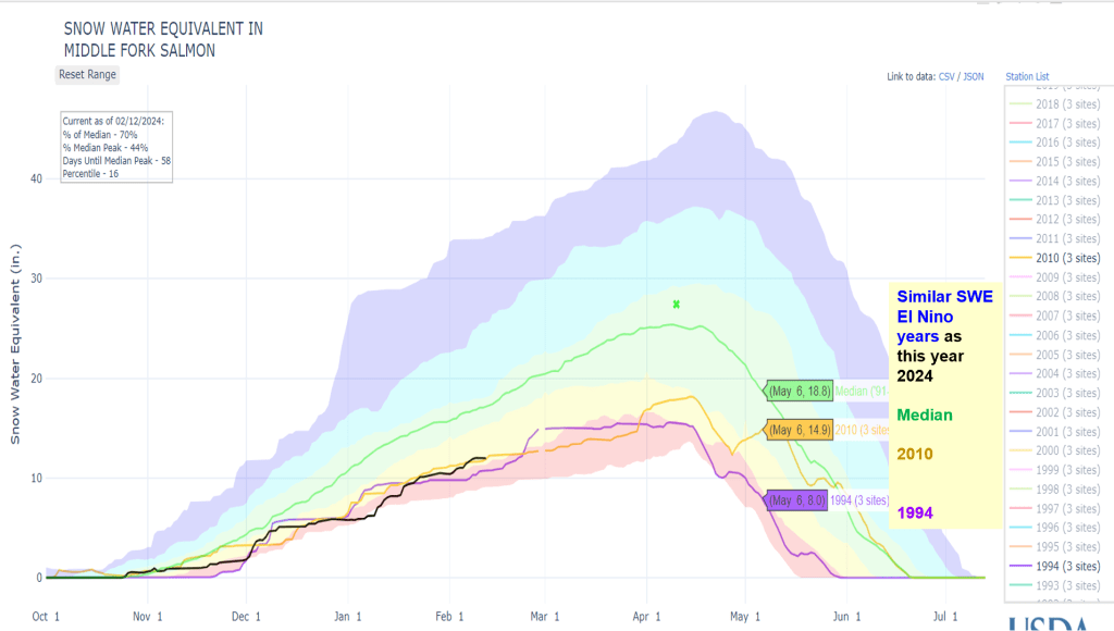
Snow & Flow Summary for many of Idaho’s whitewater rivers. Current snow, water supply forecasts, analog snow years, and runoff examples for these years. Example runoff years used, illustrate a early to normal snow melt and a late melt that had a wet spring (2010). Also included, is bonus sneak peak at next winter, the year after a strong El Nino year like this year. Here’s an updated March weather slide from Cliff Mass Blog that shows high pressure is likely to move into the West March 13-20. This may start the lower elevation rivers to flow depending on air temperature levels.

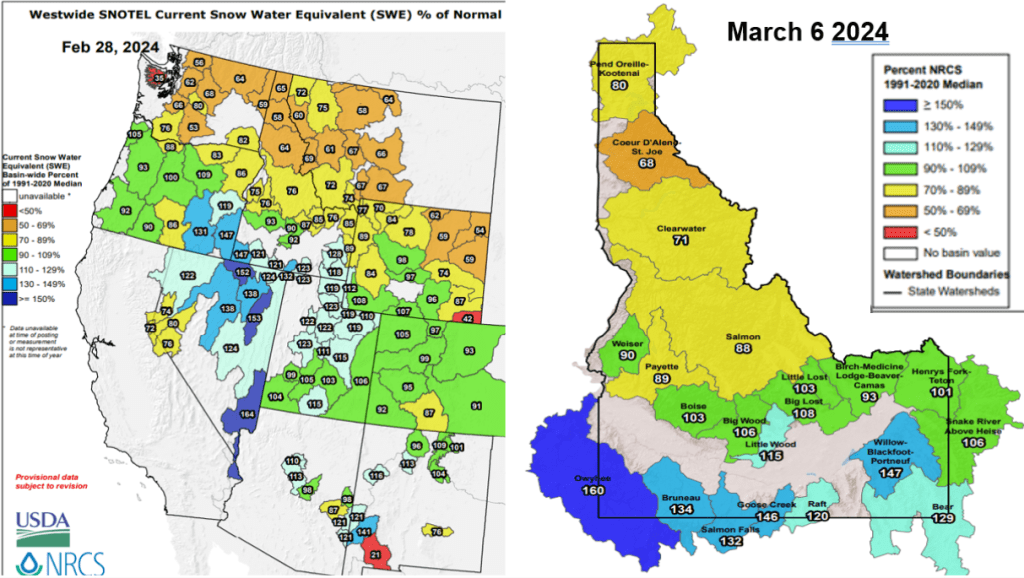

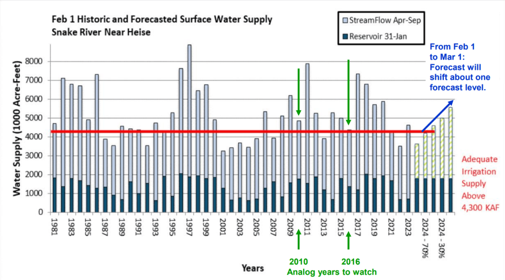
Current snow & water supply summary across the state with more details for Upper Snake, Boise and Payette basins.
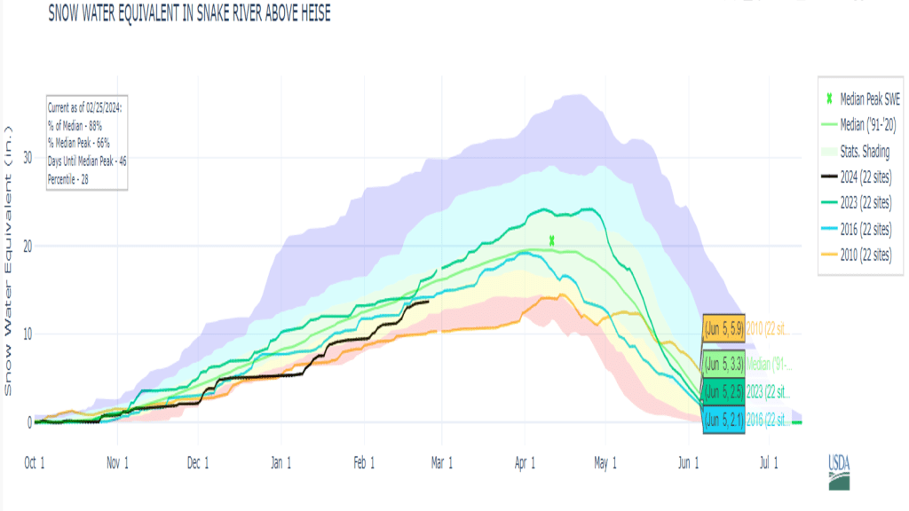
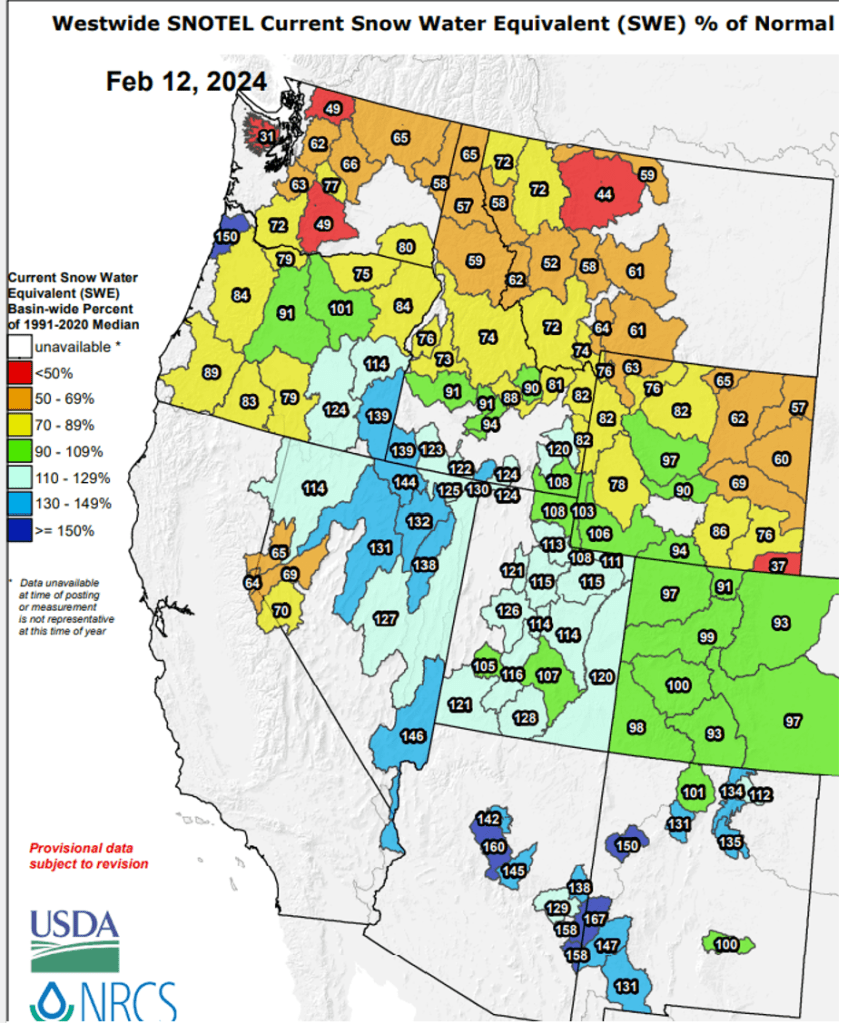
Why they send river rejection emails out on Valentine’s Day, I’ll never know but got my rejectionS. For those wondering about the snow, here’s an update that show snow changes from Jan to Feb, chance for the pack to recover and SWE graphs of analog snow years for the lucky ones that won !
Early Bird Forecasts or are they called Outlooks – either way, you got to know when to hold them, know when to believe them, know when to walk away and know which areas are favored for more snow and why. There are lots of late summer/early fall Winter Outlooks being shared and passed around. Recently, it seems there is a race to see who releases the first Outlook. Here’s a summary about what I’ve been watching for a while. See if it helps or share what you watch and works for you. Don’t believe the first forecast you hear or until you hear the same forecast from 2 or 3 unrelated friends.
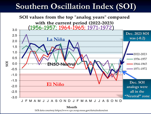
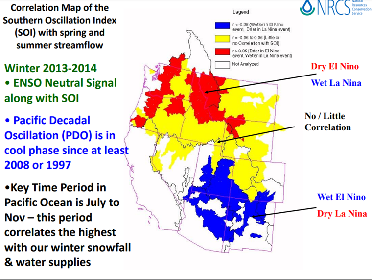
Read on for more info about SOI correlation with western rivers and how analog years are identified and used to help with predicting / monitoring this winter.
Analog years used for this winter (water years):
1956-57 is water year 1958
1964-65 is water year 1966
1971-72 is water year 1973
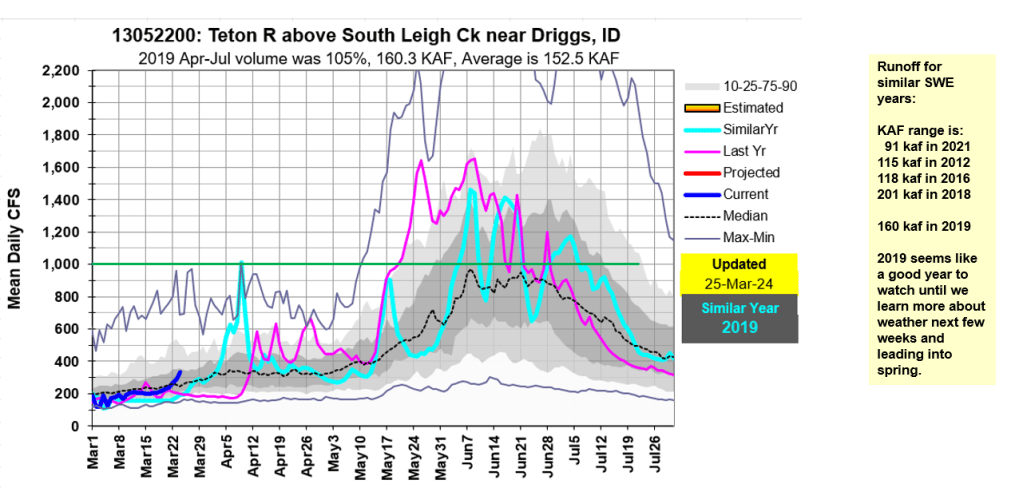
Another analysis shows this year’s El Nino initially was tracking 2009-10 El Nino winter. Next post: SWE plots of analog years and 2010 to how snow is tracking or not.