Snow2Flow Update for: MF & Main Salmon Rivers – Selway & Lochsa Rivers and a few more: Owyhee, Camas Creek and Salmon Falls Creek
Snow is melting, rivers are rising, enjoy and be safe. Know your limits.
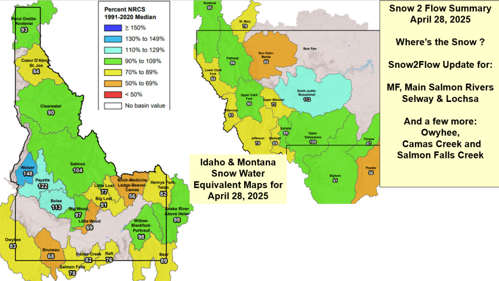

Snow2Flow Update for: MF & Main Salmon Rivers – Selway & Lochsa Rivers and a few more: Owyhee, Camas Creek and Salmon Falls Creek
Snow is melting, rivers are rising, enjoy and be safe. Know your limits.
Wow – what just hit us? Here’s a summary of the key indicators I was watching leading up to this storm. Never stop learning and watching the weather to better understand what’s happening here, around us and why.
The PNA started hinting at weather system brewing back on Mar 13 with sharp decrease and biggest drop since last Nov storm. A Buoy Pop was also marked on my calendar from around same time. Always nice to see in agreement of indicators two weeks out.
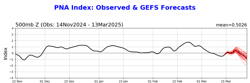
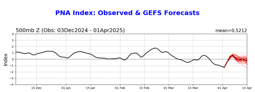
Here’s current PNA which shows the Apr 1 drop, then going positive which means return to high pressure in early April.
Severe Weather Europe from Mar 31 provides a good explanation, just need to read between the Ads. They summarize the springtime battle between winter and summer patterns fighting for the lead. This probably led to the isolated weather pattern and intense storm with 10” falling at Brundage and a couple at Bogus Monday morning followed 24 hours later with 10” at Bogus while Tamarack & Brundage received a little Tuesday morning. OpenSnow forecast weather radar nailed storm hitting Bogus early Tuesday morning and not pushing north. I should have been watching the radar loop for Brundage storm. https://www.severe-weather.eu/global-weather/april-2025-forecast-stratospheric-polar-vortex-impact-cold-air-united-states-canada-fa/
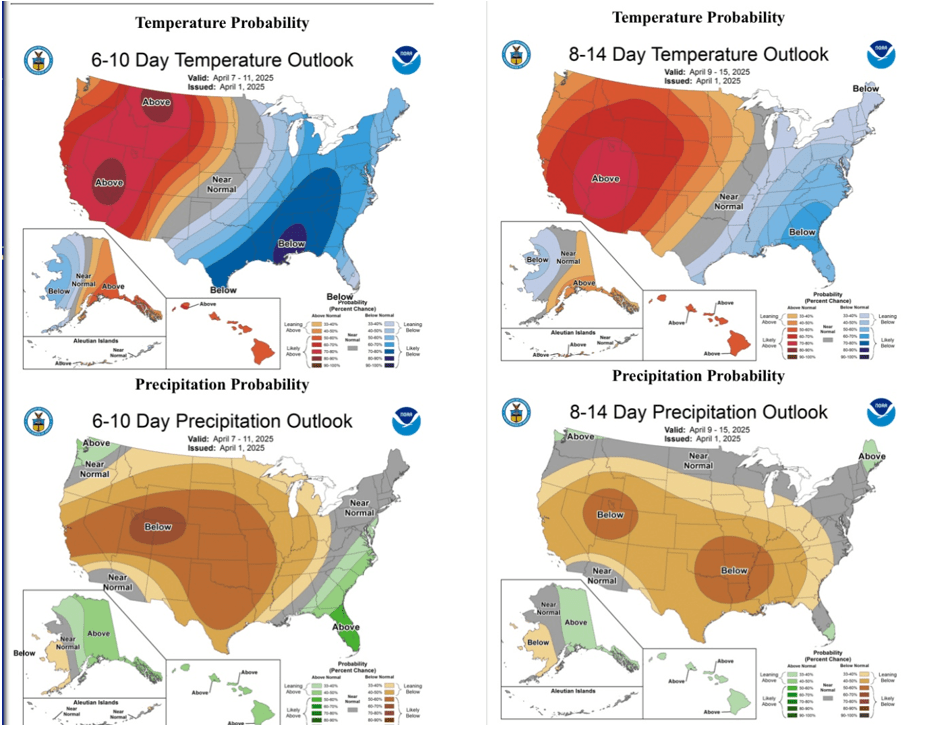
Severe Weather also provides a good summary of early April weather and why we’re gonna be warm & dry in the West and the East needs to prepare for colder and wet. Many other models are picking up intensity of this event now. Stay safe.

Spring skiing returns this weekend to Idaho’s southern resorts with freezing night temps and warm day temps. Enjoy while the nights are still freezing in the mountains.
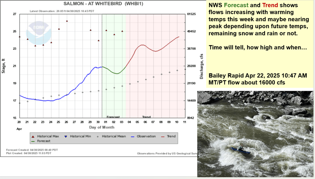
This also means the rivers will rebound with the warmer temps. Be safe out there – a friend is on a solo trip down the Main Salmon this week.

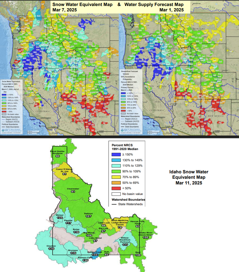
Idaho Museum of Mining & Geology talk from March 9 about 1. Current Ocean and Atmosphere Teleconnections, 2. Conditions Leading to this Year, 3. 2024 Extreme Weather & Natural Disasters, 4. Current Stream, Snow and Water Supply Forecasts with Highlights for the Payette, Boise and Owyhee Basins, and Weather Outlooks.


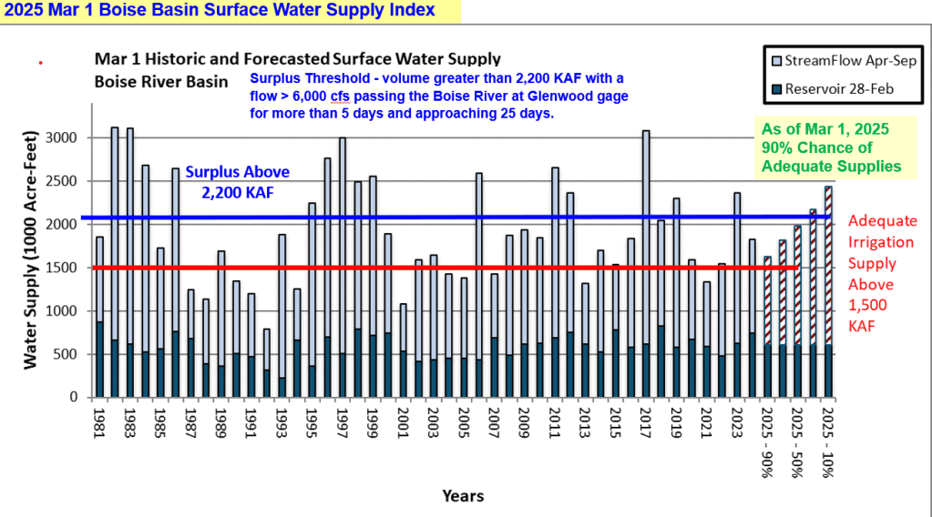
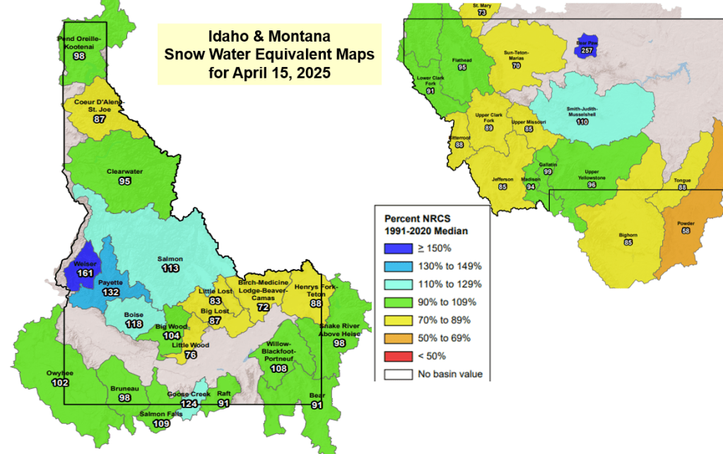
Here’s a talk given to Idaho Alfalfa & Clover Seed Growers about current conditions, analog years, acres burned, a few slides about 2024 extreme weather and disasters, and the snow & flow outlooks for the Weiser, Payette, Boise and Owyhee basins. With high, dry and cold weather here for a bit, we’re gonna loose about 1% a day, but the snow won’t be melting. Cold is good! We’ve seen winter dry spells in other years and lucky for us, SW Idaho got off to a great start this winter. Let the 2nd half of winter start – any day now…


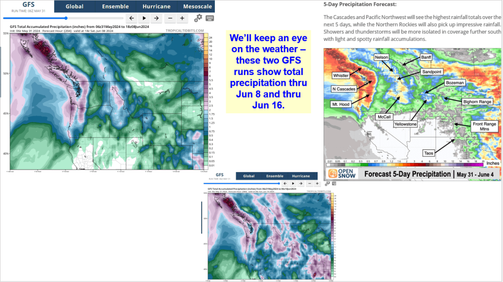
Update for Selway Lochsa Moyie Owyhee Bruneau Wood Lost and more Idaho rivers. Keep your eye on the weather as one more AR moves in next week.


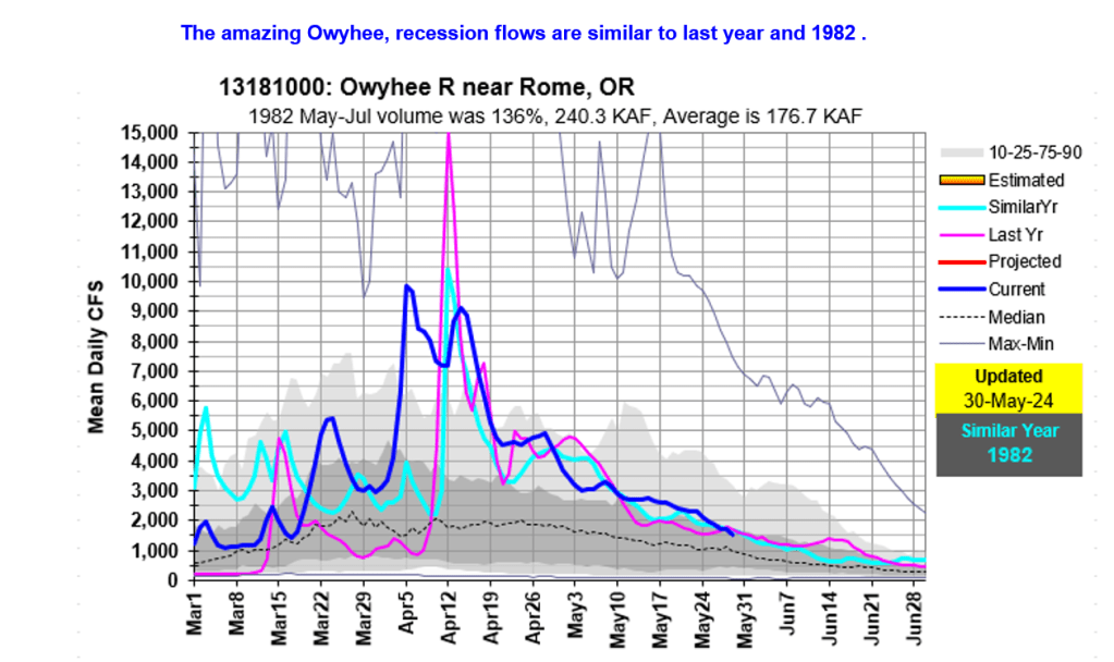
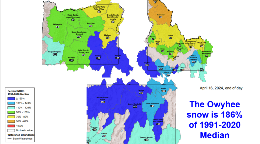
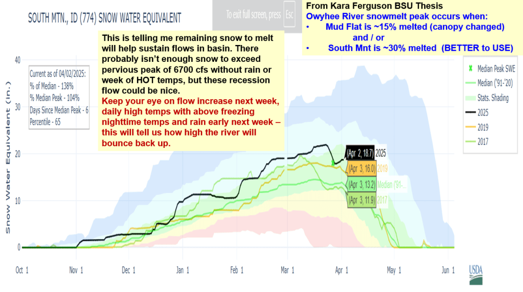
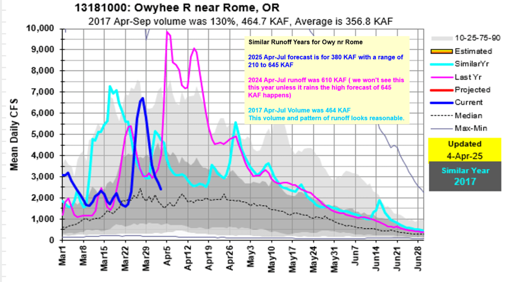
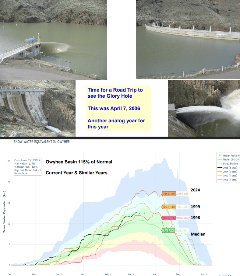
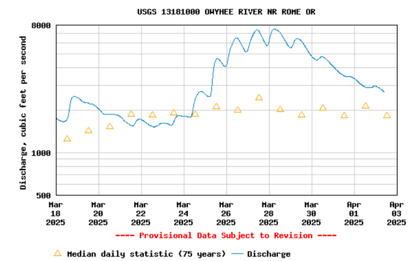
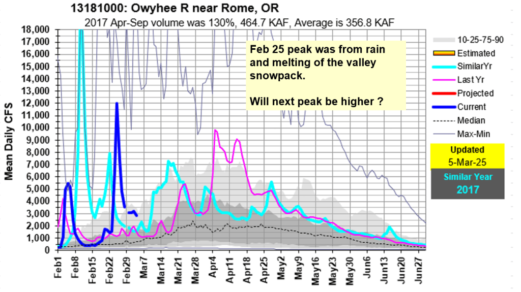
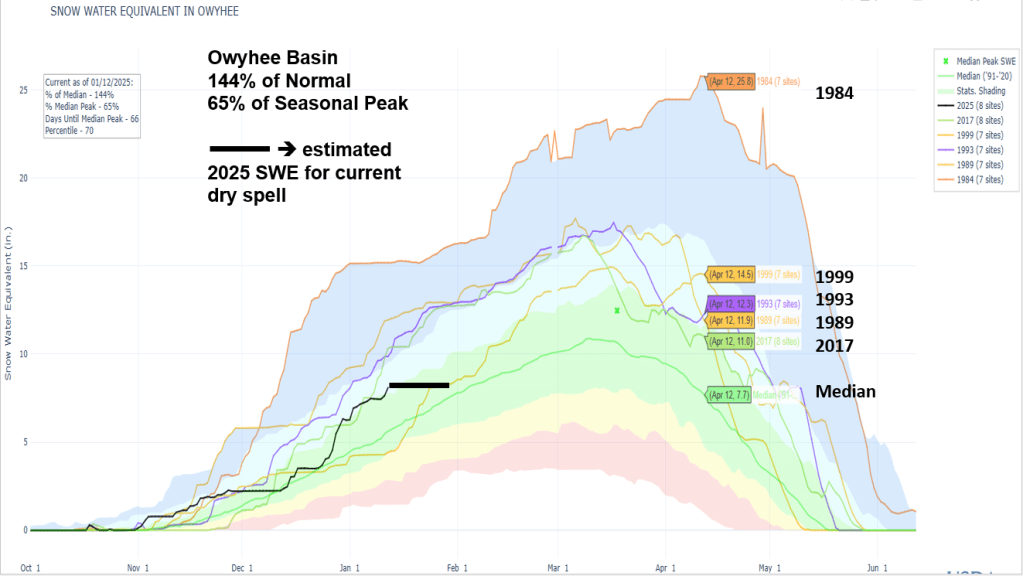
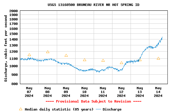
The Bruneau is rising again along with Salmon Falls Creek. The Owyhee had a long and amazing season and is holding steady from the remaining snow melting in the basin.
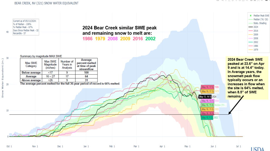

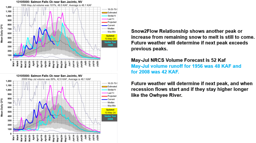
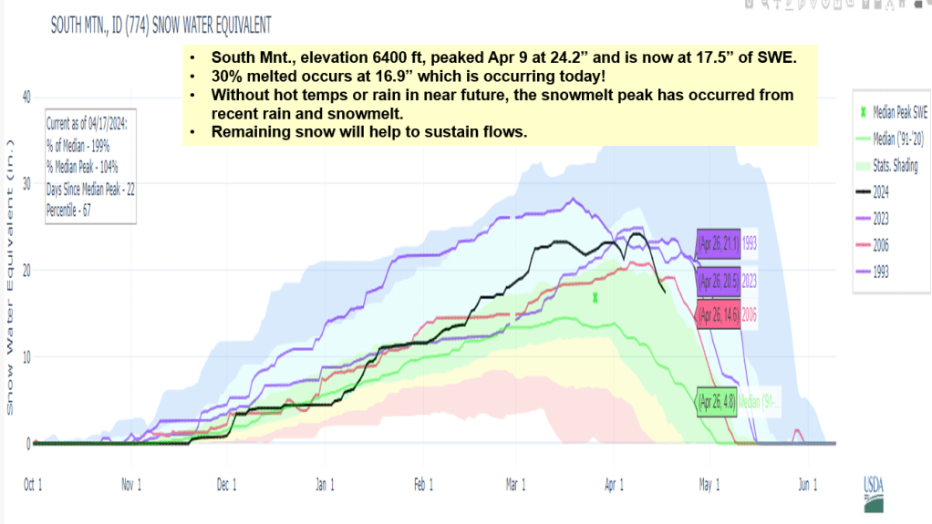
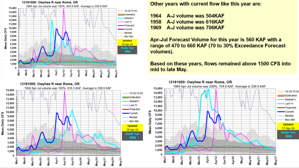
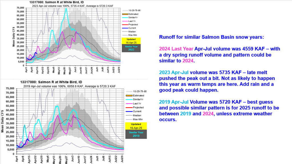
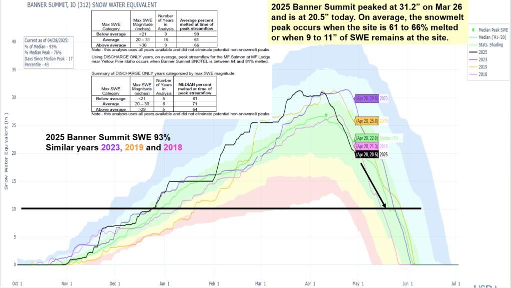
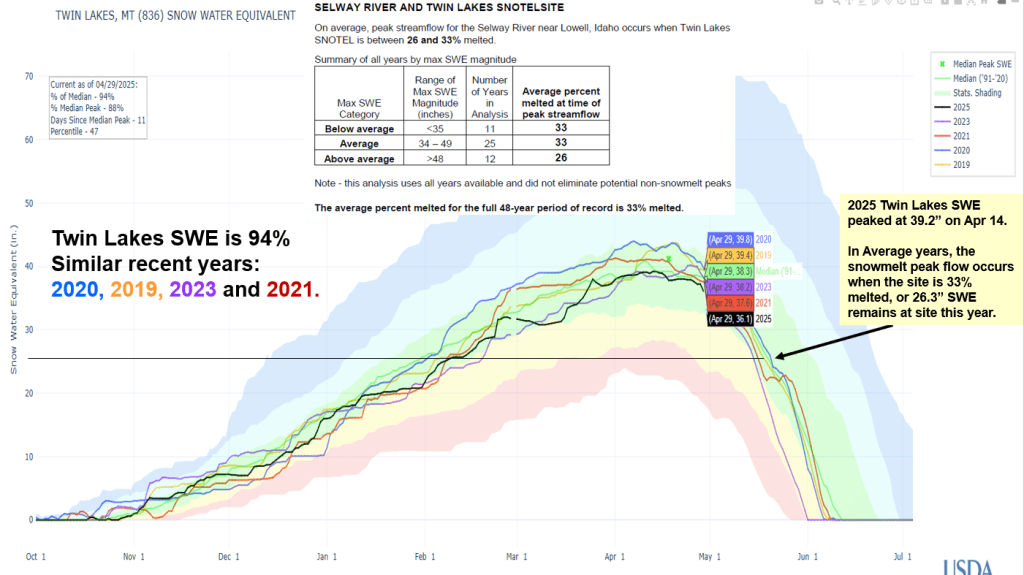
Remaining snow will help to sustain flows… how long – here are a few similar runoff volumes and recession years. With little weather on the horizon, current snow melt from warm days and freezing nights is ideal.