Current snow & water supply summary across the state with more details for Upper Snake, Boise and Payette basins.
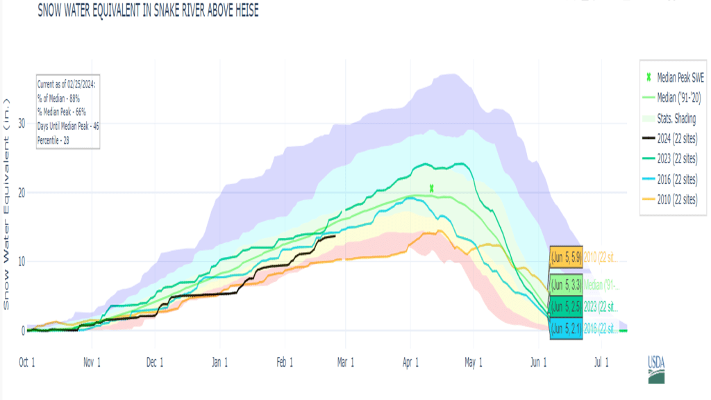
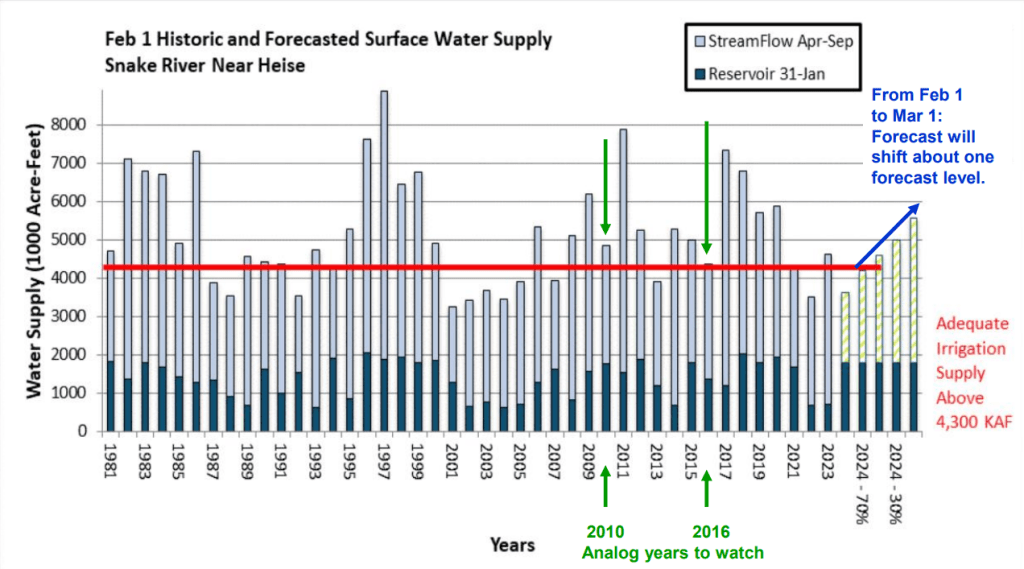

Current snow & water supply summary across the state with more details for Upper Snake, Boise and Payette basins.
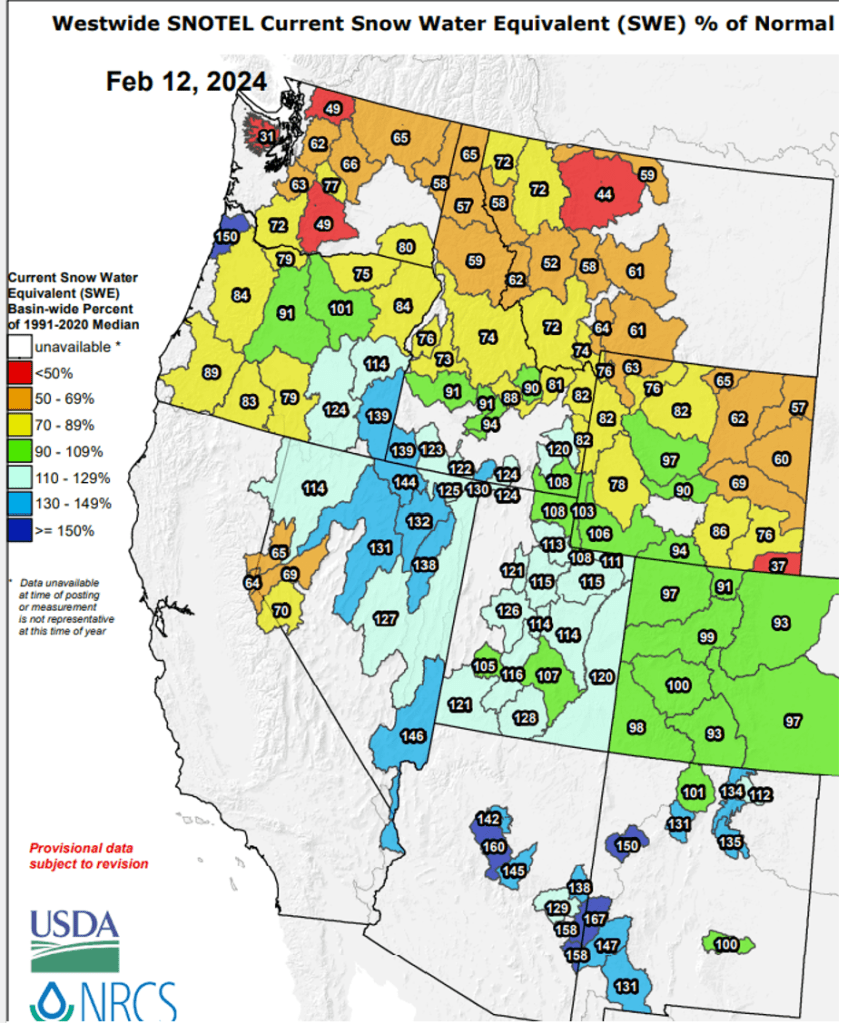
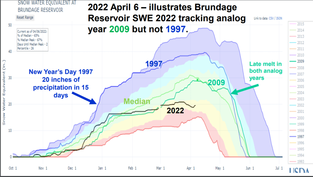
Why they send river rejection emails out on Valentine’s Day, I’ll never know but got my rejectionS. For those wondering about the snow, here’s an update that show snow changes from Jan to Feb, chance for the pack to recover and SWE graphs of analog snow years for the lucky ones that won !
Early Bird Forecasts or are they called Outlooks – either way, you got to know when to hold them, know when to believe them, know when to walk away and know which areas are favored for more snow and why. There are lots of late summer/early fall Winter Outlooks being shared and passed around. Recently, it seems there is a race to see who releases the first Outlook. Here’s a summary about what I’ve been watching for a while. See if it helps or share what you watch and works for you. Don’t believe the first forecast you hear or until you hear the same forecast from 2 or 3 unrelated friends.
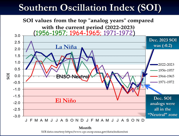
Read on for more info about SOI correlation with western rivers and how analog years are identified and used to help with predicting / monitoring this winter.
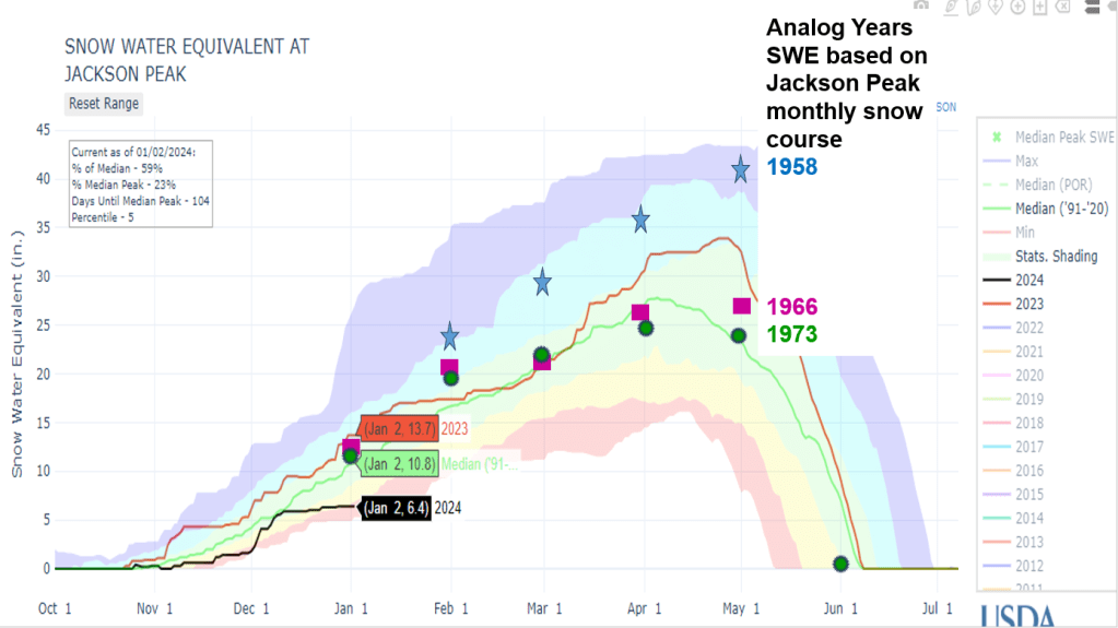
Analog years used for this winter (water years):
1956-57 is water year 1958
1964-65 is water year 1966
1971-72 is water year 1973
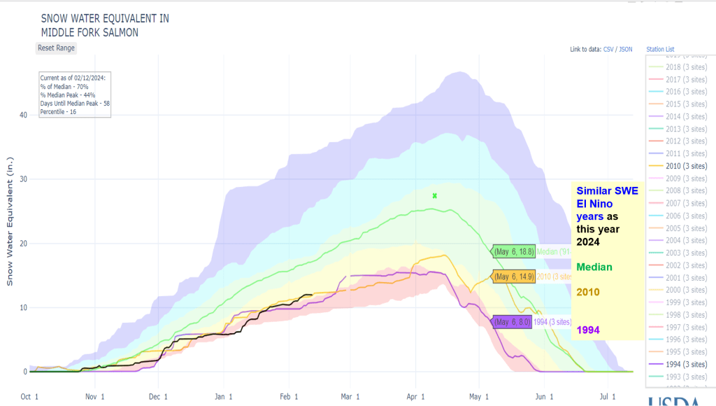
Another analysis shows this year’s El Nino initially was tracking 2009-10 El Nino winter. Next post: SWE plots of analog years and 2010 to how snow is tracking or not.
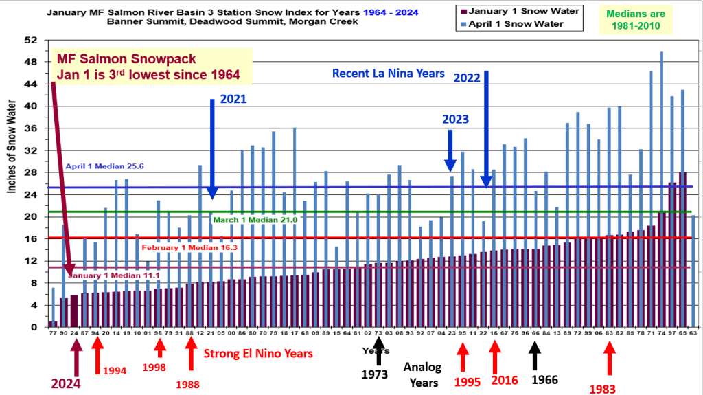
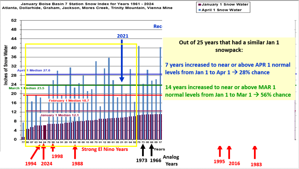
Following are long & short term snow analysis that illustrate the Jan 1 snowpack and how it ended up on Apr 1. Short answer – need more storms!


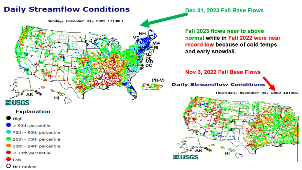
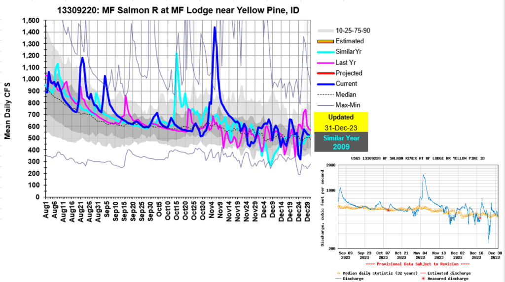
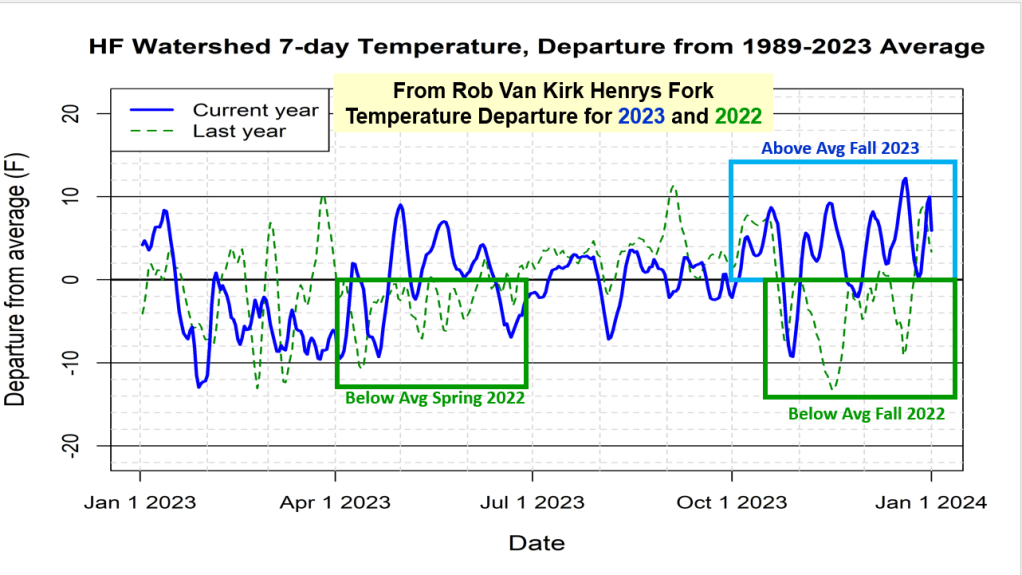
Here’s a summary of the interesting above normal streamflow we are seeing across southern half of the state. This was also observed and mentioned by others hiking, hunting and playing in the mountains this Fall. First I noticed the above average river flow levels and many rivers not freezing. So I had to dig deeper to figure out why and what happened as our Fall was fairly dry with temperatures on the warm and even record high side. Enjoy as we keep dreaming and learning about our rivers. Any other thoughts, let me know.

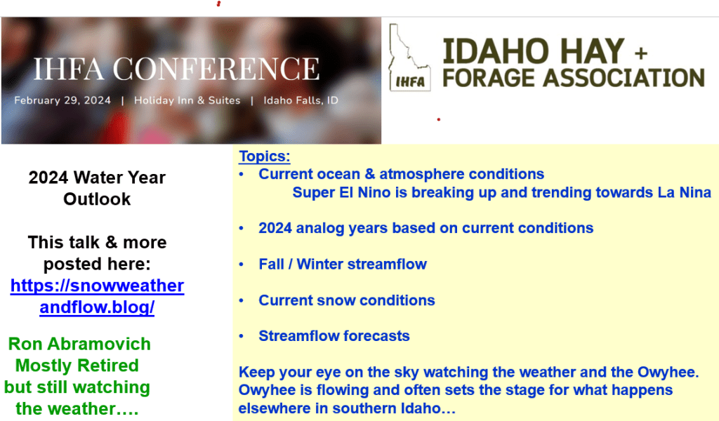
Here’s an update of fall streamflow & soil moisture conditions leading into winter, other strong El Nino years, 2024 Analog Years, chance for Owyhee & Boise basins snow to recover to normal by April 1, and a few streamflow forecasts. More posts and snow will be dropping…
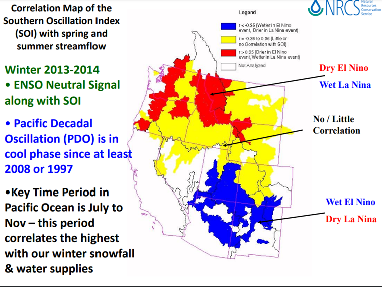
Keep in mind, Pete’s analog years are based on current Pacific Ocean and atmosphere conditions to generate awareness of current conditions and precipitation and temperatures outlooks based on
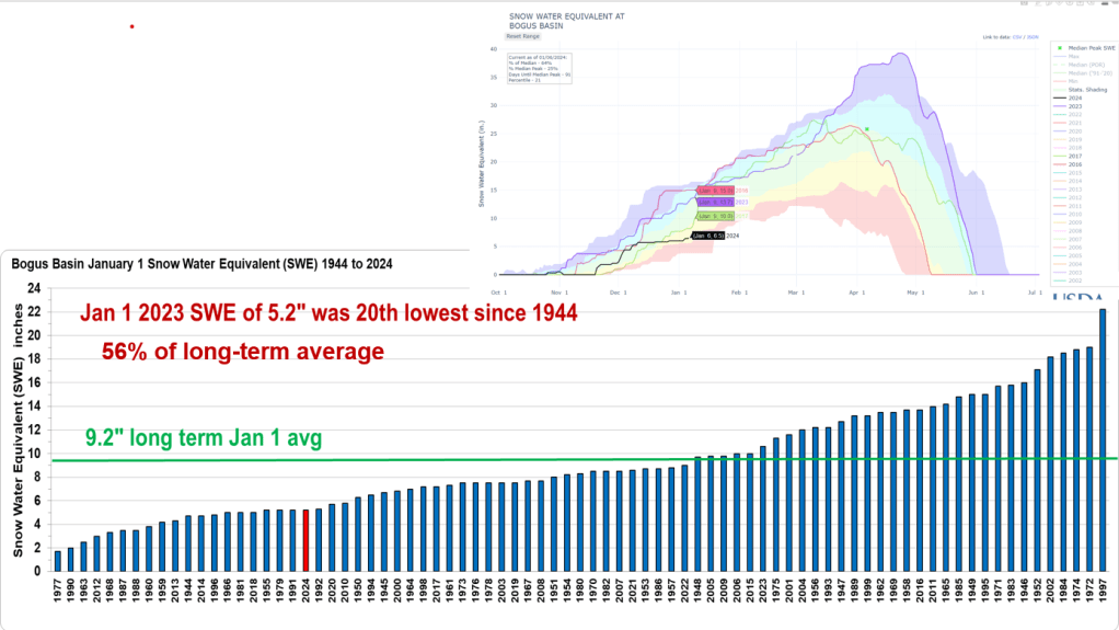
analog years. They were never intended to zoom down to a basin level or individual station, but let’s have some fun, give it a try to see how they worked to give us a heads up about the winter snowpack for Twin Lakes SNOTEL, Boise Basin and Bogus Basin SNOTEL.
Recession flows are in full swing which makes it easy to see where they’re coming from and going. Flows range from near record low in northern Idaho, below average in the Salmon, to above average in central and southern Idaho. Even the Owyhee is flowing above average. Enjoy the flow where you can and we’ll see what El Nino brings next winter…
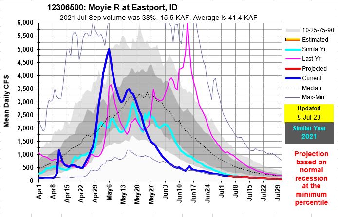
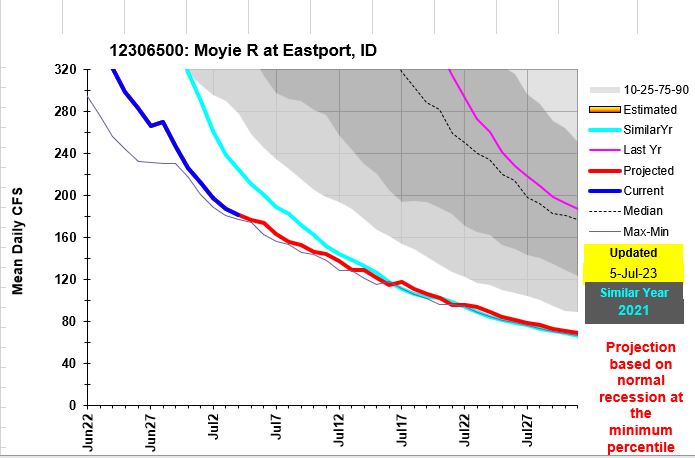
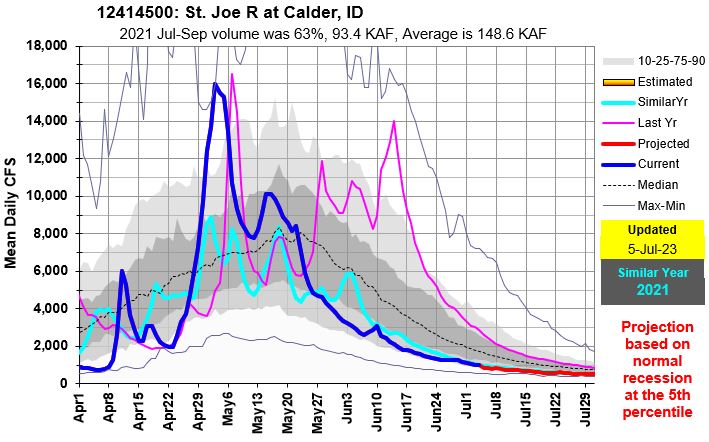
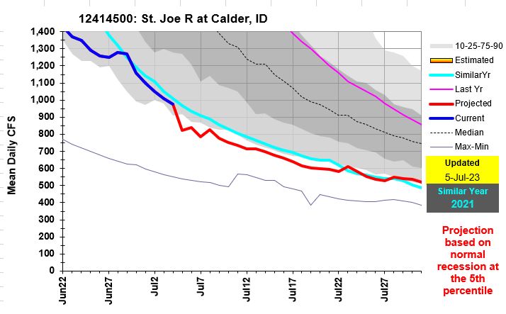
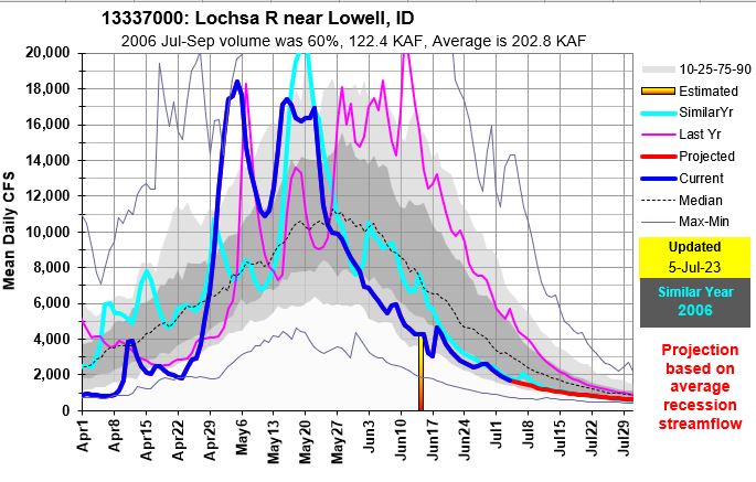

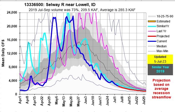
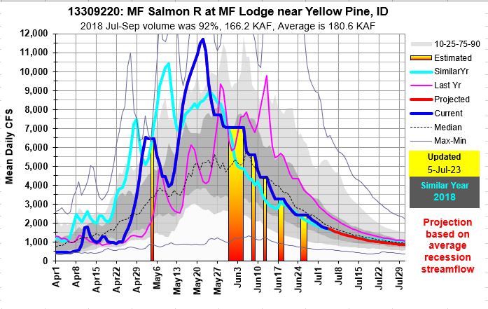
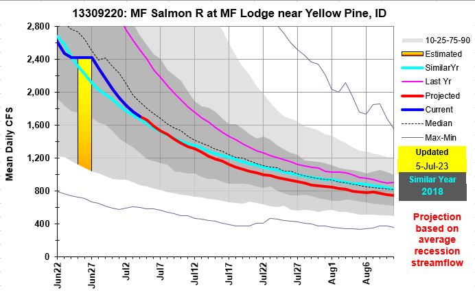
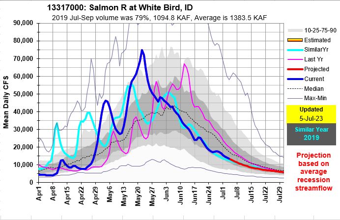
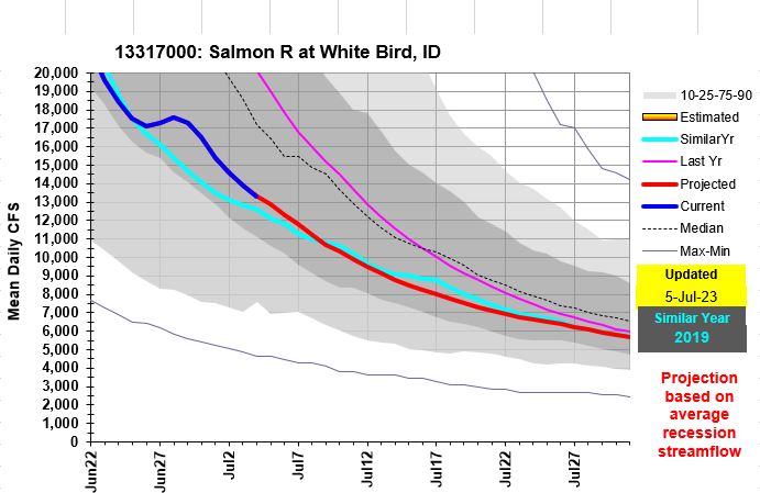

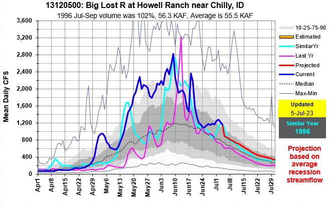
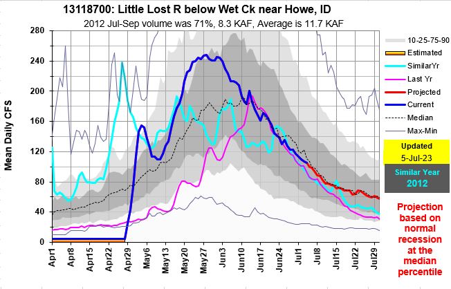
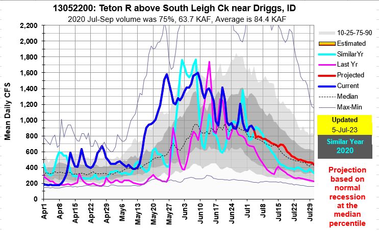
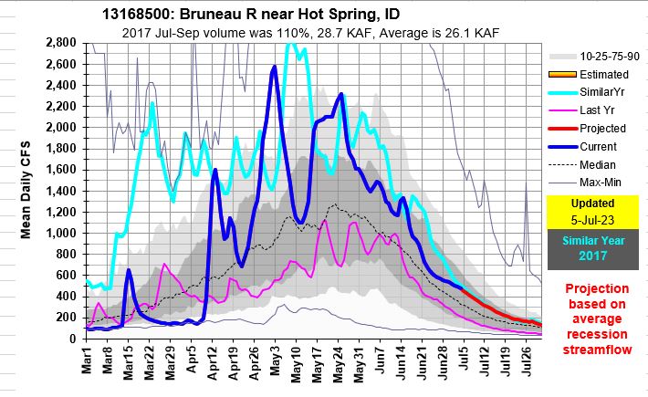

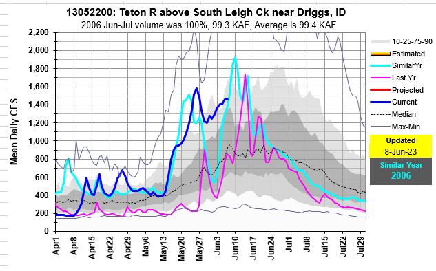
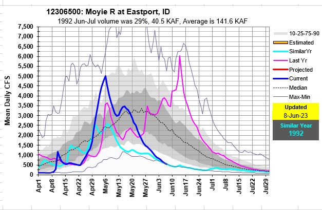
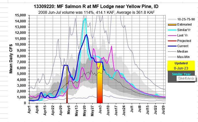
The Teton River is just reaching its snowmelt peak while the Moyie River is flowing near record low. The Owyhee River is just now reaching the tail end of recession flows. Central Idaho’s rivers are receding from their snow driven peaks. May brought warm temps with above freezing nighttime that resulted in 24/7 meting and probably record high SWE loses during the month of May because there was plenty of snow to melt. June’s cooler and wetter weather will help push recession flows out a bit before the normal low flow summer levels arrive. Owyhee and Bruneau recession flows months are a good example of these extended flows. Enjoy the river, know your limits and keep your eye on the weather and those river flow levels.

Update for Owyhee, Weiser, Camas, Salmon Falls, Bruneau, Boise & Big Wood
For complete Snow to Flow Relationships see:
Snow Melt / Peak Streamflow Relationships (PDF; 146 KB) – Report by Kara Ferguson (2017) summarizing the relationship between snowmelt and peak streamflow timing on rivers throughout Idaho.
From https://www.nrcs.usda.gov/wps/portal/wcc/home/quicklinks/states/idaho/watersupply/peak
And NWS peak flow products and forecasts:
Peak Flow and Stage Forecasts from NWS
Know your boating limits as rivers will be high for an extended period.


