Following are long & short term snow analysis that illustrate the Jan 1 snowpack and how it ended up on Apr 1. Short answer – need more storms!
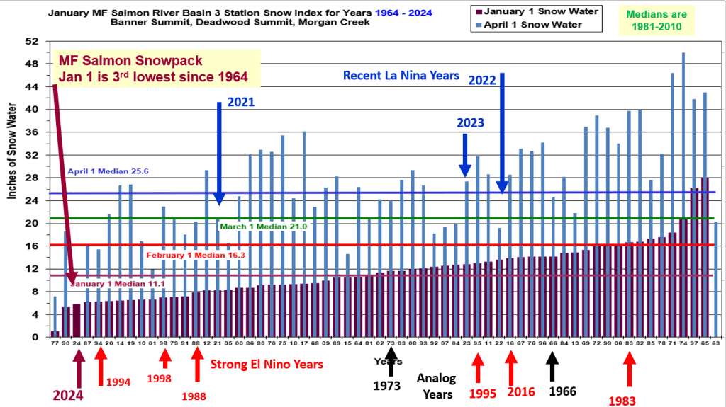


Following are long & short term snow analysis that illustrate the Jan 1 snowpack and how it ended up on Apr 1. Short answer – need more storms!
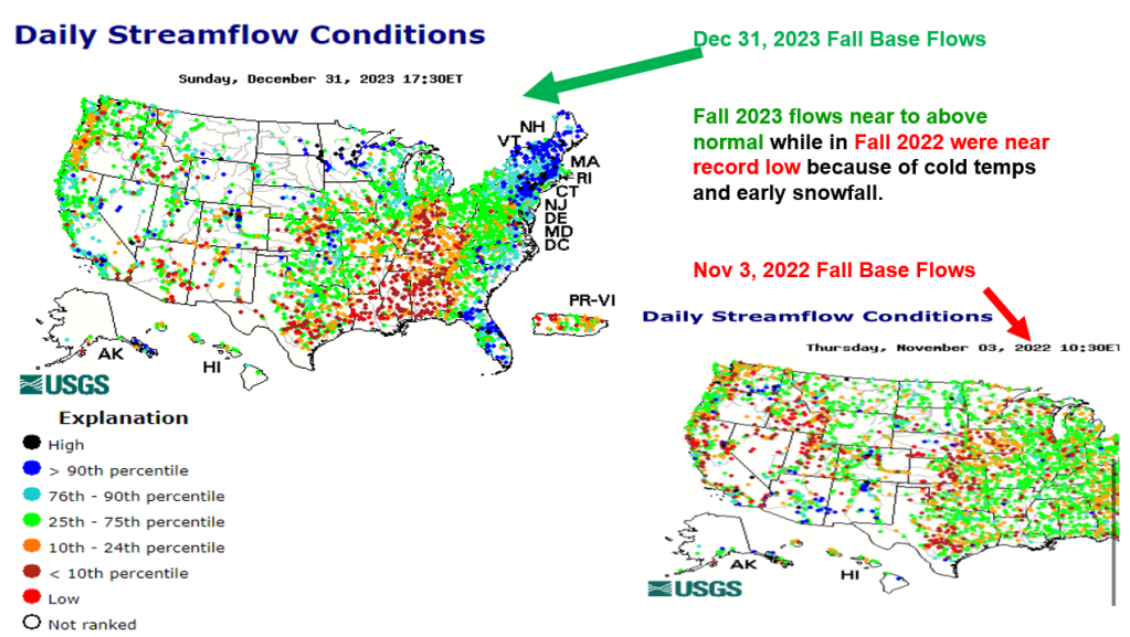
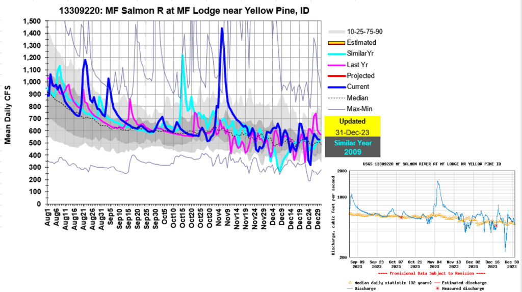
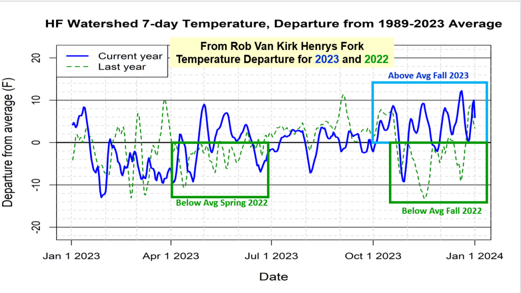
Here’s a summary of the interesting above normal streamflow we are seeing across southern half of the state. This was also observed and mentioned by others hiking, hunting and playing in the mountains this Fall. First I noticed the above average river flow levels and many rivers not freezing. So I had to dig deeper to figure out why and what happened as our Fall was fairly dry with temperatures on the warm and even record high side. Enjoy as we keep dreaming and learning about our rivers. Any other thoughts, let me know.

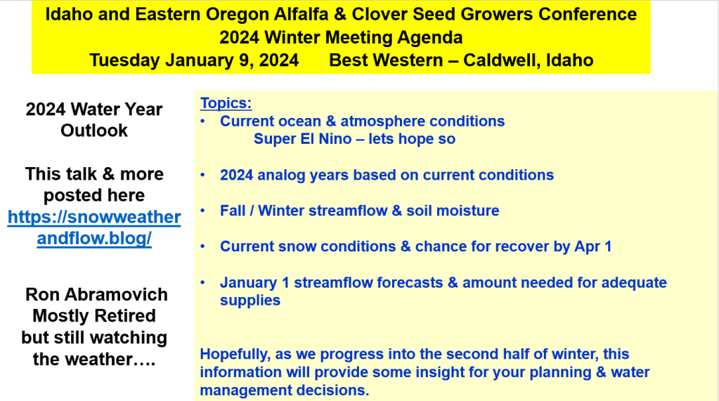
Here’s an update of fall streamflow & soil moisture conditions leading into winter, other strong El Nino years, 2024 Analog Years, chance for Owyhee & Boise basins snow to recover to normal by April 1, and a few streamflow forecasts. More posts and snow will be dropping…
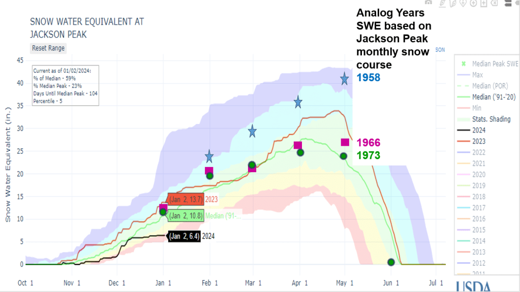
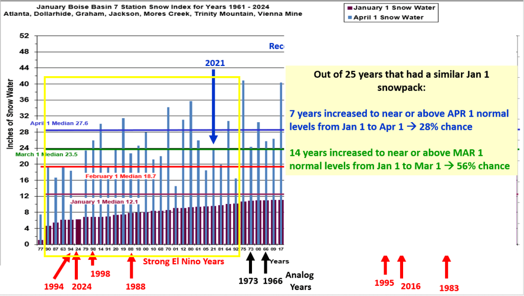
Keep in mind, Pete’s analog years are based on current Pacific Ocean and atmosphere conditions to generate awareness of current conditions and precipitation and temperatures outlooks based on
analog years. They were never intended to zoom down to a basin level or individual station, but let’s have some fun, give it a try to see how they worked to give us a heads up about the winter snowpack for Twin Lakes SNOTEL, Boise Basin and Bogus Basin SNOTEL.
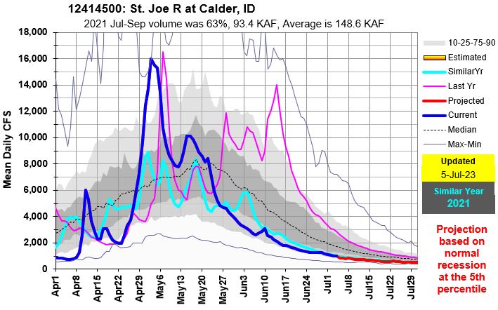
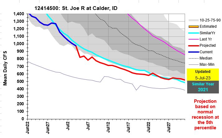
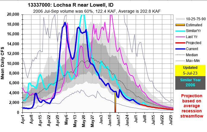
Recession flows are in full swing which makes it easy to see where they’re coming from and going. Flows range from near record low in northern Idaho, below average in the Salmon, to above average in central and southern Idaho. Even the Owyhee is flowing above average. Enjoy the flow where you can and we’ll see what El Nino brings next winter…
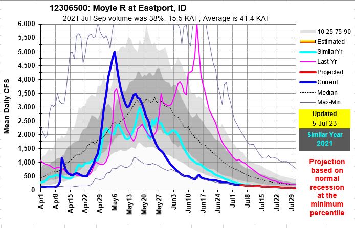
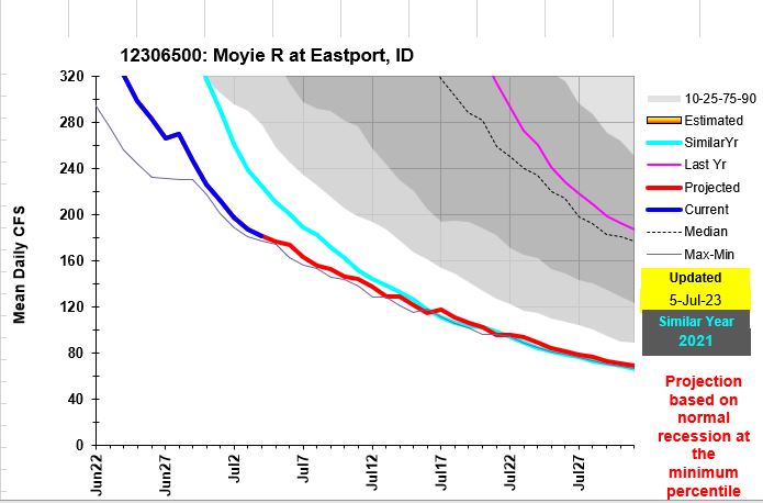

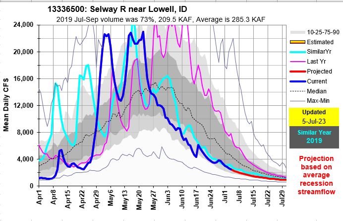
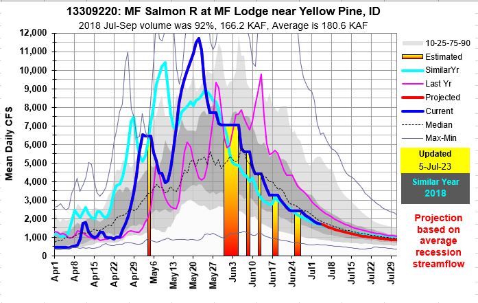
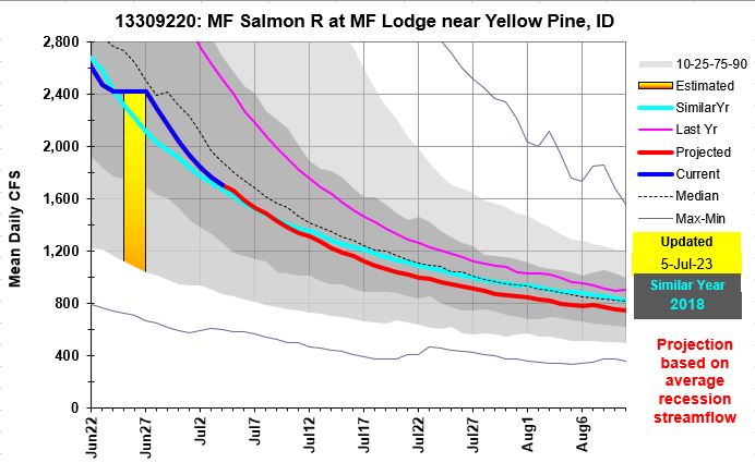
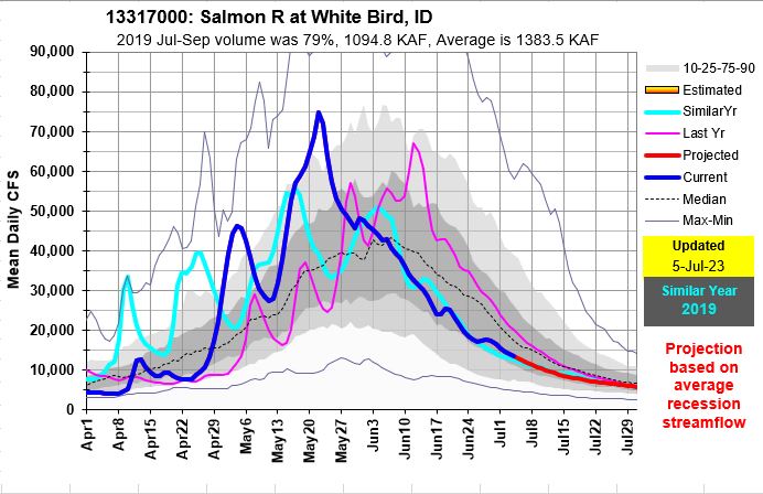
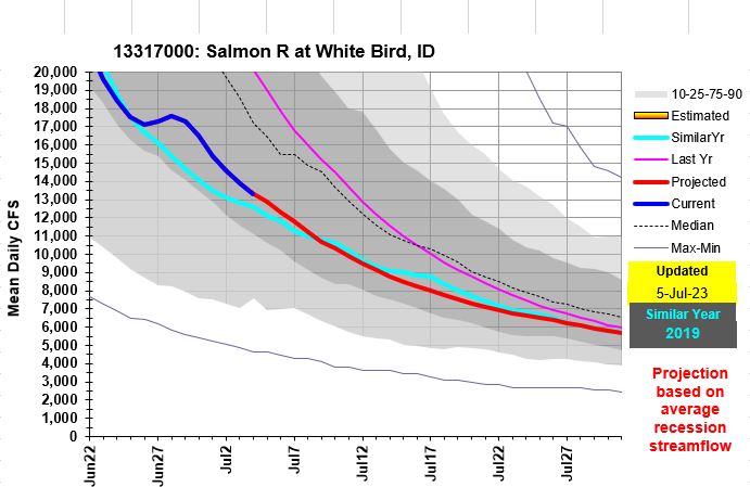

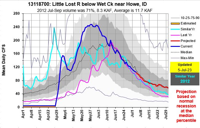
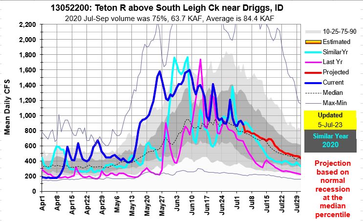
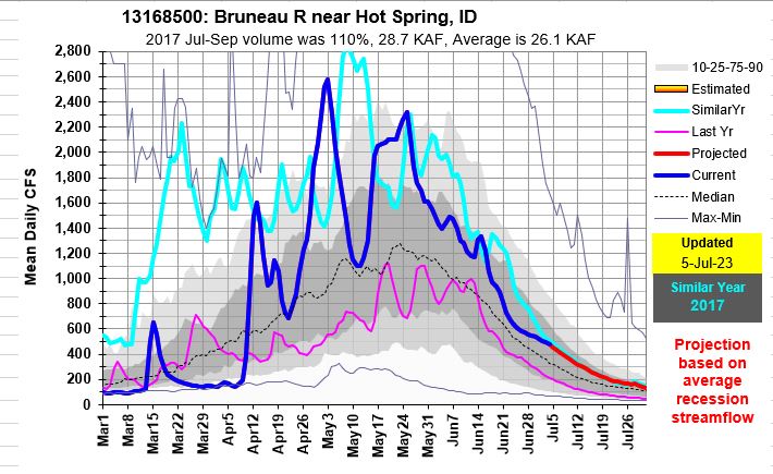

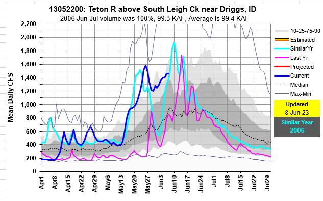
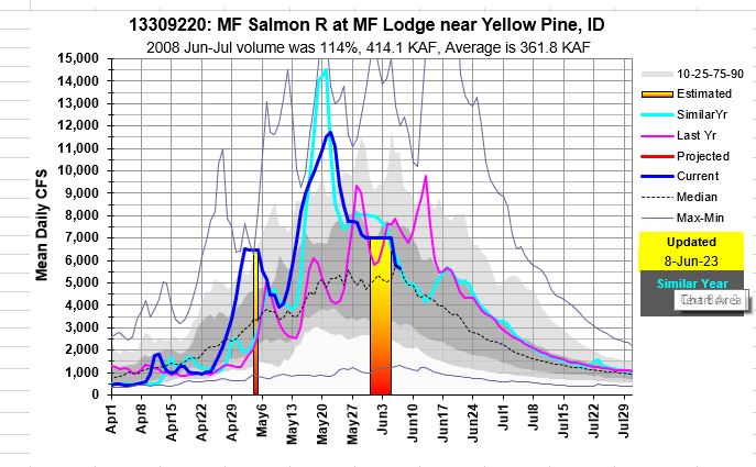
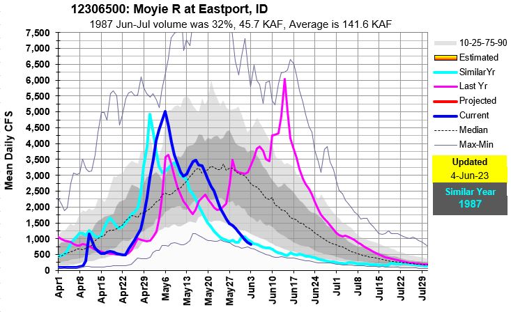
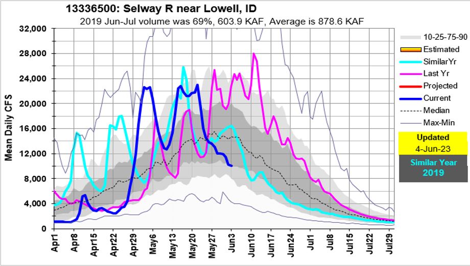
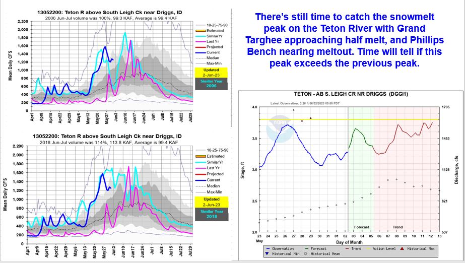
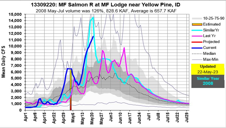
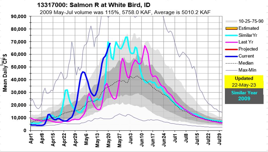
The Teton River is just reaching its snowmelt peak while the Moyie River is flowing near record low. The Owyhee River is just now reaching the tail end of recession flows. Central Idaho’s rivers are receding from their snow driven peaks. May brought warm temps with above freezing nighttime that resulted in 24/7 meting and probably record high SWE loses during the month of May because there was plenty of snow to melt. June’s cooler and wetter weather will help push recession flows out a bit before the normal low flow summer levels arrive. Owyhee and Bruneau recession flows months are a good example of these extended flows. Enjoy the river, know your limits and keep your eye on the weather and those river flow levels.
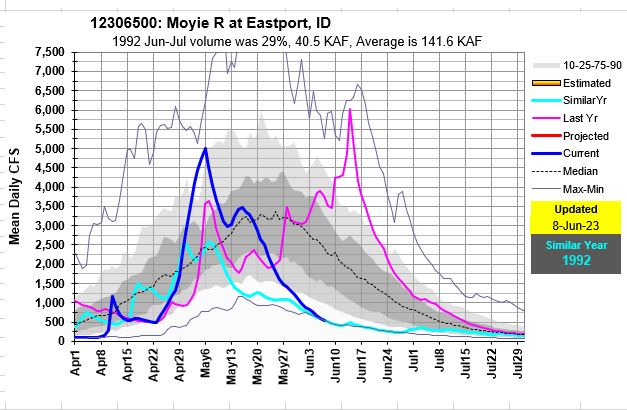

Snowmelt peaks flows have passed but June rains can generate additional increases. Didn’t realize the Moyie River is flowing near record low and exactly the opposite of 2022.
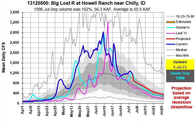
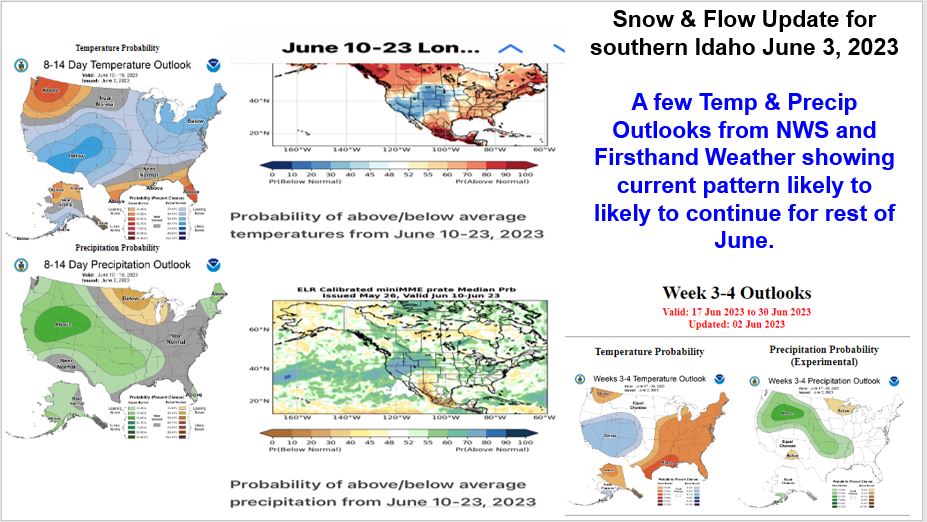
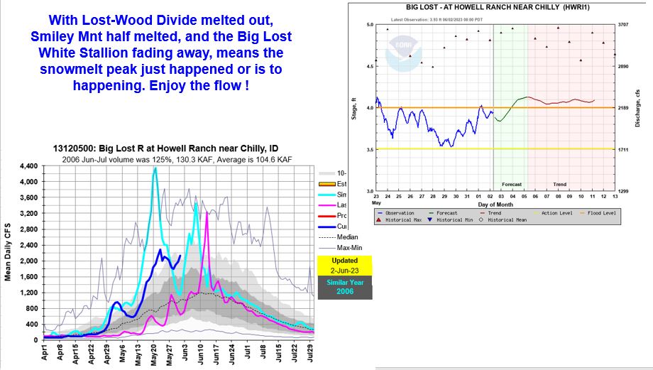
Snowmelt water is still feeding our rivers with enough from the higher elevation basins to generate another increase in the Big Lost River and Teton River. Weather outlooks are trending with more of the same weather for the rest of June – cool in southern Idaho / Nevada and warmer towards Seattle.
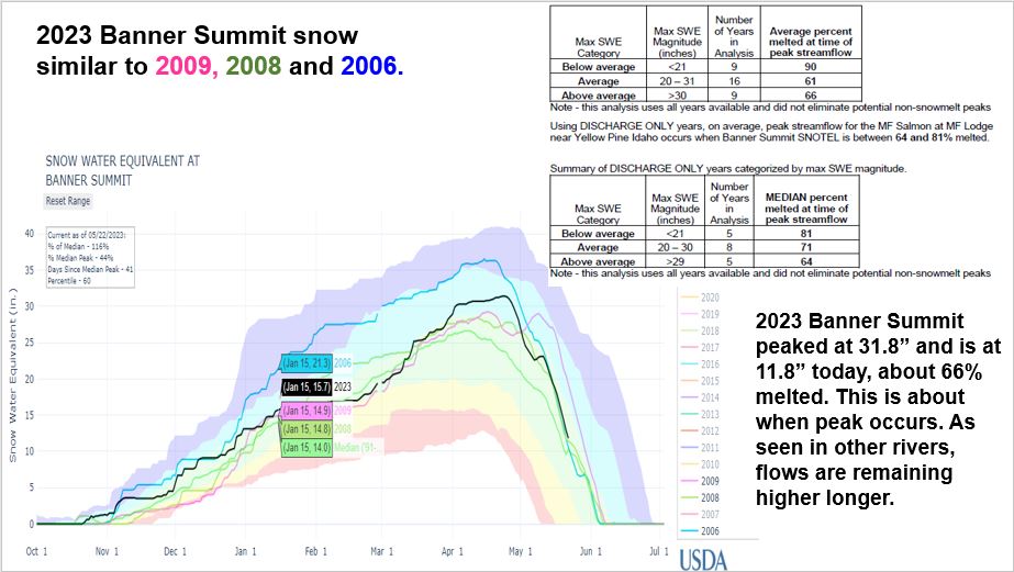
With snowmelt rates at 1.5-2.0″ a day for several days streams are reaching their peaks just as cooler temps arrived and snow starts to runs out a few sites. But as observed in the Owyhee and Bruneau Rivers, rivers stayed higher longer probably as a result of the good mid-elevation snow that feeds ’em.
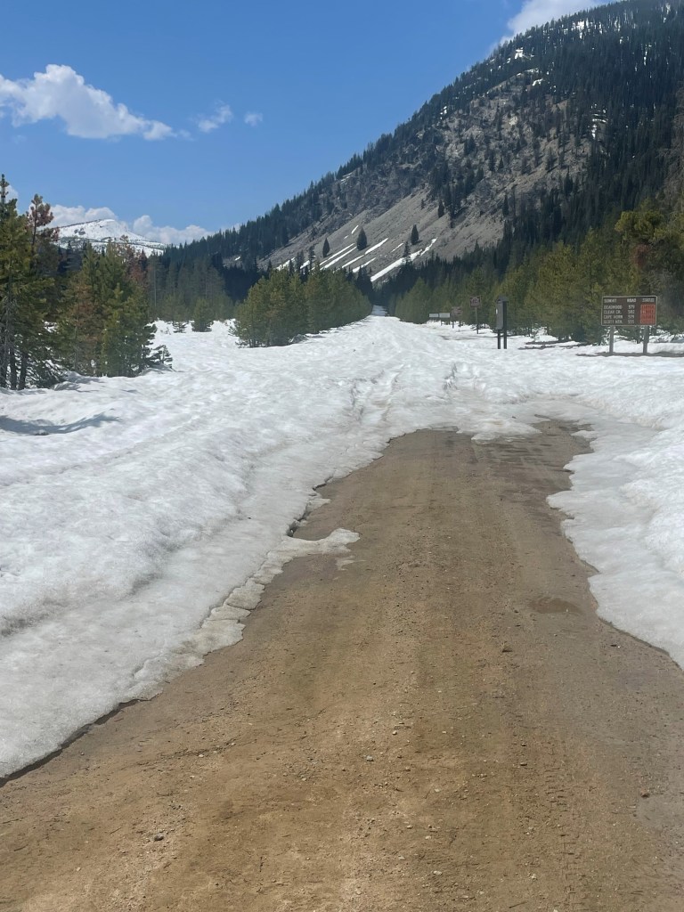
Boundary Creek Road May 19, 2023 with 15″ SWE at Banner Summit.
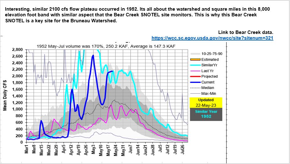
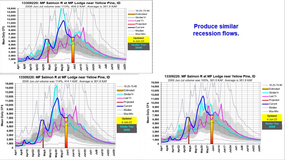
This is too interesting not to share. The 2100 cfs flow plateau has occurred in the past. This is why its important to understand these Snow2Flow Relationships. It’s all about relationships…