Temperature Driven Snow Drought

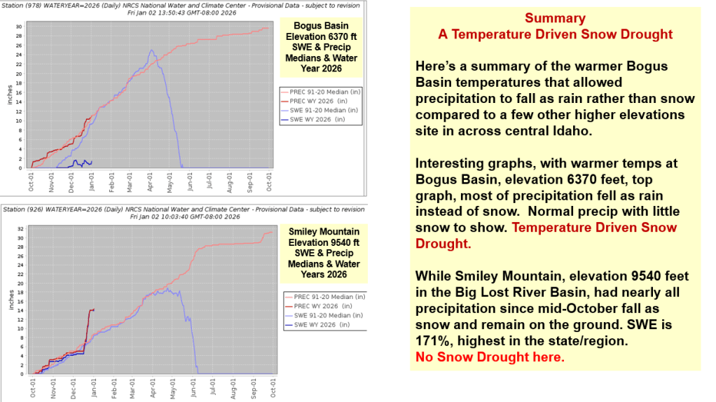
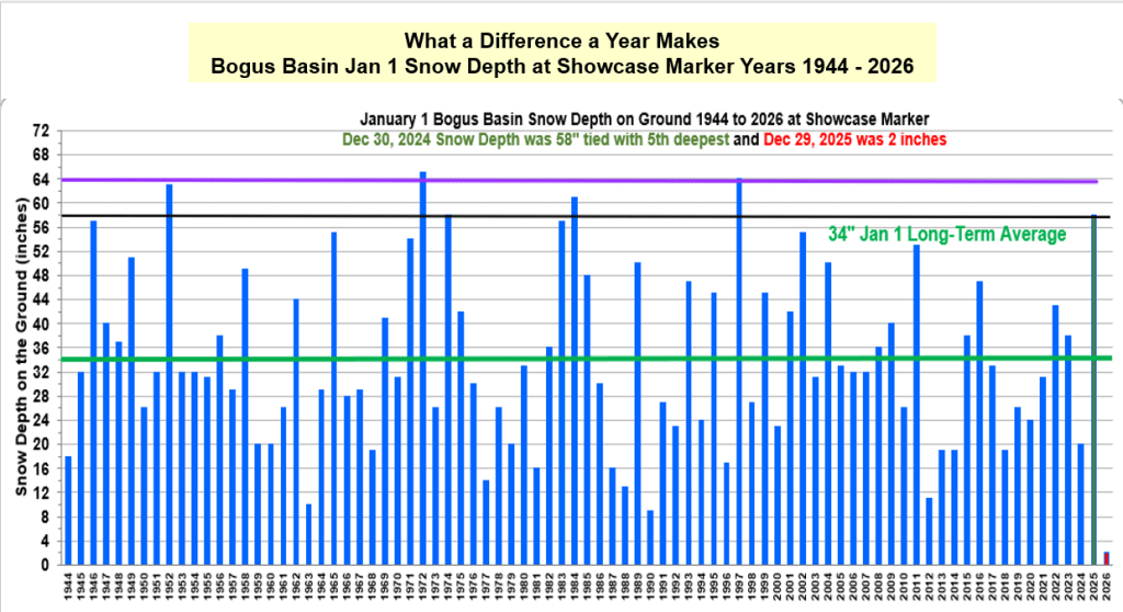
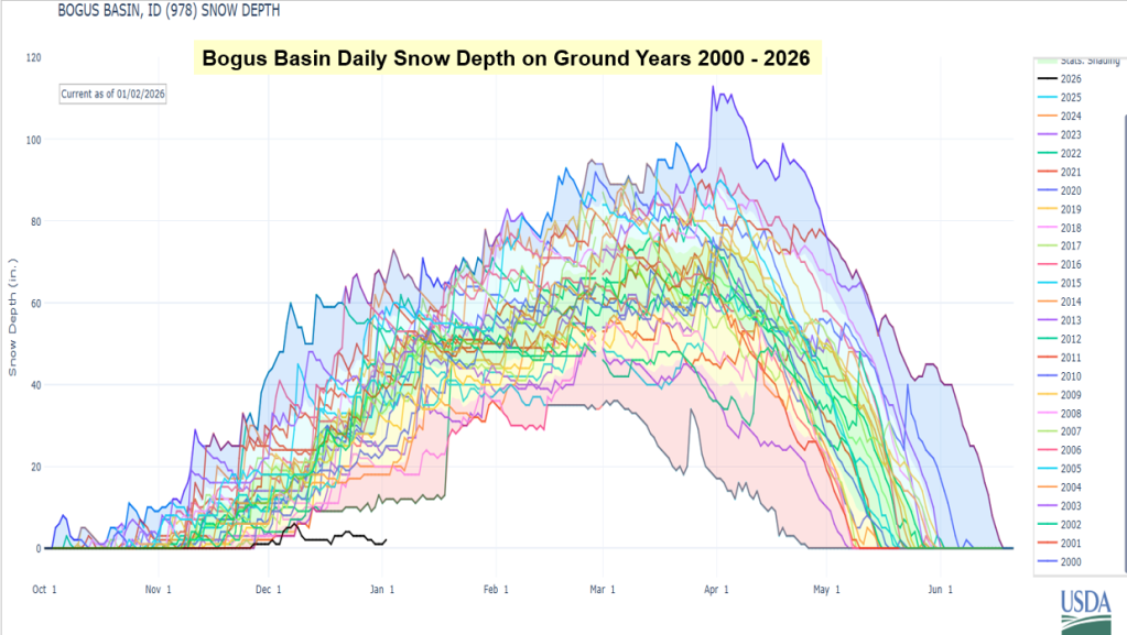
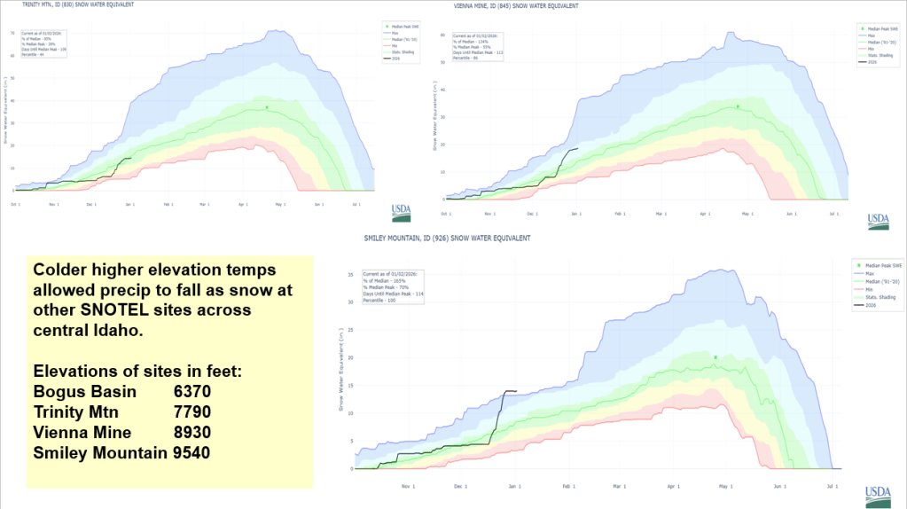
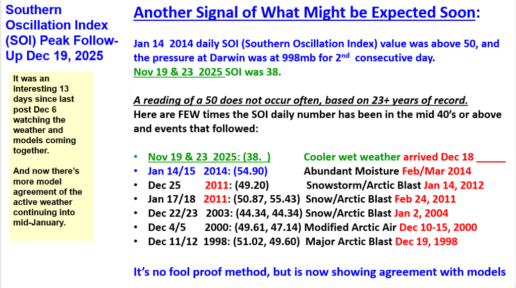
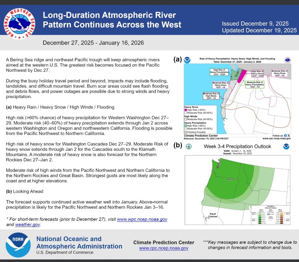
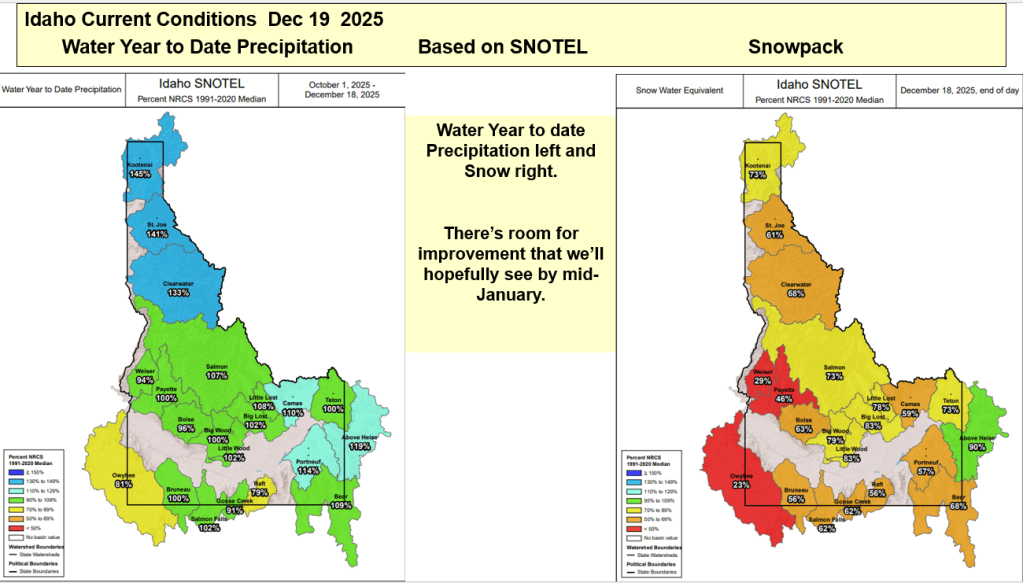
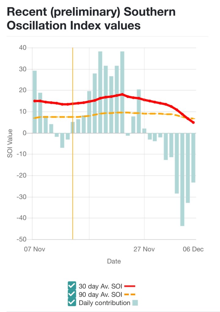
A change in weather pattern starting around Dec 18 as hinted by Nov SOI Spikes brought numerous Atmospheric Rivers events with abundant precipitation to parts of the West. Too much rain in some areas. Locally, warm temps allowed this moisture to fall as rain rather than snow except in higher elevations around Idaho. Water year to date precip is near normal across most of the state. Snowpacks are near record low in lower elevations and increase in higher elevations. Smiley Mountain snow, in the Big Lost Basin, is 171% of normal. Here’s a summary explaining the abundant moisture and influence of temps on snowfall across central Idaho.

Early Bird Forecasts and Analog Year Summary

Early Bird Forecasts or are they called Outlooks – either way, you got to know when to hold them, know when to believe them, know when to walk away and know which areas are favored for more snow and why. There are lots of late summer/early fall Winter Outlooks being shared and passed around. Recently, it seems there is a race to see who releases the first Outlook. Here’s a summary about what I’ve been watching for a while. See if it helps or share what you watch and works for you. Don’t believe the first forecast you hear or until you hear the same forecast from 2 or 3 unrelated friends.

Read on for more info about SOI correlation with western rivers and how analog years are identified and used to help with predicting / monitoring this winter.

Analog years used for this winter (water years):

1956-57 is water year 1958

1964-65 is water year 1966

1971-72 is water year 1973

Another analysis shows this year’s El Nino initially was tracking 2009-10 El Nino winter. Next post: SWE plots of analog years and 2010 to how snow is tracking or not.