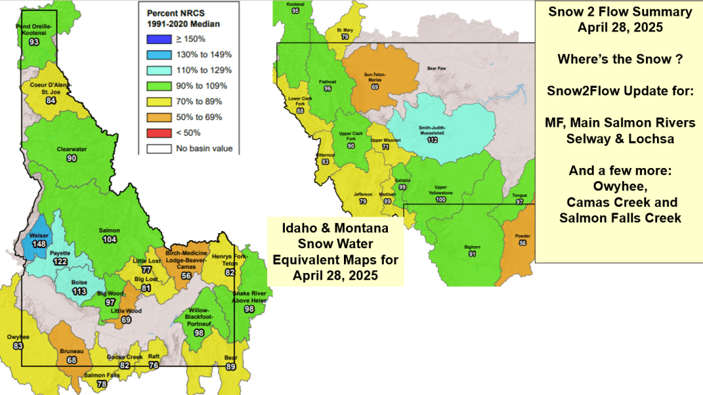
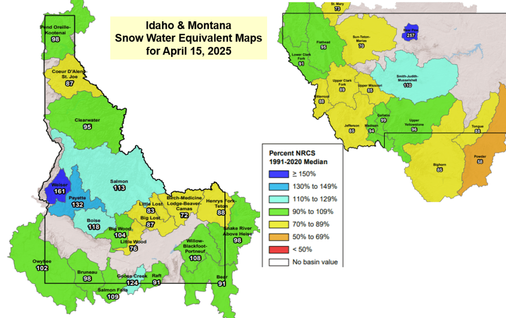
Here’s a summary of current snow water supply conditions for Idaho’s 4 River Lottery Rivers. Short on time for complete analysis but this should provide current info about the accumulation of this winter’s unique snowpack and where we are compared to other years.
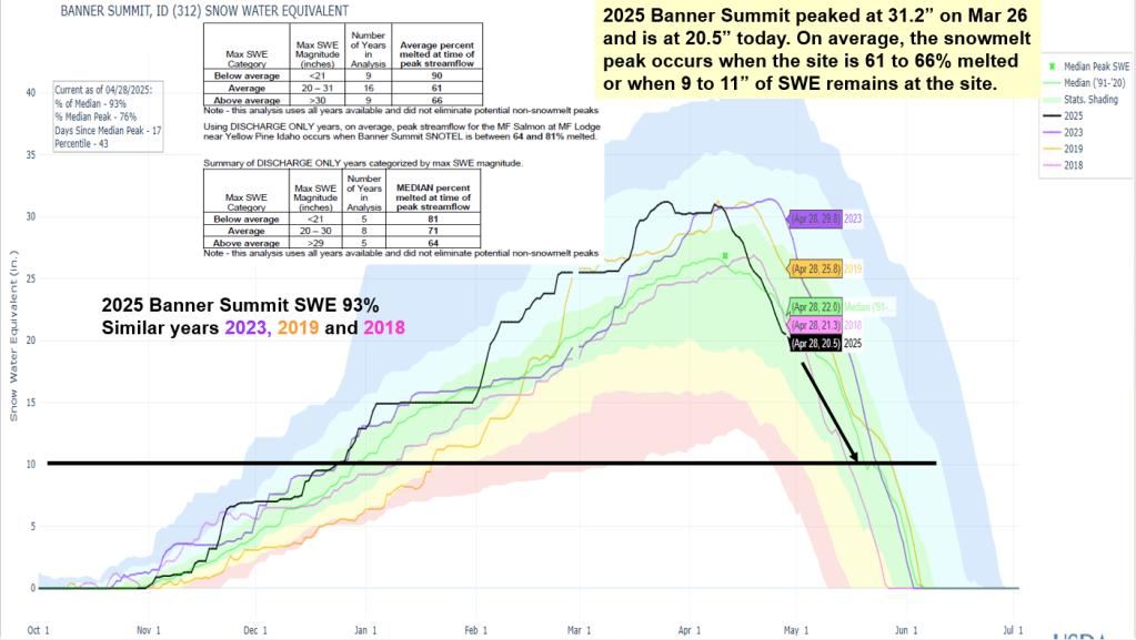
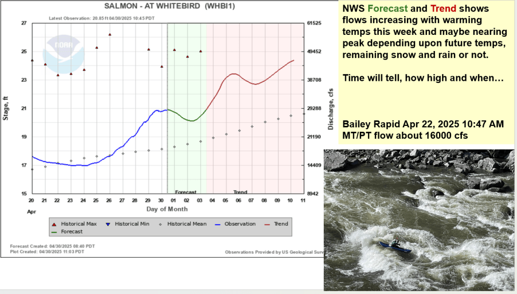
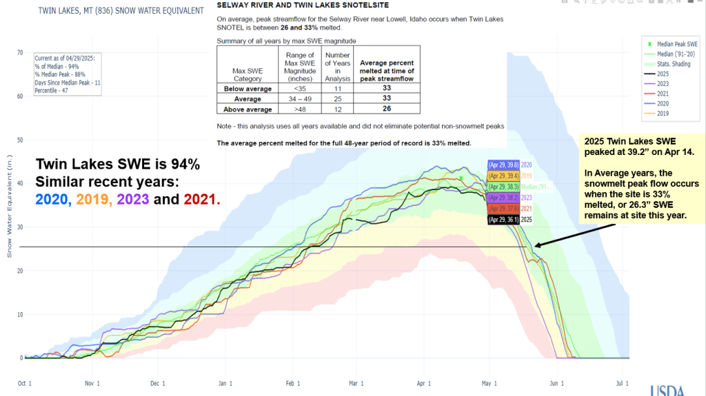
It’s always good to verify forecasts to better understand what works, and why or why not. This provides a better understanding of the relationship, other climate influencers that may have impacted the outcome and when works best. Following is a summary of Snow2Flow relationships used to predict date of peak flows, range of dates, and if the potential for additional snowmelt peaks has past or is decreasing
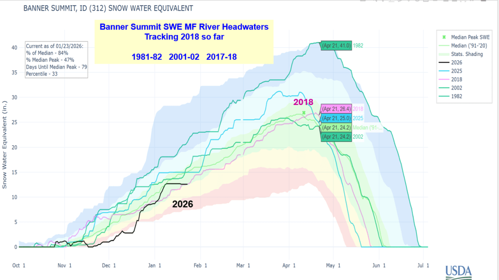
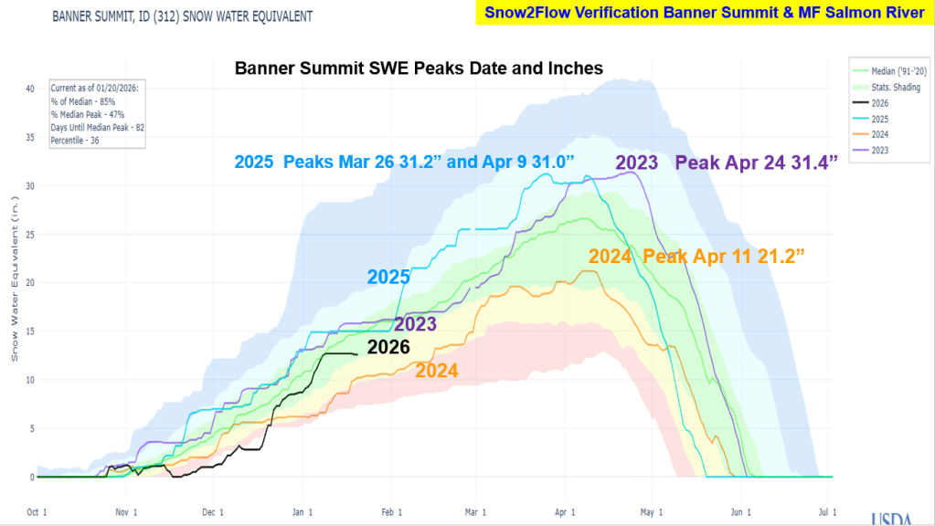
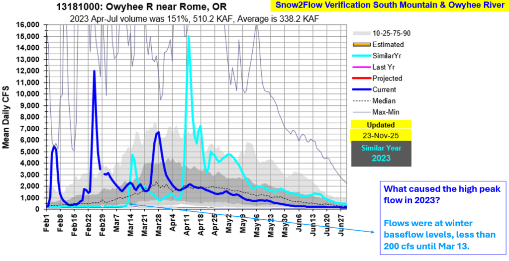
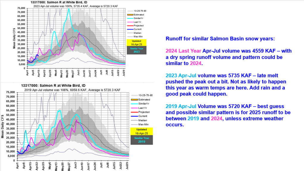
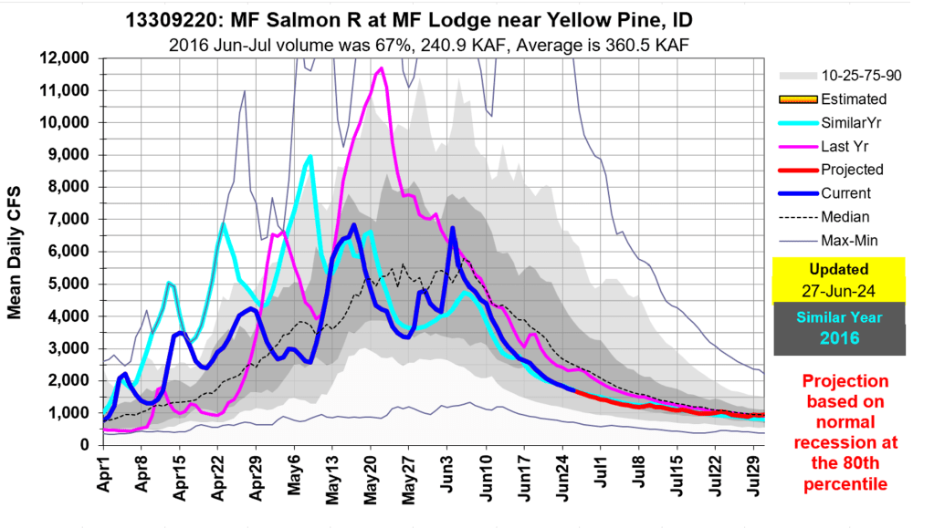
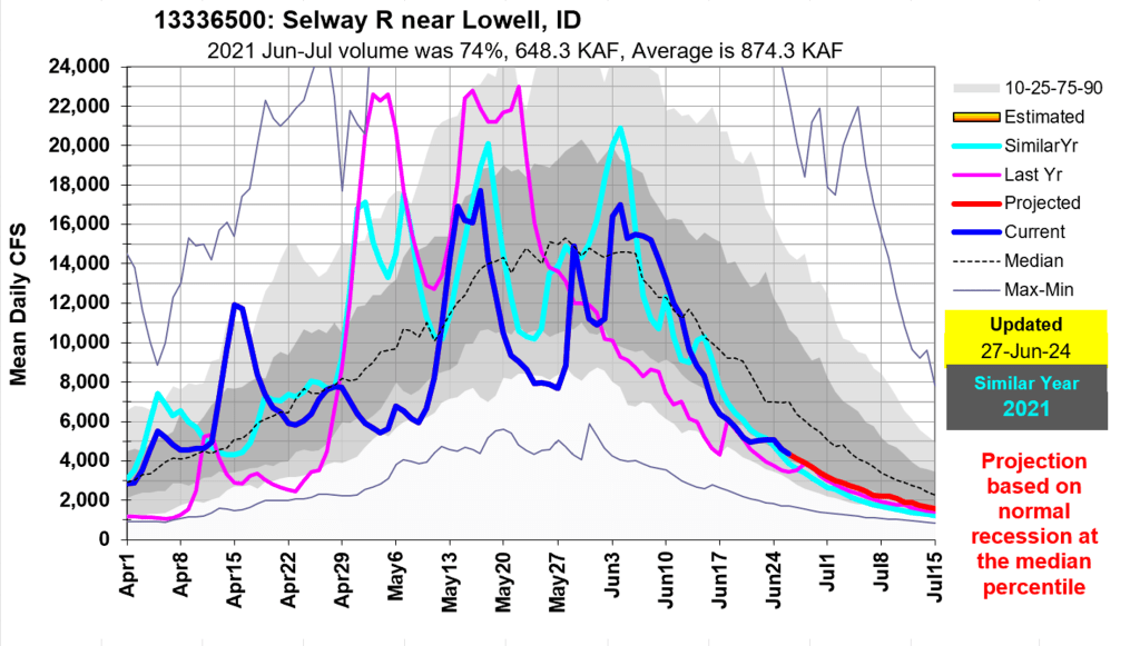
Snow & Flow graphs illustrate what happened and how the predictions preformed. 2026 SWE is also include to give you a hint how this winter is tracking these recent years. Next post Idaho’s Four River Lottery – Where’s the Snow and Flow Going in 2026 ?!
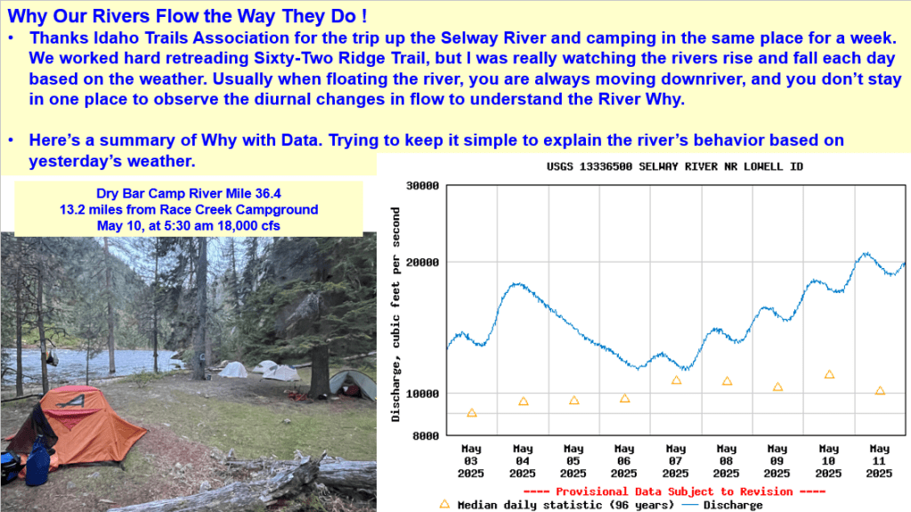
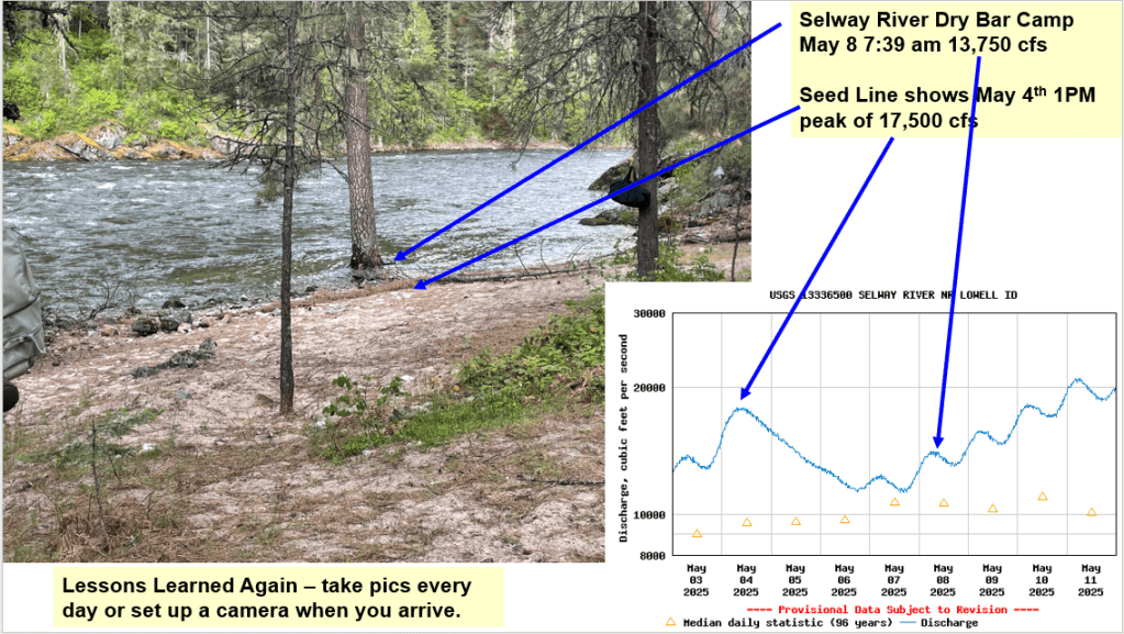
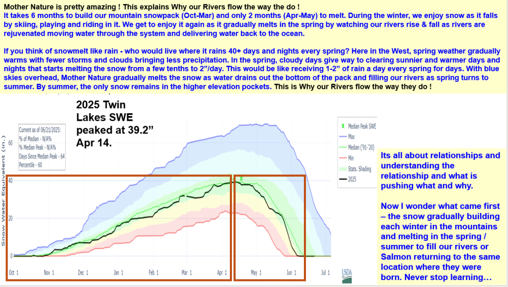
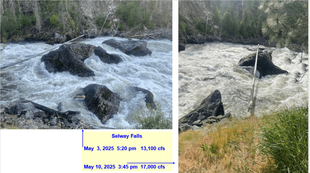
Thanks Idaho Trails Association and letting me camp, work and watch the Selway River rise and fall this May. Here’s a summary about the climatic conditions (daily/weekly weather, cold & warm fronts, record high day & non-freezing night temps, snowmelt rates, lack of spring precipitation) that produced this spring’s Selway River hydrograph shape. It’s a complex world out there. Hopefully this helps explain the diurnal river changes and why our rivers flow the way they do as our winter snowpack melts in the spring.
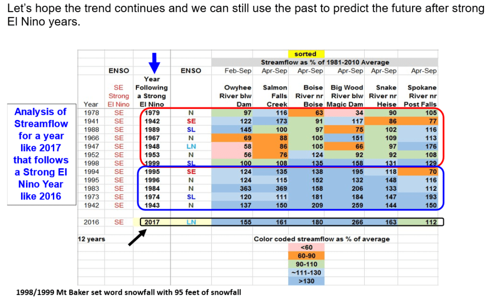
Current neutral ENSO conditions are predicted to change into La Nina conditions for this winter. Weak or strong La Nina? It doesn’t really matter in years following a strong El Nino like last year.
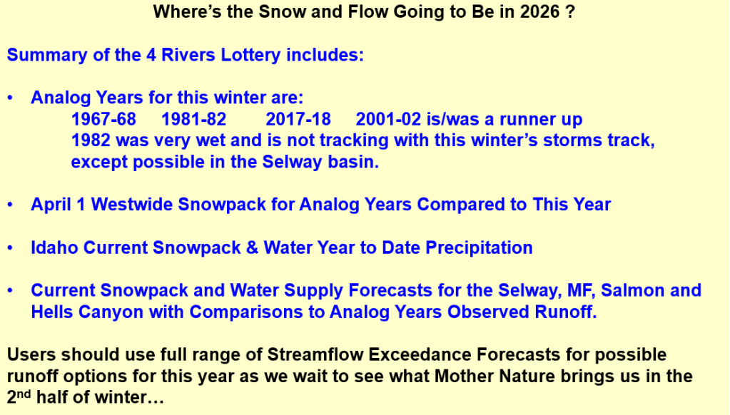
Following is a summary of the different outlooks, explanation of current conditions, and reading material if you can’t sleep or just interested in learning about these relationships. You can skip to the end for the summary to see what happens in winters following strong El Ninos or here it is…
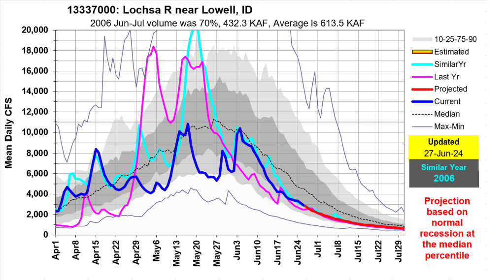
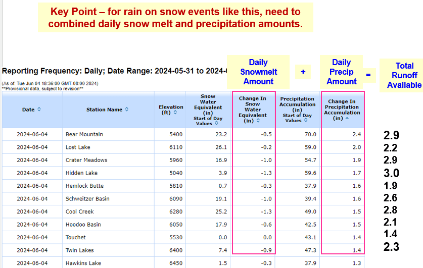
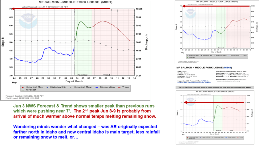
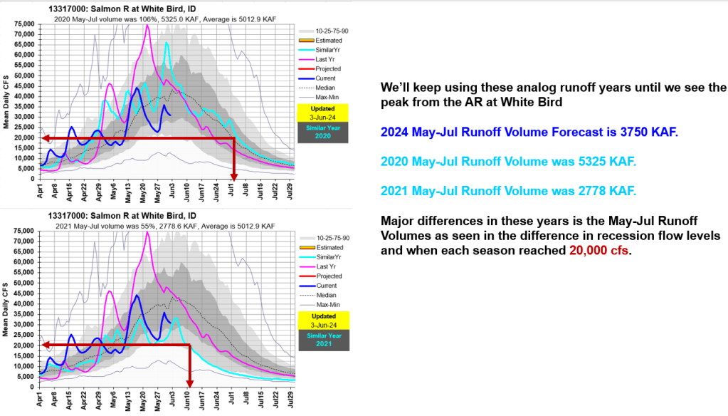
What an event it was that added much needed moisture to many Idaho rivers. Following is a statewide summary about the impacts of this early June Atmospheric River Event. This rain on snow event increased streamflow in many rivers across the state that will push recession flows out a bit.
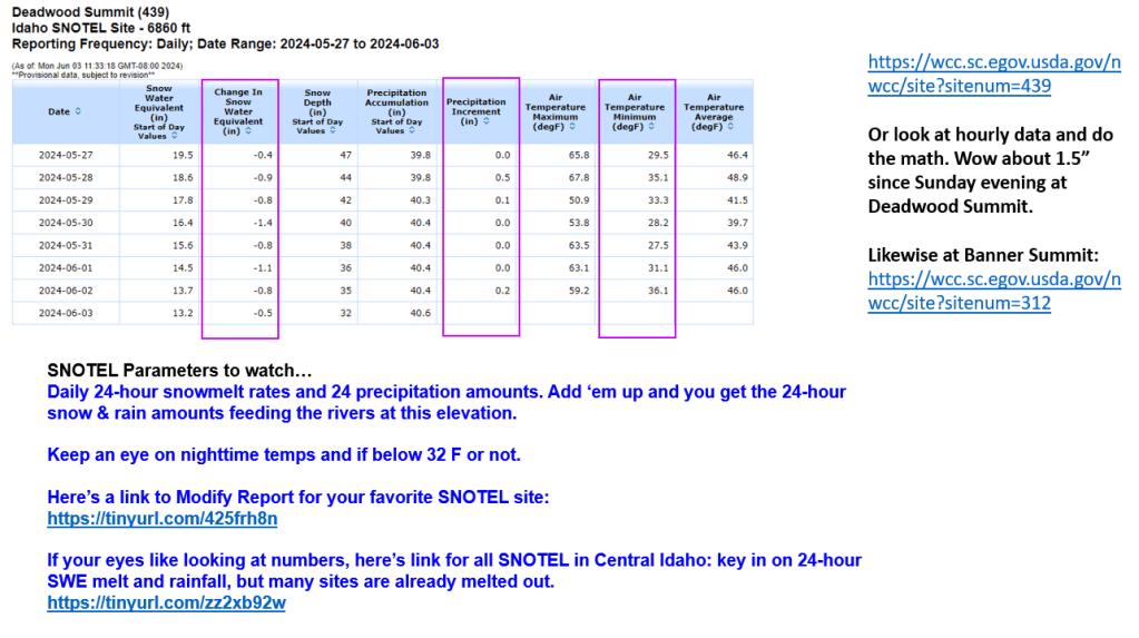
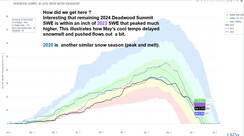
Combining daily rainfall and snowmelt resulted in 2.5 to 3.0” of Total Runoff Available at a few SNOTEL sites. The cool May temps delayed snowmelt allowing snow to remain in higher elevations that provided a runoff boost with the falling rain.
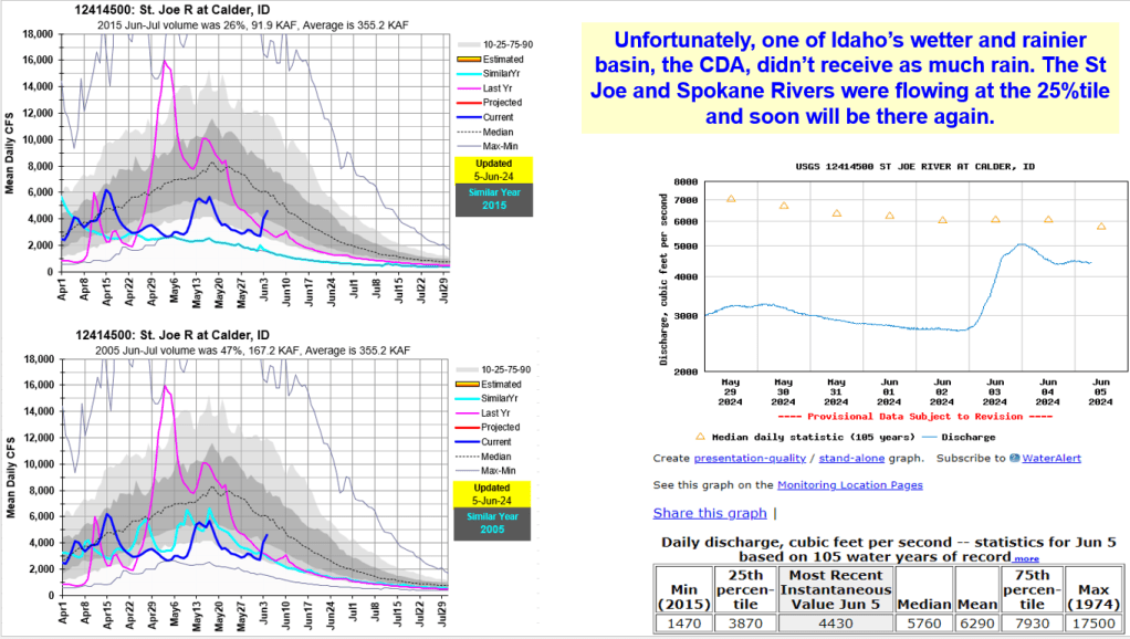
What a storm it was – who do you thank ? Those benefiting include fish, wildlife, river runners, salmon flows, hydropower production and more. The streamflow boost created another flow increase that will keep recession flows higher longer. However, some basins missed the positive impacts from this event. See the following analysis to see why some rivers benefited while others continued with their downward recession trend.
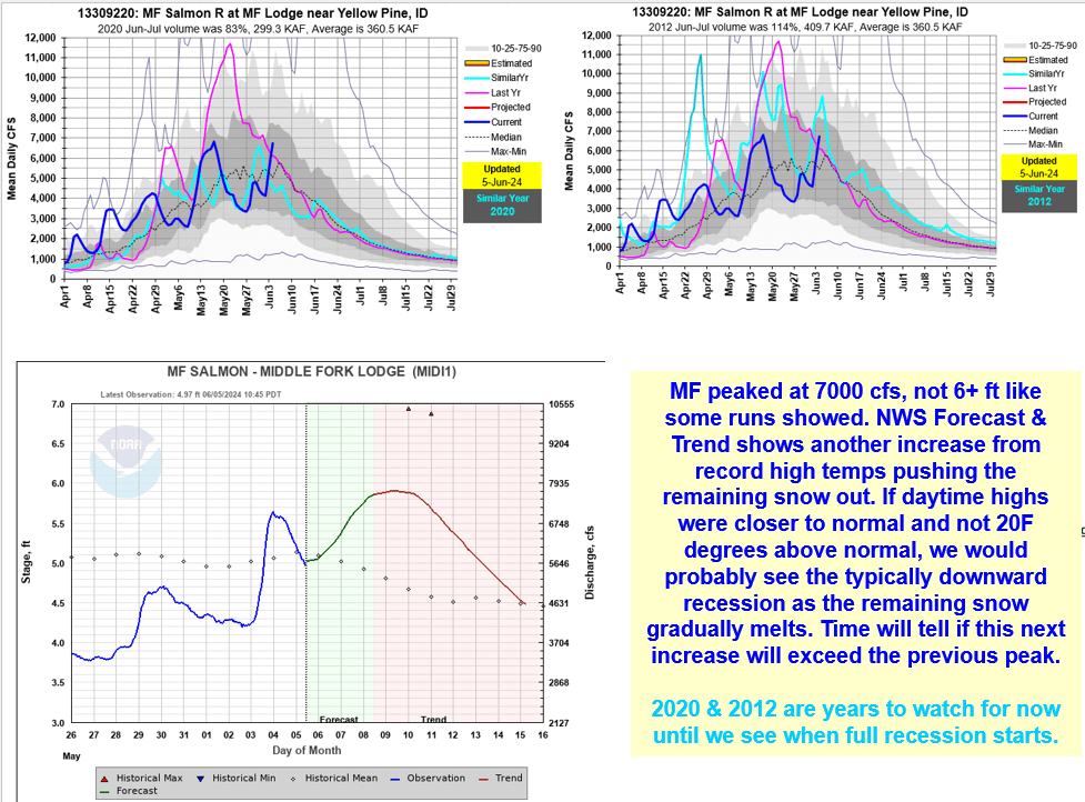
Benefits include assisting with final fill of some reservoirs, delayed irrigation water use that may even result in better reservoir carryover storage for next year. Impacts include challenges for those on rapid rising rivers especially for those adventuring on the MF Salmon River and experiencing the New Velvet Rapid up close.