Now to answer the question everyone has been asking… This is the best start at Bogus since 2002 and best at Brundage since 2015! This analysis is based on Dec 15 snow data. Keep in mind Bogus’s daily SNOTEL record starts in water year 2000 and Brundage in 1986. Snow depth sensors were in installed in late 90s early 2000s.
Comparison years may change to the better with more storms coming next week and before the new year starts! Here’s the details and forecasts follows…
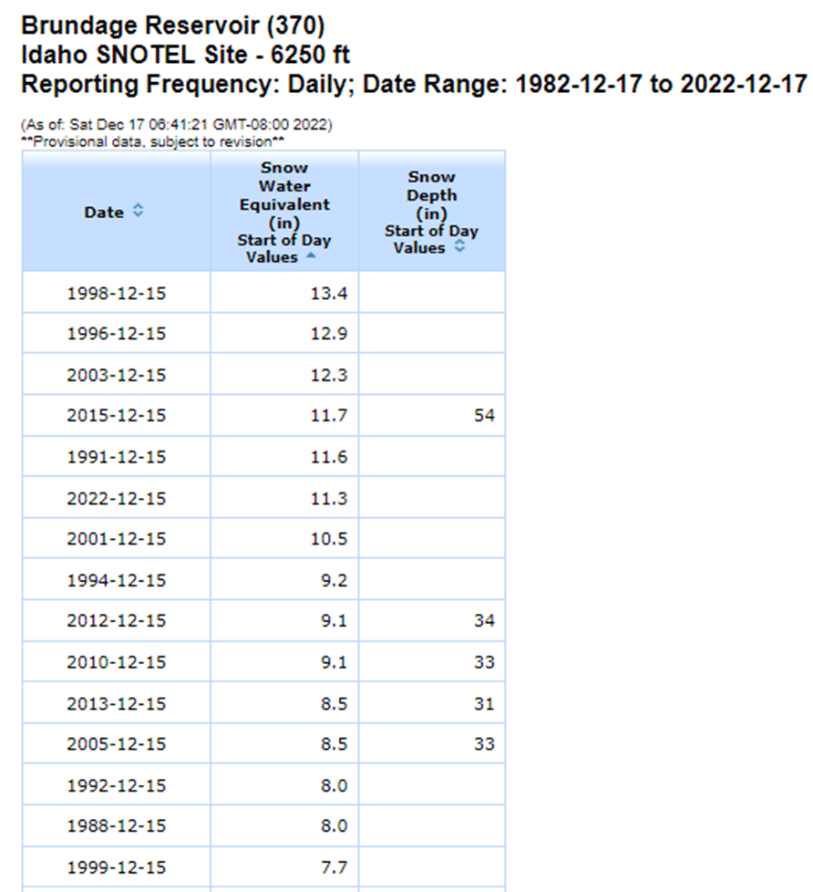
Below are Bogus & Brundage Dec 15 Snow Water Equivalent (SWE) values sorted high to low. Snow depths are included if the depth sensor was installed in that year.

Bogus Basin’s Dec 15 SWE & Depth are 10.0” and 46”, highest since Dec 15, 2001 when there was 15.0” of SWE with depth of 61”. Wow, that was good year!
Keep in mind the water year is the year designated in graphs below and runs from Oct 1 to Sep 30. So this water year is for the winter of 2022-2023 and is called water year 2023.
Brundage Reservoir SNOTEL site on Dec 15 had a SWE of 11.5″ with an estimated 45″ of snow depth, best since 2015 and 6th highest since records start in 1986. Top 5 years with more SWE on Dec 15, in order, are 1998, 1996, 2003, 2015 and 1991 followed by 2022. Remember those good wet snowy cold years in the mid to late 90s.

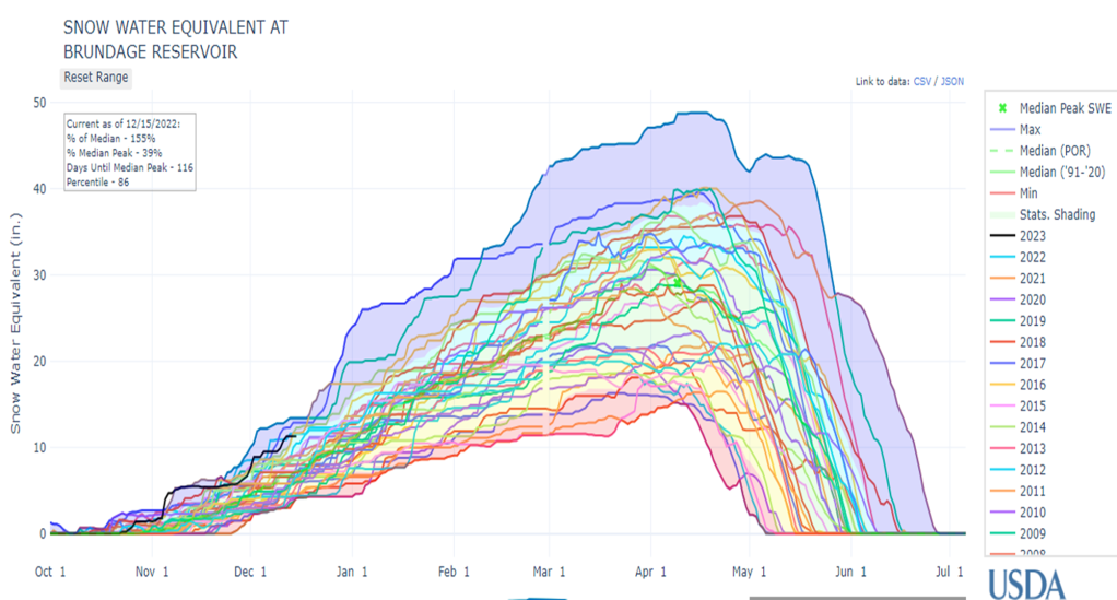
Busy but interesting graph above showing the SWE for all Bogus Basin years for the winter accumulation and melt season.
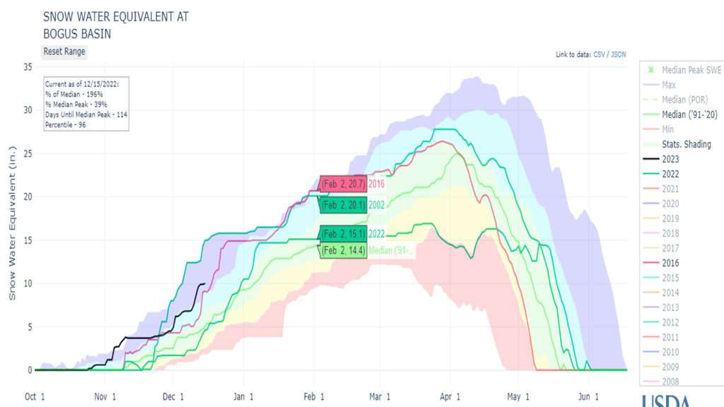
Bogus Basin time series SWE graph below shows 2002 with highest SWE on Dec 15 and this year, 2023 in black, with a little less and a bit more than 2016. Last year, 2022, is included to see how flat (dry) the SWE line was after Jan 1 and until the the wet weather returned in March/April to push the melt out later than normal. This means you should ski now and don’t wait for next Pow day. It is always interesting to see how close the SWE lines are in January for the different years and how what happens in January typically to determines the outcome trends for rest of winter. Later, we’ll talk more on last year’s dry Jan & Feb spell that also bled into March and if this is likely to happen again this year.
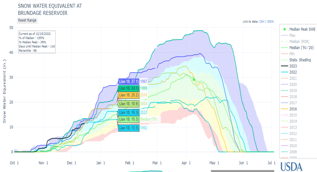
Similar with Brundage Reservoir you can see this year’s SWE, 2023 in black, is 6th highest with higher Dec 15 amounts in 1998, 1996, 2003, 2015 and 1991. These are actually Water Years – 1999, 1997, 2004, 2016, 1992 and 2023 this year.
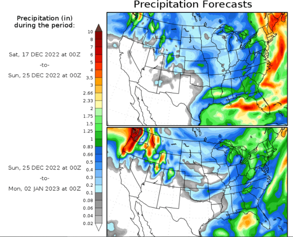
With a break between storms of blue skies and cold temps, it’s time tune & wax those boards for when the moisture returns. These two 7-day precipitation forecasts show more moisture coming the 2nd 7-days. Lets hope it stays on the radar for Santa’s arrival and beyond.
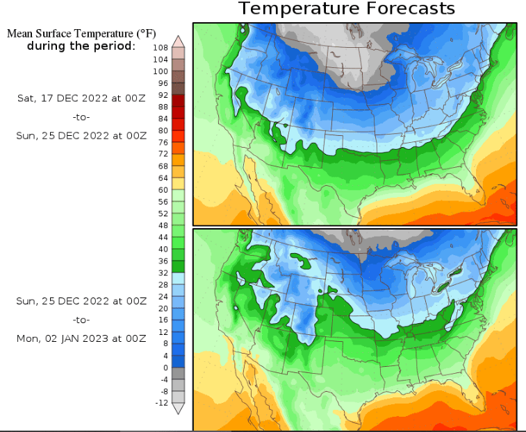
Top temp map shows cold temps upon us now with 7-day average temps averaging -12F in the mid-west and less cold the 2nd week, Dec 25-Jan 2. Remember cold is good, don’t let anyone kid you.
For the many years/decades I’ve been watching these 7-day forecasts, its interesting to point out that this 7-day temp anomaly for Dec 17-25 is one of the first times that I have seen so much blue & white and so little red that signifies above average temps. Cold is good.

Thanks for reading and if still looking for a stocking stuffer – check out Airflare. An inexpensive phone wilderness rescue app that can be used by rescuers to determine your exact location. https://airflare.com/
Great blog Ron! I love the knowledge!
LikeLike
Wow!
Happy hols, it appears we’ll have a few days a bit cooler than average here, but well within normal for this time of year…
Sent from my iPad
>
LikeLike
Same to you and thanks for rain info from down under. I’ll use it in next post !!!
LikeLike