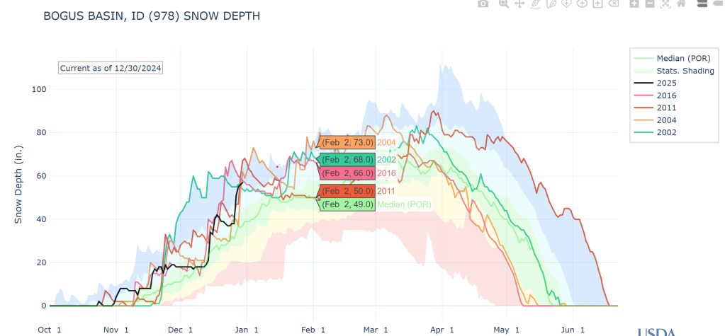
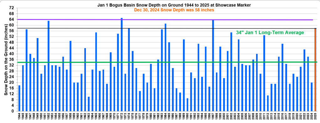
Updated graph Jan 2 with Dec 30 Snow Depth measurement value of 58” for the long-term snow course at the Showcase Marker. This winter is off to the best start since 2011 and in the top 5 highest years since daily snow depth measurements start in 2000.
Compared to historic Jan 1 data, that starts in 1944, this year is tied for 5th for the most snow on the ground for the Jan 1 snow survey. Other high years were 1997, 1984, 1972,and 1952.
Storms are still expected but smaller in size compared to recent ones. Winter like temps finally arrive as cold temps dip into mid-West in mid-Jan.
Lots going on with the Polar Vortex stretching and pulling, and lots to learn about Greenland’s weather impacts on our weather. We know we are in for a colder ride between now and mid-Jan, especially in the Mid-west. Here are Judah’s thoughts for the 3rd week of Jan. Stay tuned as lots gong on 3rd week of Jan along with my birthday !
“So, during the third week of January this will result in a transition to milder weather in both Europe and the Eastern US with cold weather becoming more entrenched in the Western US. But it also appears Siberia will turn colder at this time, so I don’t think winter weather in the Eastern US is done just yet like last winter.” http://www.judahcohen.org/