
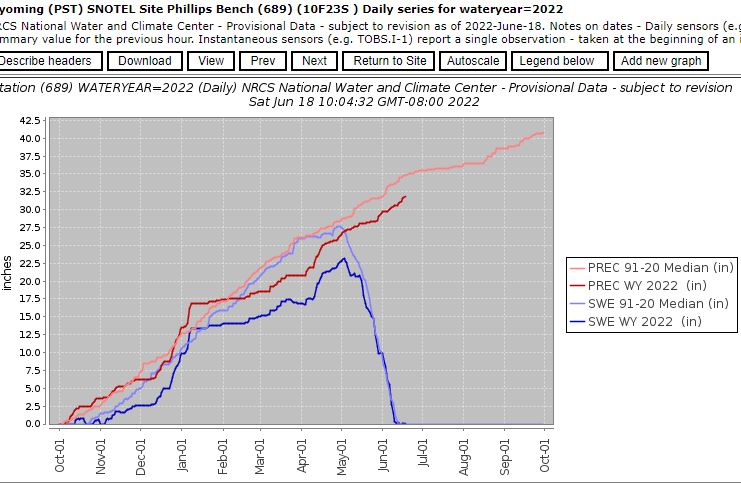
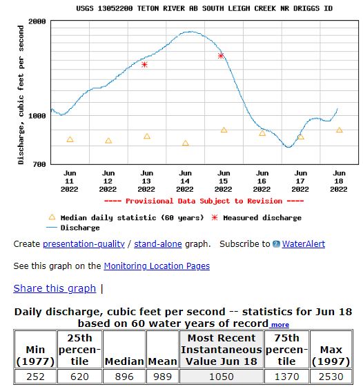
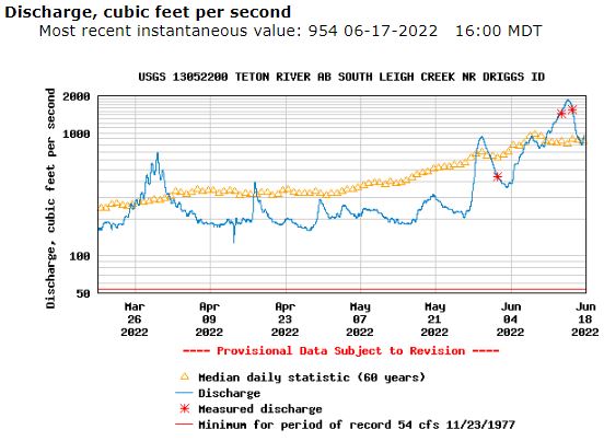
This Teton River runoff is a great example to explain of how these Snow to Flow Relationships are used to predict the ‘snowmelt peak’ as opposed to the ‘absolute peak’, a rain influenced peak which may be higher. Teton R still has enough remaining snow for another bump in flows from the remaining snowpack based on snow to flow relationship with Phillips Bench and Grand Targhee SNOTEL sites.
We’re now 7 days after Phillips melt out and right at Targhee’s half melt with 15.7” on the snow pillow. Flow is rising as seen with the diurnal snowmelt. Cooler temps will arrive Sunday to slow melt. Remaining snow will help sustain flows as they decrease again.


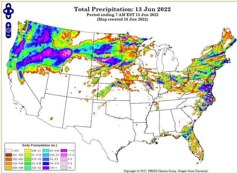
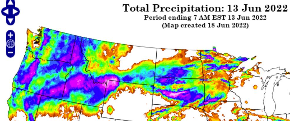
Precipitation totals in inches for June 12 (5 AM MT to 5AM MT) to June 13 from PRISM, and zoomed in below. https://prism.oregonstate.edu/
Link to Cliff Mass Yellowstone precipitation / snowmelt event summary. https://cliffmass.blogspot.com/2022/06/the-origins-of-yellowstone-flooding-and.html
