
This has got to be one of the longest, driest falls in a while in the PNW and hot in Seattle!
All good things must end as winter arrives this weekend. While we’ve been enjoying fall colors with little wind that extended Nature’s Fall show, the winter stage was being set in Siberian with a currently an above normal snow cover area.
A good Siberian snow cover in Oct/Nov influences the jet stream across the US/Can border from PNW to Great Lakes region and Europe. Time will tell where the jet stream will cross the border, but several storms with colder temps and snow have already arrived in the Great Lakes Region.
This weekend, snow will fall down to 4000 ft. in central Idaho and more next week. Stay tuned as we ride in on a 3-peat of La Niña winters. More to follow as we review last year’s analog years and forecasts with what happened and end with this winter’s analog years.
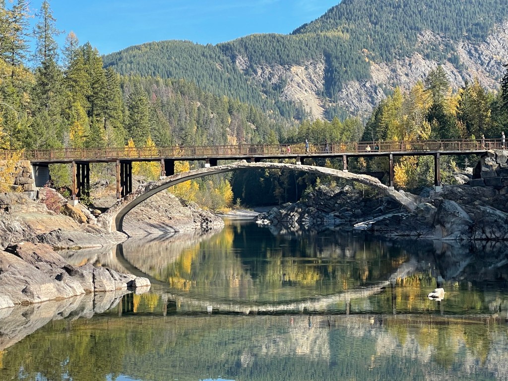

Fall pics from Glacier NP – October 17, 2022.
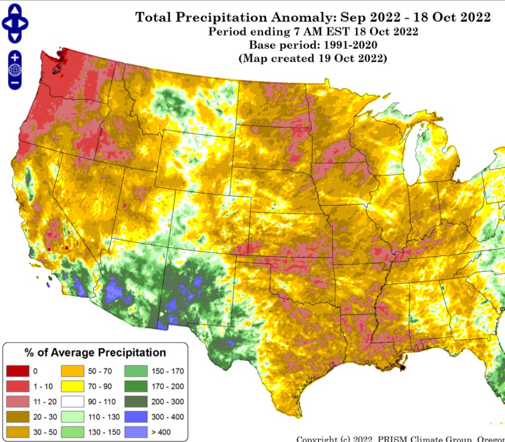
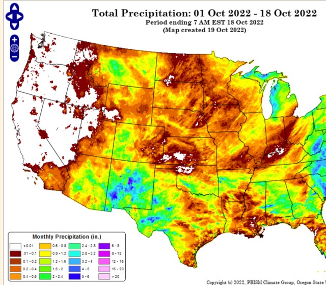
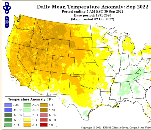
Here’s a few images to illustrate how dry and hot September & October have been.

For those who like details, here’s a long wordy article explaining the Siberian snow cover relationship, and more… or hang tight as we get ready for winter to enjoy the ride!!!
