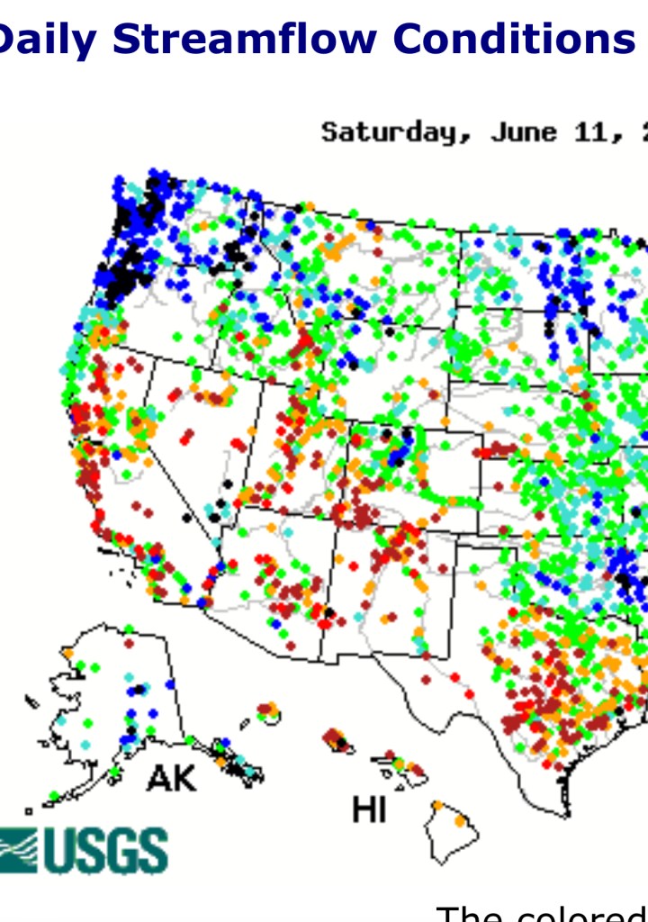
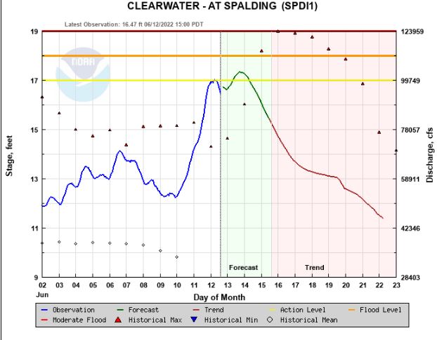
Saturday mountain temps were around 50F in northern Idaho allowing about a dozen SNOTEL sites to melt 1.5 to 3.0 inches of snow water in a day in addition to the 1 to 1.5 inches of rain that fell. End result – rivers are very high, some at record high. Clearwater R at Spalding is pushing 100,000 cfs, record high for today based on 50 years of data. More rivers will continue rising after Sunday’s rain and snowmelt.
Flood control releases start Monday at 8AM for Boise R with flows at Glenwood Bridge going from 1250 to 2750 cfs by 10AM.
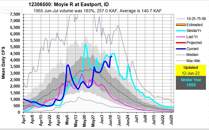
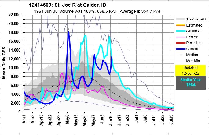
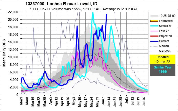
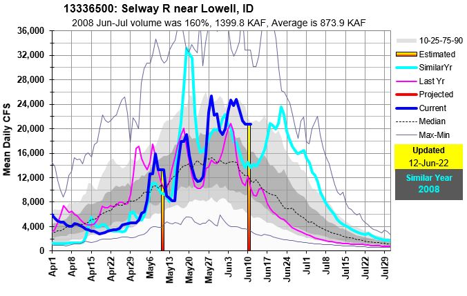
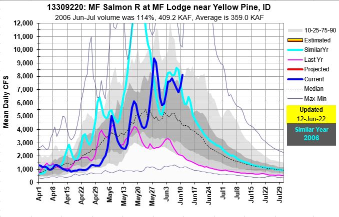
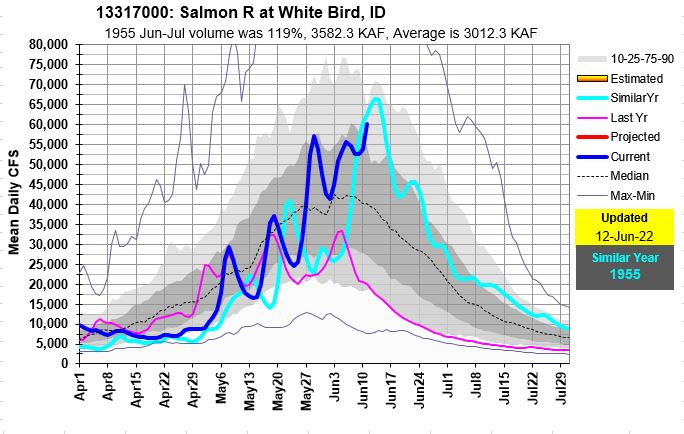
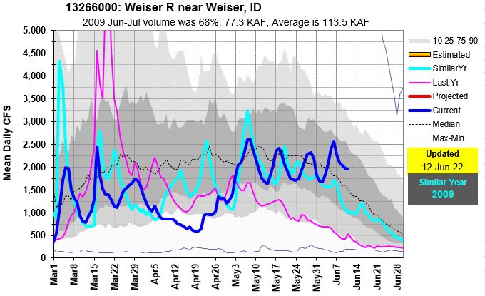
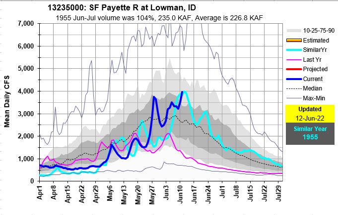
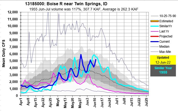
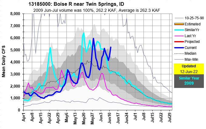
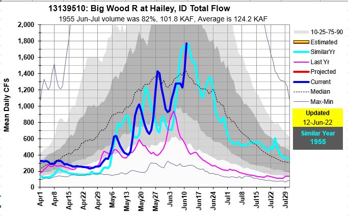
Here are few graphs to illustrate how high these flows are compared to historic exceedances, and max levels that show this year, last year and similar current flow year.

https://www.nwrfc.noaa.gov/rfc/hydrographs/