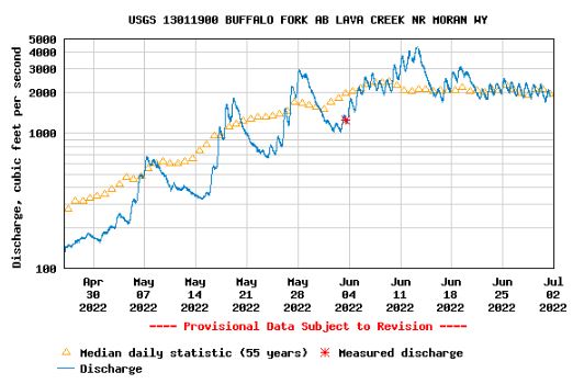
You know the snowmelt streamflow peak flows have occurred in the Upper Snake when the Buffalo Fork peaks. This means we’re on the downhill side of the streamflow hydrograph – not just in Upper Snake but probably across the whole state. The Buffalo Fork is typically the last tributary in the Upper Snake to reach its snowmelt peak. Buffalo Fork is holding steady and flowing right at its long term average. Thanks Lyle Swank for teaching me this relationship!
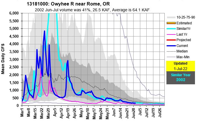
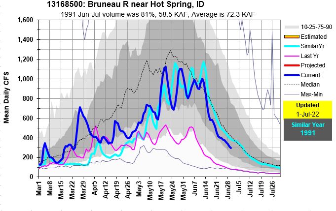
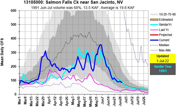
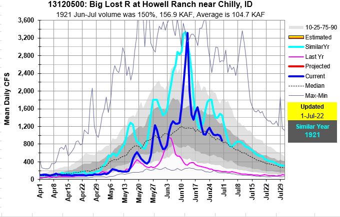
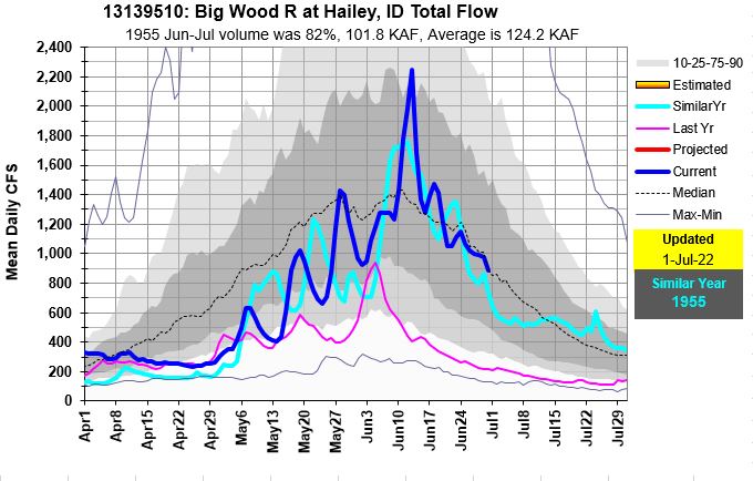
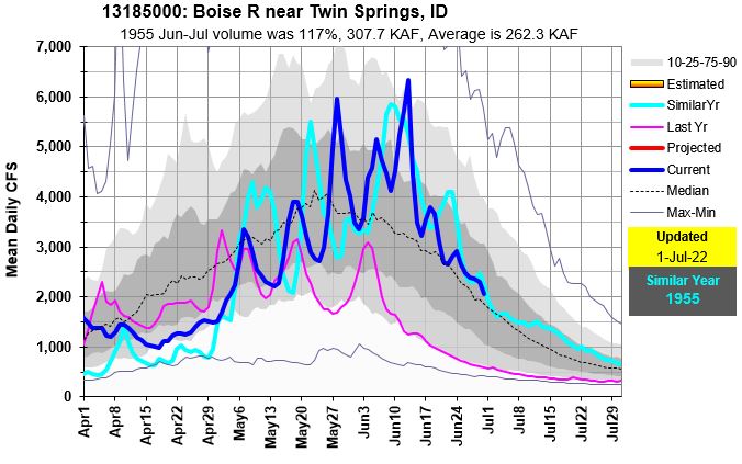
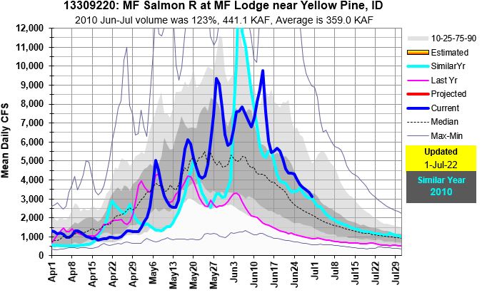
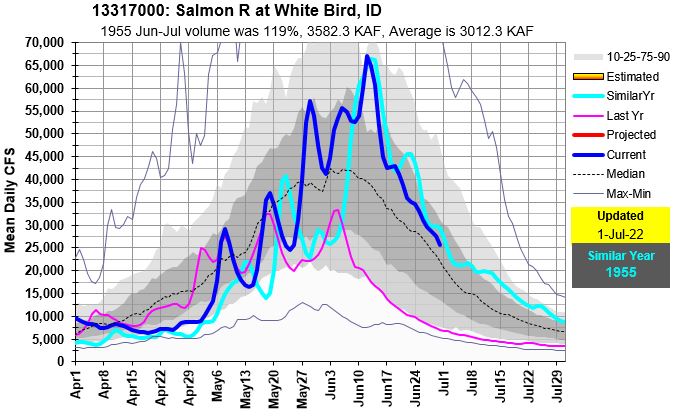
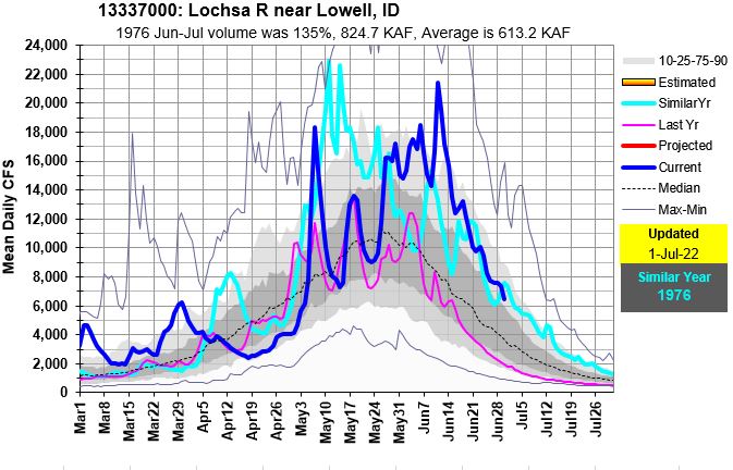
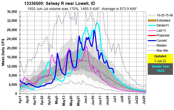
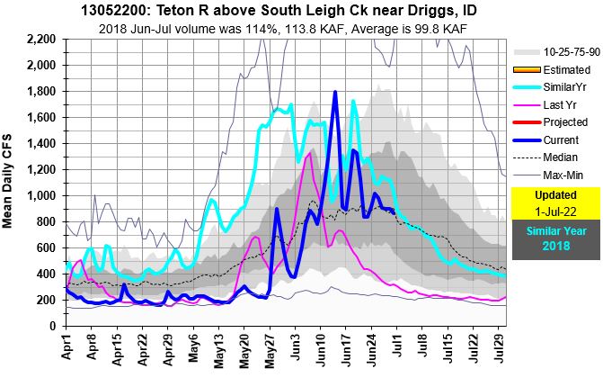
Peaks flows where amazing this year and occurred in all shapes and sizes depending upon snow, spring rain and air temps. Here’s a quick summary of them: the early one – Owyhee. Bookend peaks – Salmon Falls. Flashy pointed peaks – Big Lost & Big Wood. Rivers that remained high and kept pushing water out from their sources – MF, Salmon, Selway, Lochsa. And the late ones – Snake at Jackson and Teton, but when compared to historic average, they were timely.
Following graphs show current year flow, last year and similar year to illustrate summer flow trends. Using the past years to predict the future still works when you are on the downhill side of the hydrograph.