
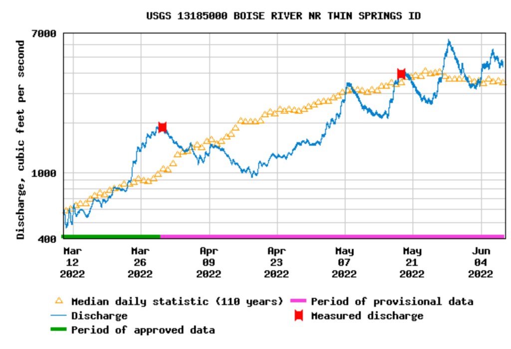
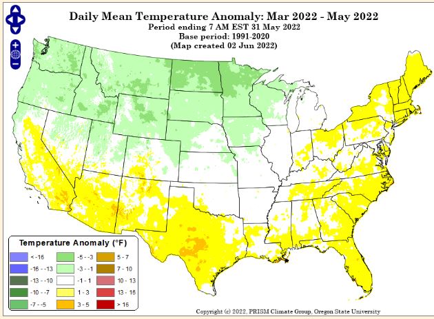
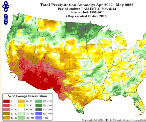
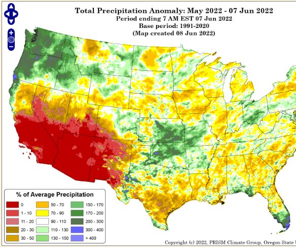
The roller coaster – warm/dry – cool/wet – weekend weather pattern will continue this weekend and possibly another weekend. This cool/wet trend started in early April bringing much needed valley rain and mountain snow across the PNW and into Idaho. Adding moisture to the pack, delaying melt, increasing water supplies, decreasing irrigation demand, pushing streamflow peaks out and extending recession flows. What more could one want? Here’s a brief recap of the spring weather that illustrates the weather impacts on our rivers / water supplies.
I’ll post more basins soon and updates as we transition from season to season and where we are on the streamflow hydrograph because it’s all about water & weather – from what we wear, how & where we recreate, crops we grow and how they grow, hydropower produced, fish migration, and more…
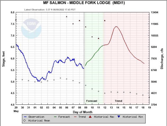
Stay safe and know your skill limits as some rivers still have enough snow and weekend rain potential to keep feeding them and deliver another peak until the drier summer weather pattern that we all love arrives…
FYI – there’s a planned increase for the Boise River in town for Thursday June 9 – Reclamation is releasing fish flow augmentation water with +500 cfs at 8:00am. +300 cfs on Friday June 10, and another +500 cfs on Monday June 13. This will last approximately 2 weeks.


Good Work!
LikeLike
This is awesome. Thanks for keeping us informed and educated!
LikeLike